
File:Autoroute 19.png

本预览的尺寸:625 × 599像素。 其他分辨率:250 × 240像素 | 501 × 480像素 | 706 × 677像素。
原始文件 (706 × 677像素,文件大小:104 KB,MIME类型:image/png)
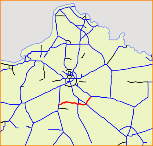
| 描述 | French A19 highway, as in 2009-06 with the opening of the new section between A6 and A10. |
| 来源 | based on Image:Carte Autoroute A1.svg |
| 作者 | from user:Madcap, modified by user:Sting |
| 本作品已被作者Madcap释出到公有领域。这适用于全世界。 在一些国家这可能不合法;如果是这样的话,那么: |
文件历史
点击某个日期/时间查看对应时刻的文件。
| 日期/时间 | 缩略图 | 大小 | 用户 | 备注 | |
|---|---|---|---|---|---|
| 当前 | 2009年7月6日 (一) 16:13 | | 706 × 677(104 KB) | Sting | Complementary section of the highway, as in 2009-06 after the opening of the part between A6 and A10 |
| 2007年11月11日 (日) 16:09 |  | 706 × 677(99 KB) | Michiel1972 | {{Information |Description=A19 |Source=based on Image:Carte Autoroute A1.svg |Date= |Author= from user:Madcap |Permission= |other_versions= }} {{PD-user|Madcap}} Category:Detailed autoroute maps of France |
文件用途
以下页面使用本文件:
全域文件用途
以下其他wiki使用此文件:
- de.wikipedia.org上的用途
- fr.wikipedia.org上的用途
- it.wikipedia.org上的用途
- lmo.wikipedia.org上的用途
- nl.wikipedia.org上的用途
- uk.wikipedia.org上的用途
- www.wikidata.org上的用途