
File:Awaji-island 1.png
本预览的尺寸:544 × 599像素。 其他分辨率:218 × 240像素 | 436 × 480像素 | 903 × 995像素。
原始文件 (903 × 995像素,文件大小:372 KB,MIME类型:image/png)
摘要
| 描述 |
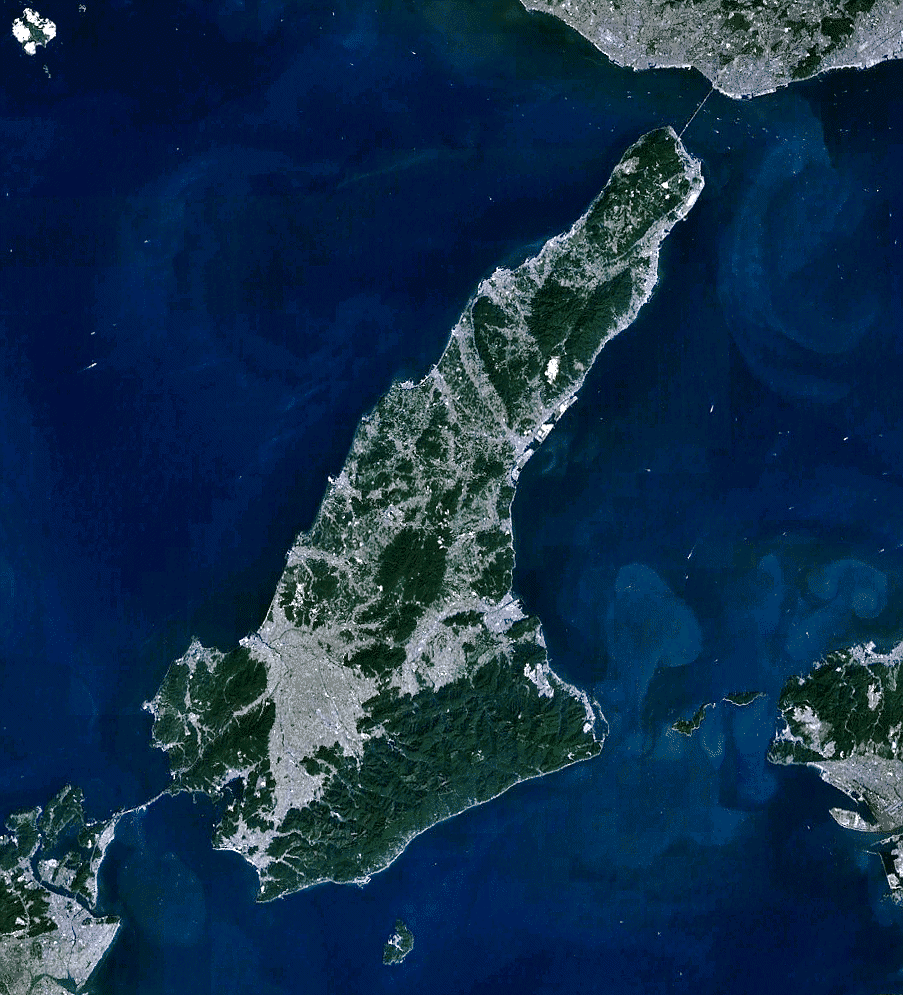
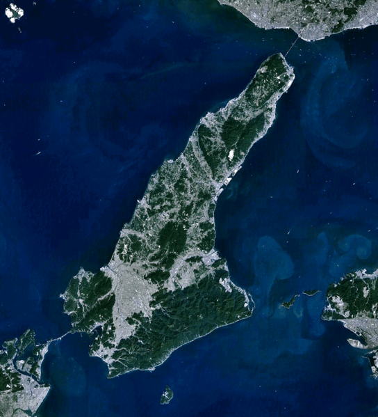
English: the view of Awaji-shima(island), from Landsat, generated on NASA World Wind.
日本語: 衛星ランドサットからの淡路島。NASA World Windで作成。 |
| 日期 | |
| 来源 | NASA World Wind (http://worldwind.arc.nasa.gov/java/ ) |
| 作者 | Pinqui |
| 其他版本 |
|

许可协议
| 本圖像屬於公有領域,因其為NASA的World Wind衛星地圖瀏覽器的一張截圖,且使用了公有領域圖層,如Blue Marble、MODIS、Landsat、SRTM、USGS、GLOBE等。
|
 |
文件历史
点击某个日期/时间查看对应时刻的文件。
| 日期/时间 | 缩略图 | 大小 | 用户 | 备注 | |
|---|---|---|---|---|---|
| 当前 | 2010年12月8日 (三) 01:28 | | 903 × 995(372 KB) | Pinqui | {{Information |Description={{en|1=the view of Awaji-shima(island), from Landsat, generated on NASA World Wind.}} {{ja|1=衛星ランドサットからの淡路島。NASA World Windで作成。}} |Source=NASA World Wind (http://worldwind.arc.nasa.gov/java/ |
文件用途
没有页面链接到本图像。
全域文件用途
以下其他wiki使用此文件:
- ar.wikipedia.org上的用途
- ca.wikipedia.org上的用途
- ceb.wikipedia.org上的用途
- cs.wikipedia.org上的用途
- de.wikipedia.org上的用途
- en.wikipedia.org上的用途
- en.wikivoyage.org上的用途
- es.wikipedia.org上的用途
- fi.wikipedia.org上的用途
- fr.wikivoyage.org上的用途
- he.wikipedia.org上的用途
- he.wikivoyage.org上的用途
- hy.wikipedia.org上的用途
- incubator.wikimedia.org上的用途
- ja.wikipedia.org上的用途
- ko.wikipedia.org上的用途
- nl.wikipedia.org上的用途
- ro.wikipedia.org上的用途
- th.wikipedia.org上的用途
- uk.wikipedia.org上的用途
- www.wikidata.org上的用途