
File:Bakassi.jpg

本预览的尺寸:800 × 598像素。 其他分辨率:320 × 239像素 | 640 × 478像素 | 1,024 × 765像素 | 1,280 × 956像素。
原始文件 (1,280 × 956像素,文件大小:92 KB,MIME类型:image/jpeg)
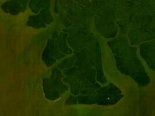
| 描述 | Bakassi Peninsula in the Bight of Bonny, Cameroon | |||
| 日期 | ||||
| 来源 | NASA World Wind screenshot. | |||
| 作者 | Bohr | |||
| 授权 (二次使用本文件) |
|

文件历史
点击某个日期/时间查看对应时刻的文件。
| 日期/时间 | 缩略图 | 大小 | 用户 | 备注 | |
|---|---|---|---|---|---|
| 当前 | 2006年8月19日 (六) 20:47 | | 1,280 × 956(92 KB) | Bohr~commonswiki | {{Information |Description=Bakassi Peninsula in the Bight of Bonny, Cameroon |Source=NASA World Wind screenshot. |Date=August 19, 2006 |Author=~~~ |Permission={{PD-WorldWind}} |other_versions= }} Category:Maps of Nigeria |
文件用途
以下页面使用本文件:
全域文件用途
以下其他wiki使用此文件:
- es.wikipedia.org上的用途
- fi.wikipedia.org上的用途
- pt.wikipedia.org上的用途
- wuu.wikipedia.org上的用途
- yo.wikipedia.org上的用途