
File:Cotedazur.png
本预览的尺寸:800 × 498像素。 其他分辨率:320 × 199像素 | 640 × 398像素 | 826 × 514像素。
原始文件 (826 × 514像素,文件大小:453 KB,MIME类型:image/png)
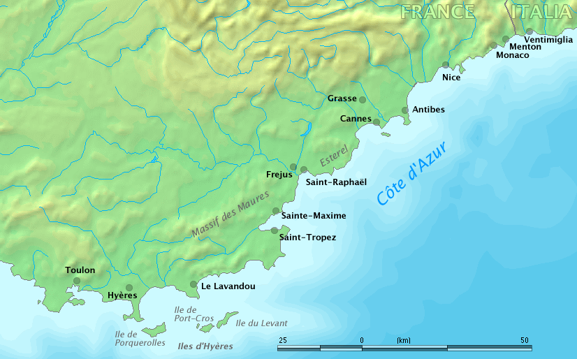
Map of Côte d'Azur, France
Original work by Markus Bernet, background map courtesy of www.demis.nl[失效链接].

|
本文件已被Côte d’Azur overview map.png取代。建议您使用其他文件。请注意,删除被取代的图片需要达成一致。
|

|
This image is in the public domain because it came from the site https://www.demis.nl/products/web-map-server/examples/ and was released by the copyright holder. Permission is granted to copy, distribute and/or modify this map since it is based on free of copyright images from: www.demis.nl. See also approval email on de.wp and its clarification.
|
| This work has been released into the public domain by its copyright holder, www.demis.nl. This applies worldwide. 在一些国家这可能不合法;如果是这样的话,那么: www.demis.nl无条件地授予任何人以任何目的使用本作品的权利,除非这些条件是法律规定所必需的。
|
derivative works
此文件衍生的作品: Fort de Brégançon location.png
文件历史
点击某个日期/时间查看对应时刻的文件。
| 日期/时间 | 缩略图 | 大小 | 用户 | 备注 | |
|---|---|---|---|---|---|
| 当前 | 2006年3月28日 (二) 09:32 | | 826 × 514(453 KB) | MRB | Map of ''Côte d'Azur'', France Original work by Markus Bernet, background map courtesy of [http://www.demis.nl/mapserver/mapper.asp www.demis.nl]. {{Demis-pd}} |
文件用途
没有页面链接到本图像。
全域文件用途
以下其他wiki使用此文件:
- ar.wikipedia.org上的用途
- bg.wikipedia.org上的用途
- el.wikipedia.org上的用途
- en.wikipedia.org上的用途
- fa.wikipedia.org上的用途
- fr.wikipedia.org上的用途
- uk.wikipedia.org上的用途