
File:Estonian archipelago (Saaremaa and Hiiumaa).jpg
此为最大尺寸。
Estonian_archipelago_(Saaremaa_and_Hiiumaa).jpg (354 × 516像素,文件大小:33 KB,MIME类型:image/jpeg)
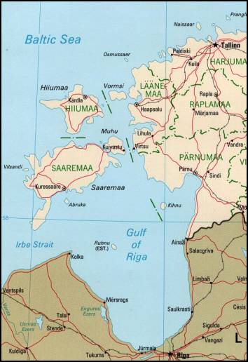
Estonian achipelo (Saarema and Hiiumaa) from en:wiki
This image is an edited version of the original image from the Perry-Castañeda Library Map Collection ([1]) at the University of Texas Libraries. Editing and original upload by en:user:Pascal on en:wiki
See http://www.lib.utexas.edu/maps/europe/estonia_pol99.jpg
The Frequently Asked Questions section indicates that unless otherwise indicated, maps are in the public domain. No such indication for this image.

|
此map图片可使用矢量图形重新创建为SVG文件。这具有很多好处;更多信息请参见共享资源:待清理媒体。如果存在此图片的SVG格式,请将其上传,然后将此模板替换为
{{vector version available|新图片名称}}。
建议您将SVG命名为“Estonian archipelago (Saaremaa and Hiiumaa).svg”,这样在使用Vector version available(或Vva)模板时就不需要填写新图片名称参数。 |


| 本作品已被作者Perry-Castañeda Library释出到公有领域。这适用于全世界。 在一些国家这可能不合法;如果是这样的话,那么: Perry-Castañeda Library无条件地授予任何人以任何目的使用本作品的权利,除非这些条件是法律规定所必需的。
|
_(cropped_230x260).jpg)
.jpg?uselang=zh)
.jpg?uselang=zh)
.jpg?action=history&uselang=zh)
.jpg)
文件历史
点击某个日期/时间查看对应时刻的文件。
| 日期/时间 | 缩略图 | 大小 | 用户 | 备注 | |
|---|---|---|---|---|---|
| 当前 | 2007年4月18日 (三) 18:55 | | 354 × 516(33 KB) | Tene~commonswiki | Reverted to earlier revision |
| 2007年4月18日 (三) 18:52 |  | 354 × 516(33 KB) | Tene~commonswiki | {{Information |Description=Map Of Estonian archipelago (Saaremaa and Hiiumaa) from http://www.lib.utexas.edu/maps/europe/estonia_pol99.jpg See talk page for copyright explanation. Quote... "Most of the maps scanned by the University of Texas Libraries | |
| 2005年3月20日 (日) 19:05 |  | 354 × 516(33 KB) | Laurens~commonswiki | Estonian achipelo (Saarema and Hiiumaa) from en:wiki |
文件用途
全域文件用途
以下其他wiki使用此文件:
- af.wikipedia.org上的用途
- ar.wikipedia.org上的用途
- arz.wikipedia.org上的用途
- avk.wikipedia.org上的用途
- az.wikipedia.org上的用途
- az.wiktionary.org上的用途
- be-tarask.wikipedia.org上的用途
- bg.wikipedia.org上的用途
- bn.wikipedia.org上的用途
- br.wikipedia.org上的用途
- ca.wikipedia.org上的用途
- ceb.wikipedia.org上的用途
- cs.wikipedia.org上的用途
- cy.wikipedia.org上的用途
- da.wikipedia.org上的用途
- de.wikipedia.org上的用途
- dsb.wikipedia.org上的用途
- el.wikipedia.org上的用途
- en.wikipedia.org上的用途
查看本文件的更多全域用途。
.jpg)
.jpg)