
File:Mallorca.jpg
本预览的尺寸:785 × 599像素。 其他分辨率:314 × 240像素 | 629 × 480像素 | 1,006 × 768像素 | 1,138 × 869像素。
原始文件 (1,138 × 869像素,文件大小:164 KB,MIME类型:image/jpeg)
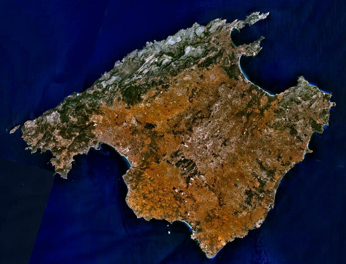
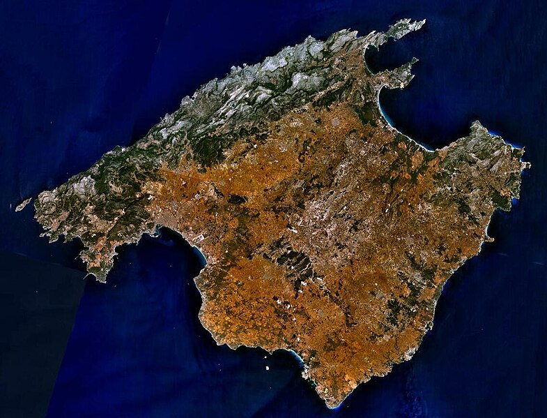
| 描述 | Sattelite image of Majorca |
| 来源 | NASA World Wind - Used Filter: "NTL Landsat7 (Visible Color)" |
| 作者 | NASA |
| 授权 (二次使用本文件) |
"The Landsat Global Mosiac, Blue Marble, and the USGS raster maps and images are all Public Domain." (See http://www.worldwindcentral.com/wiki/Unofficial_FAQ#Are_images_on_World_Wind_copyrighted.3F |
| 本圖像屬於公有領域,因其為NASA的World Wind衛星地圖瀏覽器的一張截圖,且使用了公有領域圖層,如Blue Marble、MODIS、Landsat、SRTM、USGS、GLOBE等。
|
 |
文件历史
点击某个日期/时间查看对应时刻的文件。
| 日期/时间 | 缩略图 | 大小 | 用户 | 备注 | |
|---|---|---|---|---|---|
| 当前 | 2023年6月5日 (一) 17:19 | | 1,138 × 869(164 KB) | PalauanLibertarian | Cropped 11 % horizontally, 8 % vertically using CropTool with precise mode. |
| 2012年12月30日 (日) 19:31 |  | 1,280 × 944(174 KB) | Rotatebot | Bot: Image rotated by 180° | |
| 2012年12月30日 (日) 09:16 |  | 1,280 × 944(174 KB) | Rotatebot | Bot: Image rotated by 180° | |
| 2005年5月15日 (日) 08:29 |  | 1,280 × 958(175 KB) | Leipnizkeks | Sattelite image of Majorca - Source: NASA World Wind - Used Filter: "NTL Landsat7 (Visible Color)" - License: "The Landsat Global Mosiac, Blue Marble, and the USGS raster maps and images are all Public Domain." (See http://www.worldwindcentral.com/wiki/Un |
文件用途
全域文件用途
以下其他wiki使用此文件:
- af.wikipedia.org上的用途
- an.wikipedia.org上的用途
- ar.wikipedia.org上的用途
- arz.wikipedia.org上的用途
- ast.wikipedia.org上的用途
- az.wikipedia.org上的用途
- be-tarask.wikipedia.org上的用途
- be.wikipedia.org上的用途
- bg.wikipedia.org上的用途
- br.wikipedia.org上的用途
- ca.wikipedia.org上的用途
- Illes Balears
- Mallorca
- Llista d'illes de la mar Mediterrània
- Portal:Illes Balears
- Portal:Illes Balears/Mallorca
- Plantilla:Distribució en les Illes Balears
- Usuari:Bilif
- Geografia dels Països Catalans
- Geografia de les Illes Balears
- Usuari:Aïda Lacomba Moreno
- Usuari:Maria quetglas
- Viquiprojecte:PESCAR/2018
- Viquiprojecte:PESCAR/seguiment 2018
- ca.wikiquote.org上的用途
- ceb.wikipedia.org上的用途
- cs.wikipedia.org上的用途
- cy.wikipedia.org上的用途
- da.wikipedia.org上的用途
- de.wikipedia.org上的用途
- de.wikivoyage.org上的用途
- de.wiktionary.org上的用途
- el.wikipedia.org上的用途
- en.wikipedia.org上的用途
查看本文件的更多全域用途。