
File:Map indicating Foxe Basin, Nunavut, Canada.png
此为最大尺寸。
Map_indicating_Foxe_Basin,_Nunavut,_Canada.png (360 × 330像素,文件大小:47 KB,MIME类型:image/png)
摘要
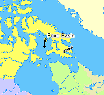
Map indicating Foxe Basin, Nunavut, Canada.
Nunavut
Greenland
Quebec
Newfoundland and Labrador
Manitoba
© Her Majesty the Queen in Right of Canada, Department of Natural Resources. All rights reserved.
Licence Agreement
许可协议

|
本作品的著作权持有者允许任何人以任何目的使用该作品,包括无限制的再分发、商业性使用和修改内容。
使用注意:
|
文件历史
点击某个日期/时间查看对应时刻的文件。
| 日期/时间 | 缩略图 | 大小 | 用户 | 备注 | |
|---|---|---|---|---|---|
| 当前 | 2006年3月21日 (二) 14:31 | | 360 × 330(47 KB) | David Kernow~commonswiki | == Summary == Map indicating Foxe Basin, Nunavut, Canada. {{legend|#ffff66|Nunavut}} {{legend|#ffffcc|Greenland}} {{legend|#d5fe94|Quebec}} {{legend|#ecebb6|Newfoundland and Labrador}} {{legend|#ccccff|Manitoba}} {{legend|#ffcccc|Ontario |
文件用途
以下页面使用本文件:
全域文件用途
以下其他wiki使用此文件:
- ar.wikipedia.org上的用途
- bs.wikipedia.org上的用途
- ca.wikipedia.org上的用途
- ceb.wikipedia.org上的用途
- da.wikipedia.org上的用途
- de.wikipedia.org上的用途
- en.wikipedia.org上的用途
- es.wikipedia.org上的用途
- fi.wikipedia.org上的用途
- fr.wikipedia.org上的用途
- hr.wikipedia.org上的用途
- hu.wikipedia.org上的用途
- is.wikipedia.org上的用途
- ja.wikipedia.org上的用途
- nl.wikipedia.org上的用途
- nn.wikipedia.org上的用途
- no.wikipedia.org上的用途
- pt.wikipedia.org上的用途
- ro.wikipedia.org上的用途
- sh.wikipedia.org上的用途
- sr.wikipedia.org上的用途
- sv.wikipedia.org上的用途
- www.wikidata.org上的用途
- zh-min-nan.wikipedia.org上的用途