
File:Rs-Sachalin-map.png
此为最大尺寸。
Rs-Sachalin-map.png (636 × 326像素,文件大小:106 KB,MIME类型:image/png)
摘要
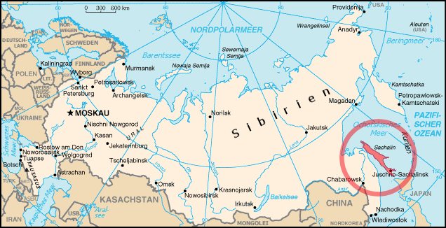
| 描述 | Position of Sachalin island |
| 日期 | |
| 来源 | Edited Rs-map.png from German Wikipedia |
| 作者 | ErnstA |
| 授权 (二次使用本文件) |
Public Domain |
许可协议
此作品在美国属于公有领域,因为其是由美国政府的官员或雇员,基于其个人公务目的制作的作品,参考美国法典第17篇第1章第105条。
注意︰本模板仅适用于美国联邦政府的原创作品,不适用于任何美国州、属地、联邦个体、县、市或任何次级政府的作品。本模板也不适用于1978年以后由美国邮政署出版的邮票图案(参看美国版权局实践纲领第313.6(C)(1)条)。也不适用于部分美国硬币;参看美国铸币局使用条款。 |
 | |
| 本文件已被确认为免除已知的著作权法限制(包括所有相关权利)。 | ||
文件历史
点击某个日期/时间查看对应时刻的文件。
| 日期/时间 | 缩略图 | 大小 | 用户 | 备注 | |
|---|---|---|---|---|---|
| 当前 | 2006年8月16日 (三) 17:30 | | 636 × 326(106 KB) | ErnstA~commonswiki | {{Information |Description= Position of Sachalin island |Source= Edited Rs-map.png from German Wikipedia |Date= 16 AUG 2006 |Author= ErnstA |Permission= Public Domain |other_versions= none }} |
| 2006年8月16日 (三) 16:36 |  | 636 × 326(102 KB) | ErnstA~commonswiki | {{Information |Description= Position of Sachalin island |Source= Edited Rs-map.png from German Wikipedia |Date= 16 AUG 2006 |Author= ErnstA |Permission= Public Domain |other_versions= none }} |
文件用途
没有页面链接到本图像。
全域文件用途
以下其他wiki使用此文件:
- bs.wikipedia.org上的用途
- fy.wikipedia.org上的用途
- hr.wikipedia.org上的用途
- it.wikipedia.org上的用途
- lt.wikipedia.org上的用途
- ro.wikipedia.org上的用途
- sh.wikipedia.org上的用途