
File:Saldanha Bay WW.jpg

本预览的尺寸:750 × 600像素。 其他分辨率:300 × 240像素 | 600 × 480像素 | 960 × 768像素 | 1,280 × 1,024像素。
原始文件 (1,280 × 1,024像素,文件大小:933 KB,MIME类型:image/jpeg)
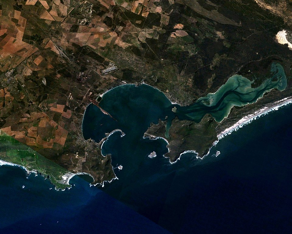
| 描述 | Saldanha Bay, Western Cape, South Africa. Coordinates: 33º 02' 11" S 17º 59' 04" E. Facing east (north is to the left.) |
| 日期 | |
| 来源 | Made with The GIMP! from a NASA World Wind screenshot |
| 作者 | Júlio Reis (User:Tintazul) |
| 授权 (二次使用本文件) |
I, the author release this image into Public Domain. |
| 本圖像屬於公有領域,因其為NASA的World Wind衛星地圖瀏覽器的一張截圖,且使用了公有領域圖層,如Blue Marble、MODIS、Landsat、SRTM、USGS、GLOBE等。
|
 |
文件历史
点击某个日期/时间查看对应时刻的文件。
| 日期/时间 | 缩略图 | 大小 | 用户 | 备注 | |
|---|---|---|---|---|---|
| 当前 | 2005年11月5日 (六) 23:33 | | 1,280 × 1,024(933 KB) | Tintazul | {{Information| |Description=Saldanha Bay, Western Cape, South Africa. Coordinates: 33º 02' 11" S 17º 59' 04" E. Facing east (north is to the left.) |Source=Made with [http://www.gimp.org/ The GIMP!] from a [http://worldwind.arc.nasa.gov/ NASA World Wind |
文件用途
以下页面使用本文件:
全域文件用途
以下其他wiki使用此文件:
- af.wikipedia.org上的用途
- ceb.wikipedia.org上的用途
- de.wikipedia.org上的用途
- en.wikipedia.org上的用途
- eo.wikipedia.org上的用途
- es.wikipedia.org上的用途
- fi.wikipedia.org上的用途
- fr.wikipedia.org上的用途
- it.wikipedia.org上的用途
- nl.wikipedia.org上的用途
- pt.wikipedia.org上的用途
- ru.wikipedia.org上的用途
- www.wikidata.org上的用途