
File:Shanghai highway network.svg

此SVG文件的PNG预览的大小:496 × 599像素。 其他分辨率:199 × 240像素 | 397 × 480像素 | 636 × 768像素 | 848 × 1,024像素 | 1,696 × 2,048像素 | 963 × 1,163像素。
原始文件 (SVG文件,尺寸为963 × 1,163像素,文件大小:77 KB)
摘要
| 描述 |
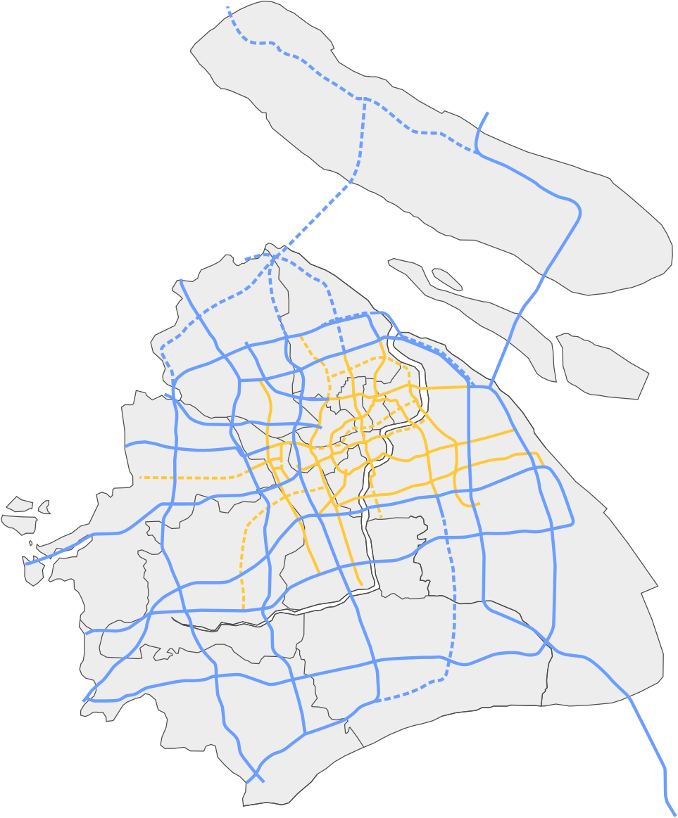
English: A map showing the highway network of Shanghai.
中文:上海公路和高速公路网地图.
|
| 日期 | |
| 来源 | 自己的作品 |
| 作者 | Heights |
| 其他版本 |
本檔案衍生自: |


许可协议
我,本作品著作权人,特此采用以下许可协议发表本作品:
本文件采用知识共享署名-相同方式共享 3.0 未本地化版本许可协议授权。
- 您可以自由地:
- 共享 – 复制、发行并传播本作品
- 修改 – 改编作品
- 惟须遵守下列条件:
- 署名 – 您必须对作品进行署名,提供授权条款的链接,并说明是否对原始内容进行了更改。您可以用任何合理的方式来署名,但不得以任何方式表明许可人认可您或您的使用。
- 相同方式共享 – 如果您再混合、转换或者基于本作品进行创作,您必须以与原先许可协议相同或相兼容的许可协议分发您贡献的作品。
文件历史
点击某个日期/时间查看对应时刻的文件。
| 日期/时间 | 缩略图 | 大小 | 用户 | 备注 | |
|---|---|---|---|---|---|
| 当前 | 2020年12月29日 (二) 19:57 | | 963 × 1,163(77 KB) | Heights | Reverted to version as of 19:54, 29 December 2020 (UTC) |
| 2020年12月29日 (二) 19:55 |  | 963 × 1,163(70 KB) | Heights | Reverted to version as of 04:31, 14 November 2017 (UTC) | |
| 2020年12月29日 (二) 19:54 |  | 963 × 1,163(77 KB) | Heights | December 2020 update retry | |
| 2020年12月29日 (二) 19:51 | 没有缩略图 | 963 × 1,163(1.58 MB) | Heights | December 2020 update | |
| 2017年11月14日 (二) 04:31 |  | 963 × 1,163(70 KB) | Heights | November 2017 update | |
| 2016年12月16日 (五) 00:55 |  | 963 × 1,155(67 KB) | Heights | Reflects new construction as of December 2016. | |
| 2014年1月2日 (四) 16:08 |  | 963 × 1,155(66 KB) | Heights | Hopefully this fixes the border issues, sorry! | |
| 2014年1月2日 (四) 15:56 |  | 949 × 1,200(66 KB) | Heights | Correct dotted lines | |
| 2014年1月2日 (四) 15:51 |  | 949 × 1,200(66 KB) | Heights | Modified colours; green was too drastic | |
| 2014年1月2日 (四) 02:22 |  | 949 × 1,200(66 KB) | Heights | New map with less clutter Expressways are in green, blue is municipal roadways/elevated roads |
文件用途
以下60个页面使用本文件:
- 124省道 (上海)
- 125省道 (上海)
- 222省道 (上海)
- 223省道 (上海)
- 上海交通
- 上海外环高速公路
- 上海绕城高速公路
- 上海迎宾高速公路
- 上海长江隧桥
- 上海高速公路
- 京沪高速公路
- 亭枫高速公路
- 北青公路
- 华东路
- 南亭公路
- 南六公路
- 南奉公路
- 南芦公路
- 嘉金公路黄浦江大桥
- 嘉金高速公路
- 奉浦大桥
- 宝安公路
- 宝钱公路
- 徐浦大桥
- 新卫高速公路
- 朱枫公路
- 杭州湾地区环线高速公路
- 松卫公路
- 林海公路
- 沈海高速公路
- 沪南公路
- 沪嘉高速公路
- 沪太公路
- 沪奉高速公路
- 沪宁高速公路
- 沪崇高速公路
- 沪常高速公路
- 沪慈高速公路
- 沪昆高速公路
- 沪杭甬高速公路
- 沪杭高速公路
- 沪松公路
- 沪武高速公路
- 沪渝高速公路
- 沪翔高速公路
- 沪芦高速公路
- 沪蓉高速公路
- 沪金高速公路
- 沪陕高速公路
- 沪青平高速公路
- 浦星公路
- 申嘉湖高速公路
- 莘奉金高速公路
- 蕰川公路
- 蕰川高速公路
- 金山大道
- 闵浦大桥
- 陈海公路
- User:Grjgt893u34/后海花半里區
- Template:上海市高速公路
全域文件用途
以下其他wiki使用此文件:
- en.wikipedia.org上的用途
- www.wikidata.org上的用途