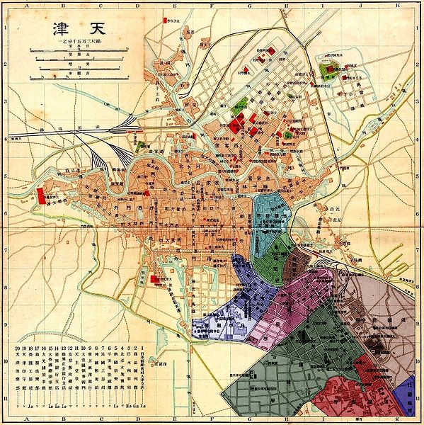
File:Tianjin 20051107 concessions coloured.jpg

本预览的尺寸:599 × 600像素。 其他分辨率:240 × 240像素 | 479 × 480像素 | 767 × 768像素 | 1,023 × 1,024像素 | 1,448 × 1,450像素。
原始文件 (1,448 × 1,450像素,文件大小:1.65 MB,MIME类型:image/jpeg)
文件历史
点击某个日期/时间查看对应时刻的文件。
| 日期/时间 | 缩略图 | 大小 | 用户 | 备注 | |
|---|---|---|---|---|---|
| 当前 | 2008年9月7日 (日) 22:50 |  | 1,448 × 1,450(1.65 MB) | Gugganij | minor edit |
| 2008年9月7日 (日) 21:45 |  | 1,448 × 1,450(1.65 MB) | Gugganij | {{Information |Description=*{{en|Map of Tianjin with concessions in colour.}} *{{de|Karte von Tianjin. Die Konzessionsgebiete wurden eingefärbt.}} |Source=*Image:Tianjin_20051107.jpg |Date=2008-09-07 21:42 (UTC) |Author=*derivative work: ~~ |
文件用途
以下22个页面使用本文件:
全域文件用途
以下其他wiki使用此文件:
- ar.wikipedia.org上的用途
- ca.wikipedia.org上的用途
- cs.wikipedia.org上的用途
- de.wikipedia.org上的用途
- en.wikipedia.org上的用途
- es.wikipedia.org上的用途
- fr.wikipedia.org上的用途
- he.wikipedia.org上的用途
- hu.wikipedia.org上的用途
- hy.wikipedia.org上的用途
- is.wikipedia.org上的用途
- it.wikipedia.org上的用途
- pt.wikipedia.org上的用途
- ru.wikipedia.org上的用途
- uk.wikipedia.org上的用途
- vi.wikipedia.org上的用途
- wuu.wikipedia.org上的用途


