
File:Txu-oclc-224300691-se19-6.jpg

本预览的尺寸:788 × 600像素。 其他分辨率:316 × 240像素 | 631 × 480像素 | 1,010 × 768像素 | 1,280 × 974像素 | 2,560 × 1,948像素 | 5,164 × 3,929像素。
原始文件 (5,164 × 3,929像素,文件大小:10.27 MB,MIME类型:image/jpeg)
摘要
| 描述 |
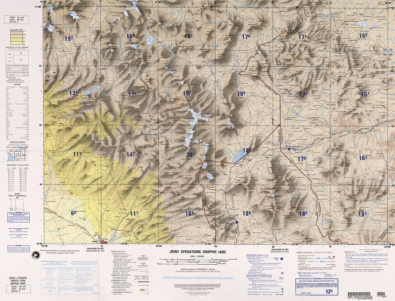
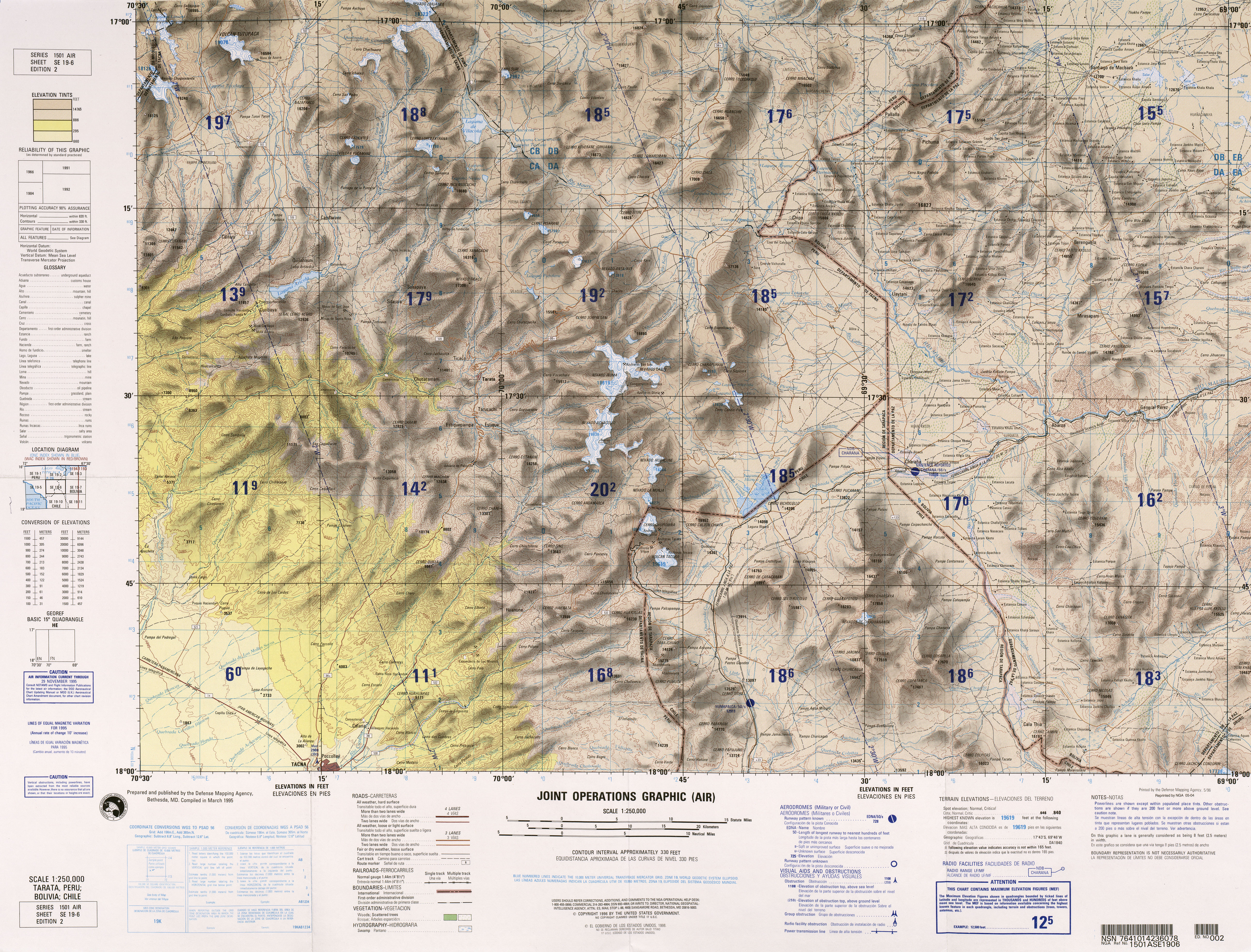
English: frontera Chile-Peru-Bolivia, Tacna |
|||
| 日期 | ||||
| 来源 | http://www.lib.utexas.edu/maps/jog/latin_america/txu-oclc-224300691-se19-6.jpg | |||
| 作者 | This work is in the public domain in the United States because it is a work of the United States Federal Government under the terms of 17 U.S.C. § 105. See Copyright. | |||
| 授权 (二次使用本文件) |
|
|||
| 其他版本 | 此文件衍生的作品: Río-cosapilla.png |

.jpg)
文件历史
点击某个日期/时间查看对应时刻的文件。
| 日期/时间 | 缩略图 | 大小 | 用户 | 备注 | |
|---|---|---|---|---|---|
| 当前 | 2011年12月30日 (五) 23:03 | | 5,164 × 3,929(10.27 MB) | Keysanger |
文件用途
以下4个页面使用本文件:
全域文件用途
以下其他wiki使用此文件:
- arz.wikipedia.org上的用途
- ca.wikipedia.org上的用途
- ceb.wikipedia.org上的用途
- de.wikipedia.org上的用途
- en.wikipedia.org上的用途
- es.wikipedia.org上的用途
- ka.wikipedia.org上的用途
- pt.wikipedia.org上的用途
- qu.wikipedia.org上的用途
- www.wikidata.org上的用途