
File:Upwelling image1.jpg
此为最大尺寸。
Upwelling_image1.jpg (514 × 337像素,文件大小:187 KB,MIME类型:image/jpeg)
摘要
| 描述 |
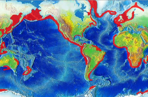
English: Global map highlighting areas of upwelling |
| 日期 |
2008年9月13日 (原始上传日期) |
| 来源 | http://oceanservice.noaa.gov/education/kits/currents/media/upwelling_image1.jpg |
| 作者 | NOAA |
| 授权 (二次使用本文件) |
US Federal Government |
许可协议
本图像属于公有领域,因该作品最初来自于美国国家海洋和大气管理局职员的职务作品。
|
原始上传日志
本檔案是由Wcam使用CommonsHelper,從en.wikipedia轉移到維基共享資源。
原始描述頁面位於這裡。下列使用者名稱均來自en.wikipedia。
- 2008-09-13 17:59 Mikiemike 514×337× (191795 bytes) {{Information |Description=Global map highlighting areas of upwelling |Source=http://oceanservice.noaa.gov/education/kits/currents/media/upwelling_image1.jpg |Date=9-13-08 |Author=NOAA |Permission=US Federal Government |other_versions= }}
文件历史
点击某个日期/时间查看对应时刻的文件。
| 日期/时间 | 缩略图 | 大小 | 用户 | 备注 | |
|---|---|---|---|---|---|
| 当前 | 2009年1月15日 (四) 01:30 | | 514 × 337(187 KB) | File Upload Bot (Magnus Manske) | {{BotMoveToCommons|en.wikipedia}} {{Information |Description={{en|Global map highlighting areas of upwelling}} |Source=Transferred from [http://en.wikipedia.org en.wikipedia]; transferred to Commons by User:Wcam using [http://tools.wikimedia.de/~magn |
文件用途
全域文件用途
以下其他wiki使用此文件:
- af.wikipedia.org上的用途
- ar.wikipedia.org上的用途
- ast.wikipedia.org上的用途
- bn.wikipedia.org上的用途
- bs.wikipedia.org上的用途
- ca.wikipedia.org上的用途
- da.wikipedia.org上的用途
- de.wikipedia.org上的用途
- en.wikipedia.org上的用途
- eo.wikipedia.org上的用途
- es.wikipedia.org上的用途
- eu.wikipedia.org上的用途
- fa.wikipedia.org上的用途
- fr.wikipedia.org上的用途
- it.wikipedia.org上的用途
- ka.wikipedia.org上的用途
- kk.wikipedia.org上的用途
- ko.wikipedia.org上的用途
- lv.wikipedia.org上的用途
- ml.wikipedia.org上的用途
- ms.wikipedia.org上的用途
- nl.wikipedia.org上的用途
- nn.wikipedia.org上的用途
- no.wikipedia.org上的用途
- pl.wikipedia.org上的用途
- pt.wikipedia.org上的用途
- ru.wikipedia.org上的用途
- sl.wikipedia.org上的用途
- th.wikipedia.org上的用途
- tr.wikipedia.org上的用途
- ur.wikipedia.org上的用途
- vi.wikipedia.org上的用途