
File:Yugorsky Peninsula.png
此为最大尺寸。
Yugorsky_Peninsula.png (710 × 534像素,文件大小:18 KB,MIME类型:image/png)
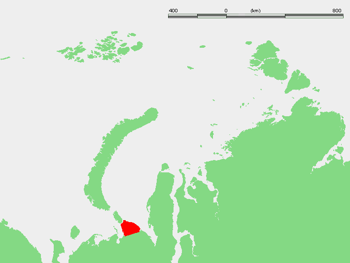
| 描述 | Location of the Yugorsky Peninsula in Russia: west of Yamal Peninsula and to the southeast of the islands Novaya Zemla and Vaigach | ||||
| 来源 | w:Image:Kara seaYGP.PNG (originally from demis.nl) | ||||
| 作者 | demis/w:User:Mohonu | ||||
| 授权 (二次使用本文件) |
|
文件历史
点击某个日期/时间查看对应时刻的文件。
| 日期/时间 | 缩略图 | 大小 | 用户 | 备注 | |
|---|---|---|---|---|---|
| 当前 | 2007年12月16日 (日) 22:27 | | 710 × 534(18 KB) | Hardscarf | {{Information |Description=Location of the Yugorsky Peninsula in Russia: west of Yamal Peninsula and to the southeast of the islands Novaya Zemla and Vaigach |Source=w:Image:Kara seaYGP.PNG (originally from demis.nl) |Date= |Author=demis/[[:w:User:Mo |
文件用途
全域文件用途
以下其他wiki使用此文件:
- az.wikipedia.org上的用途
- ca.wikipedia.org上的用途
- en.wikipedia.org上的用途
- es.wikipedia.org上的用途
- fa.wikipedia.org上的用途
- fr.wikipedia.org上的用途
- hr.wikipedia.org上的用途
- it.wikipedia.org上的用途
- nl.wikipedia.org上的用途
- nn.wikipedia.org上的用途
- no.wikipedia.org上的用途
- pl.wikipedia.org上的用途
- pl.wiktionary.org上的用途
- pt.wikipedia.org上的用途
- uk.wikipedia.org上的用途
- www.wikidata.org上的用途