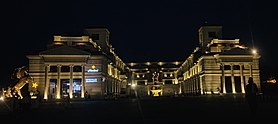
古吉蘭瓦拉
| 古吉蘭瓦拉 گوجرانوالہ | |
|---|---|
| City district | |
    | |
| 綽號:The City of Wrestlers The City of Foods | |
| 坐標:32°09′00″N 74°11′00″E / 32.15°N 74.183333333333°E | |
| 國家 | |
| 省份 | 旁遮普省 |
| District | Gujranwala District |
| 自治市鎮 | 7 |
| 議席數量 | 19 |
| 政府 | |
| • Lieutenant | Adnan |
| 面積 | |
| • 總計 | 3,198 平方公里(1,235 平方英里) |
| 人口(2011年6月24日)[1] | |
| • 總計 | 1,961,360人 |
| 時區 | PST(UTC+5) |
| • 夏時制 | PDT(UTC+6) |
| 電話區號 | 055 |

古吉蘭瓦拉 (旁遮普語 : گوجرانوالہ ਗੋਜਰਾਨਵਾਲਾ ; 烏爾都語: گوجرانوالہ) ,為巴基斯坦旁遮普省東北部的一個城市。該城市人口1,132,509 (1998年),居巴基斯坦第7位。當地通用旁遮普語,烏爾都語、英語也很常用,特別是在學校等公共機構。
氣候[編輯]
| 古吉蘭瓦拉 | |||||||||||||
|---|---|---|---|---|---|---|---|---|---|---|---|---|---|
| 月份 | 1月 | 2月 | 3月 | 4月 | 5月 | 6月 | 7月 | 8月 | 9月 | 10月 | 11月 | 12月 | 全年 |
| 平均高溫 °C(°F) | 19.0 (66.2) |
22.0 (71.6) |
27.0 (80.6) |
33.0 (91.4) |
39.0 (102.2) |
39.0 (102.2) |
35.0 (95.0) |
35.0 (95.0) |
34.0 (93.2) |
32.0 (89.6) |
27.0 (80.6) |
21.0 (69.8) |
30.8 (87.4) |
| 平均低溫 °C(°F) | 6.0 (42.8) |
11.0 (51.8) |
16.0 (60.8) |
20.0 (68.0) |
25.0 (77.0) |
28.0 (82.4) |
27.0 (80.6) |
27.0 (80.6) |
25.0 (77.0) |
20.0 (68.0) |
14.0 (57.2) |
9.0 (48.2) |
17.8 (64.0) |
| 平均降水量 mm(英寸) | 18.0 (0.71) |
35.0 (1.38) |
24.0 (0.94) |
13.0 (0.51) |
17.0 (0.67) |
48.0 (1.89) |
82.0 (3.23) |
87.0 (3.43) |
43.0 (1.69) |
9.0 (0.35) |
11.0 (0.43) |
12.0 (0.47) |
628.8 (24.76) |
| 月均日照時數 | 220.1 | 217.5 | 244.9 | 276 | 306.9 | 270 | 226.3 | 235.6 | 267 | 291.4 | 261 | 223.2 | 3,039.9 |
| 數據來源:My Weather2[2] | |||||||||||||
參考文獻[編輯]
- ^ Pakistan: largest cities and towns and statistics of their population. World Gazetteer. Retrieved 11 December 2010.
- ^ Gujranwala Climate Profile. My Weather2. [2010-05-06]. (原始內容存檔於2020-12-05).
外部連結[編輯]
| 維基詞典上的字詞解釋 | |
| 維基共享資源上的多媒體資源 | |
| 維基新聞上的新聞 | |
| 維基語錄上的名言 | |
| 維基文庫上的原始文獻 | |
| 維基教科書上的教科書和手冊 | |
| 維基學院上的學習資源 | |
- GujranwalaPost Gujranwala's First Online Newspaper
- Gujranwala History
- Gujranwala TV (頁面存檔備份,存於網際網路檔案館)
| |||||||||||||||||

