
嘉柏隆里
| 嘉柏隆里市 Gaborone | |
|---|---|
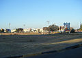
  自上而下:哈博羅內中央商務區、中央商務區、BITC | |
| 綽號:Gabs, GC, Gabz, G-City | |
 嘉柏隆里市 | |
| 坐標:24°39′25″S 25°54′31″E / 24.6569°S 25.9086°E | |
| 國家 | |
| 區 | 東南區 |
| 政府 | |
| • 市長 | Haskins Nkaigwa |
| 面積 | |
| • 城市 | 169 平方公里(65 平方英里) |
| 海拔 | 983 公尺(3,225 英尺) |
| 人口(2022年) | |
| • 城市 | 246,325人 |
| • 都會區 | 421,907 |
| [1] | |
| 時區 | 非洲中部時間(UTC+2) |
| 網站 | Gaborone City Council |
| [2][3] | |

嘉柏隆里(茨瓦納語:Gaborone)是博茨瓦納的首都和人口最多的城市,根據2022年的統計,嘉柏隆里有人口246,325人[1],佔該國總人口約10%[4]。
經濟[編輯]
過去嘉柏隆里主要靠礦產支持經濟,因為嘉柏隆里的舊城區含有豐富的錳礦,而錳在從前是製造電池的必須材料。
-
 國立體育場
國立體育場 -
 Somarelang Tikologo組織
 -
 嘉柏隆里大學


地理[編輯]
氣候[編輯]
| 嘉柏隆里(塞雷茨·卡馬爵士國際機場,1981年–2010年) | |||||||||||||
|---|---|---|---|---|---|---|---|---|---|---|---|---|---|
| 月份 | 1月 | 2月 | 3月 | 4月 | 5月 | 6月 | 7月 | 8月 | 9月 | 10月 | 11月 | 12月 | 全年 |
| 歷史最高溫 °C(°F) | 39 (103) |
40 (104) |
39 (102) |
37 (98) |
33 (91) |
29 (84) |
28 (83) |
33 (91) |
39 (103) |
38 (100) |
40 (104) |
39 (103) |
40 (104) |
| 平均高溫 °C(°F) | 32.7 (90.9) |
32.1 (89.8) |
30.8 (87.4) |
28.4 (83.1) |
25.6 (78.1) |
23.1 (73.6) |
22.9 (73.2) |
26.2 (79.2) |
30.0 (86.0) |
32.0 (89.6) |
32.3 (90.1) |
32.5 (90.5) |
29.1 (84.4) |
| 日均氣溫 °C(°F) | 25.7 (78.3) |
25.2 (77.4) |
23.7 (74.7) |
20.6 (69.1) |
16.8 (62.2) |
13.7 (56.7) |
13.5 (56.3) |
16.9 (62.4) |
21.2 (70.2) |
24.0 (75.2) |
24.7 (76.5) |
25.3 (77.5) |
20.9 (69.6) |
| 平均低溫 °C(°F) | 19.7 (67.5) |
19.3 (66.7) |
17.4 (63.3) |
13.5 (56.3) |
8.3 (46.9) |
5.0 (41.0) |
4.4 (39.9) |
7.5 (45.5) |
12.3 (54.1) |
16.3 (61.3) |
17.7 (63.9) |
18.8 (65.8) |
13.4 (56.1) |
| 歷史最低溫 °C(°F) | 14 (57) |
13 (55) |
11 (52) |
0 (32) |
−1 (30) |
−1 (30) |
−2 (28) |
0 (32) |
5 (41) |
7 (45) |
8 (46) |
11 (52) |
−2 (28) |
| 平均降水量 mm(吋) | 143 (5.6) |
82 (3.2) |
74 (2.9) |
30 (1.2) |
8.3 (0.33) |
7.5 (0.30) |
1 (0.0) |
0.9 (0.04) |
5.8 (0.23) |
5.8 (0.23) |
58 (2.3) |
71 (2.8) |
487.3 (19.13) |
| 平均降水天數 | 6 | 5 | 5 | 3 | 2 | 1 | 1 | 1 | 2 | 4 | 5 | 6 | 41 |
| 數據來源1:African Regional Climate Centre[5] | |||||||||||||
| 數據來源2:Weatherbase(極端值)[6] | |||||||||||||
友好城市[編輯]
嘉柏隆里有以下友好城市:
參考資料及註釋[編輯]
- ^ 1.0 1.1 Statistics Bostwana - Census 2022 - Population of cities, towns and villages (PDF). [2023-06-12]. (原始內容存檔 (PDF)於2022-10-09).
- ^ BOTSWANA STATISTICAL YEAR BOOK 2010 (PDF). Statistics Botswana. 嘉柏隆里: Central Statistics Office. 2011年12月 [2012-02-25]. (原始內容 (PDF)存檔於2012-02-26) (英語).
- ^ The Population of Towns, Villages and Associated Localities (PDF). 2011 Population and Housing Census. 嘉柏隆里: Statistics Botswana. 2012年6月 [2012-06-14]. (原始內容 (PDF)存檔於2012-06-14) (英語).
- ^ Central Statistics Office. BOTSWANA DEMOGRAPHIC SURVEY 2006 (PDF). Gaborone, Botswana. January 2009 [3 July 2010]. (原始內容存檔 (PDF)於2016-09-23).
- ^ Precipitation and temperature reference climatologies: Seretse Khama International Airport. African Regional Climate Centre. [January 19, 2016]. (原始內容存檔於14 March 2016).
- ^ Weatherbase: Historical Weather for Gaborone, Botswana. Weatherbase. [26 June 2012]. (原始內容存檔於24 September 2012).
- ^ Burbank's Sister Cities. Burbank Sister City Organization. [2010-07-22]. (原始內容存檔於2012-06-26) (英語).
- ^ Mooketsi, Lekopanye. Chinese firms to build massive industrial park. Mmegi. 2009-04-01 [2010-08-03]. (原始內容存檔於2012-06-26) (英語).
The last event was the signing ceremony for a twinning arrangement between Zhejiang Province and the Gaborone City Council.
- ^ Gaborone, Vasteras city councils twin. Gaborone: Daily News. 2011-10-27 [2012-06-23]. (原始內容存檔於2012-06-23) (英語).
| ||||||||||||
| ||||||||||||||||||||||