
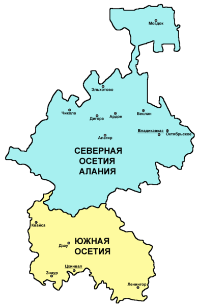
File:Ossetia rus.png

本预览的尺寸:391 × 599像素。 其他分辨率:156 × 240像素 | 313 × 480像素 | 696 × 1,067像素。
原始文件 (696 × 1,067像素,文件大小:44 KB,MIME类型:image/png)
摘要
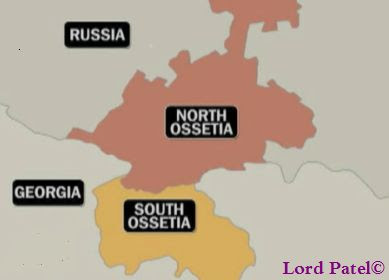
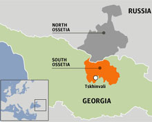
| 描述 | Map of Ossetia (North Ossetia and South Ossetia) - Russian language version. |
| 日期 | 2007年12月28日 (原始上传日期) |
| 来源 | 自己的作品 |
| 作者 | PANONIAN and Chesnok |
许可协议
self made map - Russian language version of this file: http://commons.wikimedia.org/wiki/File:Ossetia01.png (author of that file is User:PANONIAN).
| 我,本作品著作权人,释出本作品至公有领域。这适用于全世界。 在一些国家这可能不合法;如果是这样的话,那么: 我无条件地授予任何人以任何目的使用本作品的权利,除非这些条件是法律规定所必需的。 |

|
This map has been uploaded by Electionworld from en.wikipedia.org to enable the |
References
Borders and locations of major settlements:
- http://iratta.com/uploads/posts/atlas/21/karta.jpg
- http://foto.mail.ru/bk/lyks2003/150/163.html
- http://4.bp.blogspot.com/_PB5-El7se4s/SJzcr3lGyAI/AAAAAAAAISU/kagljy4-1b0/s400/ossetia+map.jpg
- http://static.guim.co.uk/sys-images/Guardian/Pix/pictures/2008/8/8/1218195196317/ossetia220.jpg
- http://www.pri.org/theworld/files/images/ossetia_map.jpg
List of larger settlements:
文件历史
点击某个日期/时间查看对应时刻的文件。
| 日期/时间 | 缩略图 | 大小 | 用户 | 备注 | |
|---|---|---|---|---|---|
| 当前 | 2024年5月10日 (五) 06:02 | | 696 × 1,067(44 KB) | Egor | Fixed bug: part of Vladikavkaz (Zavodkoy) is not a separate village and is located in a different location |
| 2011年3月6日 (日) 10:24 |  | 696 × 1,067(50 KB) | PANONIAN | improved version | |
| 2007年12月28日 (五) 07:16 |  | 453 × 674(8 KB) | Chesnok | {{ew|en|PANONIAN}} map of Ossetia (self made) {{PD-self}} Category:Ossetia Category:Maps of the Russian republics Category:Maps of Georgia |
文件用途
以下页面使用本文件:
全域文件用途
以下其他wiki使用此文件:
- ja.wikipedia.org上的用途
- krc.wikipedia.org上的用途
- ru.wikipedia.org上的用途
- sk.wikipedia.org上的用途
- uk.wikipedia.org上的用途