
File:Descent of Phoenix with a crater in the background taken by Mars Reconnaissance Orbiter.jpg
原始檔案 (1,500 × 746 像素,檔案大小:686 KB,MIME 類型:image/jpeg)
摘要
| 描述 |
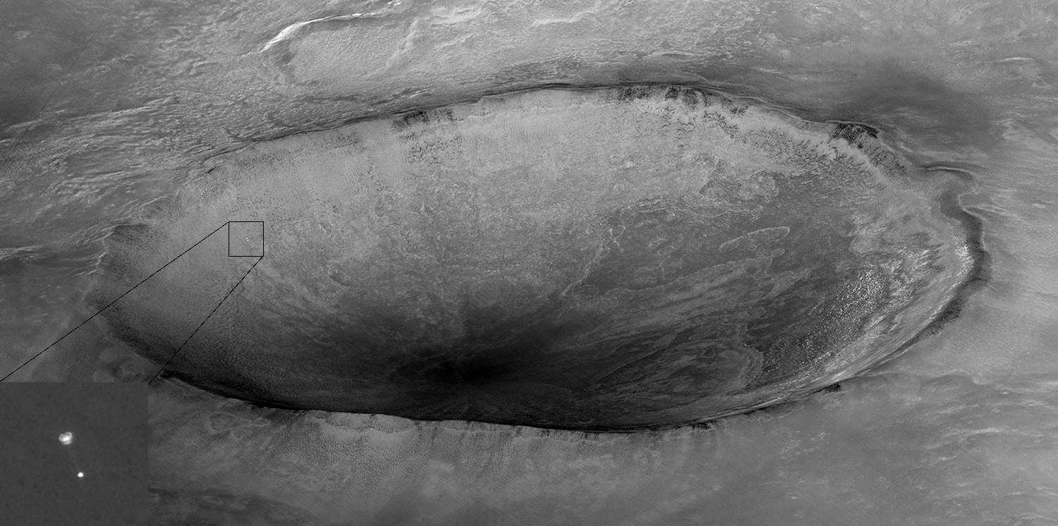
English: Image taken by Mars Reconnaissance Orbiter showing descent of Phoenix with a crater in the background. Original caption from NASA: Español: Imagen tomada por Mars Reconnaissance Orbiter (MRO) que muestra el descenso de la sonda espacial Phoenix y un cráter marciano al fondo. La sonda Phoenix y su paracaídas, que acaba de abrirse, descienden hacia la superficie marciana. Al fondo hay un cráter de 10 km llamado "Heimdall". Aunque parece descender hacia el interior del cráter, la sonda está en realidad 20 kilómetros más cerca a una altitud de 13 km.
Esta imagen fue tomada por la cámara HiRISE de la sonda MRO. En el momento de la toma, MRO se encontraba a 760 km de Phoenix, a una altitud de 310 km, y viajaba a una velocidad de 3,4 km/s. El proyecto Phoenix está dirigido por la Universidad de Arizona y administrado por el Laboratorio de Propulsión a Reacción. La nave espacial fue desarrollada por Lockheed Martin Space Systems. Français : Image prise par la sonde spatiale MRO montrant la descente de la sonde Phoenix et un cratère en arrière plan.
La sonde Phoenix et son parachute qui vient de s'ouvrir descendent vers la surface martienne. En arrière plan se trouve un cratère de 10 km nommé "Heimdall". Bien qu'elle semble descendre vers l'intérieur du cratère, la sonde est en réalité 20 kilomètres plus proche, et a une altitude de 13 km. Українська: Зображення, зроблене Mars Reconnaissance Orbiter, яке показує спуск Фенікса з кратером Марсу, на задньому плані. |
| 日期 | |
| 來源 | http://photojournal.jpl.nasa.gov/catalog/PIA10705 |
| 作者 | NASA/Jet Propulsion Lab-Caltech/University of Arizona |
| 授權許可 (重用此檔案) |
PD-USGOV-NASA |
| 其他版本 | File:Phoenix descent — unannotated.jpg |
評價
|
This image was selected as picture of the day on Wikimedia Commons for 18 December 2021. It was captioned as follows: English: Image taken by Mars Reconnaissance Orbiter showing descent of Phoenix with a crater in the background. Other languages:
Čeština: Snímek pořízený planetární sondou Mars Reconnaissance Orbiter ukazující sestupující sondu Phoenix s kráterem na povrchu Marsu v pozadí. English: Image taken by Mars Reconnaissance Orbiter showing descent of Phoenix with a crater in the background. Español: Imagen tomada por Mars Reconnaissance Orbiter que muestra el descenso de la sonda espacial Phoenix y un cráter marciano al fondo. Français : Image prise par la sonde spatiale MRO montrant la descente de la sonde Phoenix et un cratère en arrière plan. Italiano: Immagine ripresa dal Mars Reconnaissance Orbiter che mostra la discesa della sonda Phoenix con un cratere di Marte sullo sfondo. Magyar: A Mars Reconnaissance Orbiter felvétele a Phoenix űrszonda leszállásáról, a háttérben egy kráterrel Nederlands: Afdaling van de sonde Phoenix naar het oppervlak van Mars. Foto gemaakt dor de Mars Reconnaissance Orbiter. Português: Imagem tirada pela sonda espacial Mars Reconnaissance Orbiter mostrando a descida da Phoenix com uma cratera de Marte ao fundo. Русский: Фотография АМС «Феникс», спускающейся на парашюте в атмосфере Марса, сделанная Mars Reconnaissance Orbiter Українська: Зображення, зроблене Mars Reconnaissance Orbiter, яке показує спуск Фенікса з марсіанським кратером «Геймдаль», на задньому плані. |
| 此標籤不表示文件的著作權狀態。任何文件在附有此標籤的同時還需要一個有效的著作權標籤。請參閱許可協議說明頁面以了解更多資訊。 其他語言:
|
| 本作品由NASA創作,屬於公有領域。根據NASA的版權政策:“NASA的創作除非另有聲明否則不受版權保護。”(參見:Template:PD-USGov/zh,NASA版權政策或JPL圖像使用政策) | ||
 |
警告:
|
原始上傳日誌
| date/time | username | resolution | size | edit summary | |
|---|---|---|---|---|---|
| 22:32, 27 May 2008 | User:BloodIce | <a href="http://upload.wikimedia.org/wikipedia/commons/8/85/PIA10705.jpg"><img alt="Thumbnail for version as of 22:32, 27 May 2008" src="http://upload.wikimedia.org/wikipedia/commons/thumb/8/85/PIA10705.jpg/120px-PIA10705.jpg" width="120" height="60" border="0" /></a> | 1,500×746 | 181 KB | {{Information |Description= Image taken by <a href="http://en.wikipedia.org/wiki/Mars_Reconnaissance_Orbiter" class="extiw" title="en:Mars Reconnaissance Orbiter">Mars Reconnaissance Orbiter</a> showing <a href="http://en.wikipedia.org/wiki/Phoenix_(spacecraft)" class="extiw" title="en:Phoenix (spacecraft)">Phoenix</a> descending with crater in the background. |Source=[http://photojournal.jpl.nasa.gov/spacecraft/MRO Jet |
檔案歷史
點選日期/時間以檢視該時間的檔案版本。
| 日期/時間 | 縮圖 | 尺寸 | 使用者 | 備註 | |
|---|---|---|---|---|---|
| 目前 | 2019年1月7日 (一) 17:20 | | 1,500 × 746(686 KB) | Kesäperuna | 100% JPEG quality from full quality TIFF. |
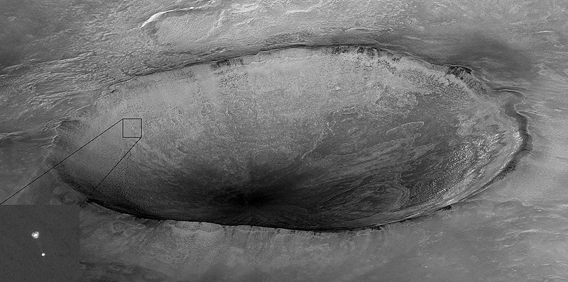
| 2008年12月25日 (四) 07:16 |  | 1,500 × 746(181 KB) | BetacommandBot | move approved by: User:LERK This image was moved from File:PIA10705.jpg {{Featured picture}} == Summary == {{Information |Description= {{en|Image taken by Mars Reconnaissance Orbiter showing descent of [[:en: |
檔案用途
下列10個頁面有用到此檔案:
全域檔案使用狀況
以下其他 wiki 使用了這個檔案:
- af.wikipedia.org 的使用狀況
- alt.wikipedia.org 的使用狀況
- av.wikipedia.org 的使用狀況
- bg.wikipedia.org 的使用狀況
- crh.wikipedia.org 的使用狀況
- cv.wikipedia.org 的使用狀況
- da.wikipedia.org 的使用狀況
- de.wikipedia.org 的使用狀況
- de.wiktionary.org 的使用狀況
- en.wikipedia.org 的使用狀況
- et.wikipedia.org 的使用狀況
- fa.wikipedia.org 的使用狀況
- fr.wikipedia.org 的使用狀況
- ht.wikipedia.org 的使用狀況
- hu.wikipedia.org 的使用狀況
- hy.wikipedia.org 的使用狀況
- it.wikipedia.org 的使用狀況
- ja.wikipedia.org 的使用狀況
- jv.wikipedia.org 的使用狀況
- ka.wikipedia.org 的使用狀況
- kk.wikipedia.org 的使用狀況
- ko.wikipedia.org 的使用狀況
- lbe.wikipedia.org 的使用狀況
- lez.wikipedia.org 的使用狀況
- mk.wikipedia.org 的使用狀況
- ms.wikipedia.org 的使用狀況
檢視此檔案的更多全域使用狀況。