
File:Bastogne Map December 19-23 1944.jpg
本预览的尺寸:800 × 477像素。 其他分辨率:320 × 191像素 | 640 × 381像素 | 1,024 × 610像素 | 1,556 × 927像素。
原始文件 (1,556 × 927像素,文件大小:1.19 MB,MIME类型:image/jpeg)
摘要
| 描写 | ||||||||||
| 日期 | ||||||||||
| 来源 | 美國陸軍軍史中心 | |||||||||
| 創作作者 | ||||||||||
| Geotemporal data | ||||||||||
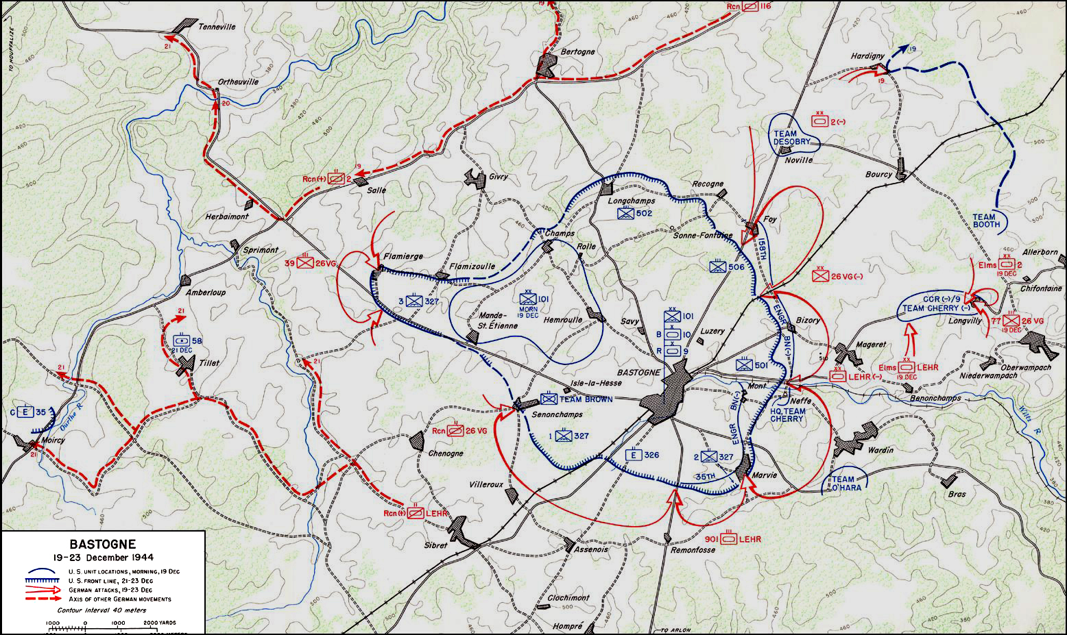
| 描繪日期 | 从1944年12月19日到1944年12月23日 | |||||||||
| 地图位置 | 巴斯托涅 | |||||||||
| 标题 |
 |
|||||||||
| 边框 |
|
|||||||||
| 地理参考 | ||||||||||

|
此military map图片可使用矢量图形重新创建为SVG文件。这具有很多好处;更多信息请参见共享资源:待清理媒体。如果存在此图片的SVG格式,请将其上传,然后将此模板替换为
{{vector version available|新图片名称}}。
建议您将SVG命名为“Bastogne Map December 19-23 1944.svg”,这样在使用Vector version available(或Vva)模板时就不需要填写新图片名称参数。 |


许可协议
| This image is in the public domain because it contains materials that originally came from the United States Army Center of Military History, subject to the following qualification.
Note: The images of all badges, insignia, decorations and medals on the "CMH Online" web site are produced by the United States Army Institute of Heraldry and protected by Title 18, United States Code, Section 704 and the Code of Federal Regulations (32 CFR, Part 507). Permission to use these images for commercial purposes must be obtained from The Institute of Heraldry prior to their use. |

|
文件历史
点击某个日期/时间查看对应时刻的文件。
| 日期/时间 | 缩略图 | 大小 | 用户 | 备注 | |
|---|---|---|---|---|---|
| 当前 | 2006年11月4日 (六) 04:59 | | 1,556 × 927(1.19 MB) | CORNELIUSSEON | {{Information |Description=Bastogne, Belgium Map; december 19-23, 1944. |Source=US Army Center for Military History |Date=December 19-23, 1944 |Author= |Permission={{PD-USGov-Military-Army-USACMH}} – US Army Center for Military History |other_versions= |
文件用途
以下页面使用本文件:
全域文件用途
以下其他wiki使用此文件:
- ar.wikipedia.org上的用途
- ca.wikipedia.org上的用途
- de.wikipedia.org上的用途
- el.wikipedia.org上的用途
- en.wikipedia.org上的用途
- en.wikisource.org上的用途
- es.wikipedia.org上的用途
- he.wikipedia.org上的用途
- it.wikipedia.org上的用途
- ja.wikipedia.org上的用途
- nl.wikipedia.org上的用途
- ru.wikipedia.org上的用途
- sl.wikipedia.org上的用途
- ta.wikipedia.org上的用途
- tr.wikipedia.org上的用途
- www.wikidata.org上的用途