
File:BisdomshertogenboschLocatie.png
此为最大尺寸。
BisdomshertogenboschLocatie.png (270 × 360像素,文件大小:6 KB,MIME类型:image/png)
摘要
| 描述 |
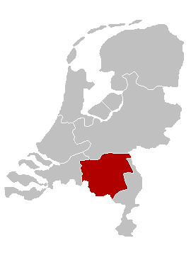
English: Map of the Diocese of 's-Hertogenbosch, The Netherlands Nederlands: Kaart van het nl:Bisdom 's-Hertogenbosch |
| 日期 | 2005年6月11日 (原始上传日期) |
| 来源 | Originally from nl.wikipedia; description page is/was here. |
| 作者 |
Original uploader was Karrow at nl.wikipedia English: Adapted from a map by nl:Gebruiker:LennartBolks (see the maps in Category:Religion in the Netherlands): colours changed by nl:Gebruiker:Karrow
Nederlands: Oorspronkelijk gemaakt door nl:Gebruiker:LennartBolks. Kleuren aangepast door nl:Gebruiker:Karrow. |
| 授权 (二次使用本文件) |
This image is in the public domain. |
许可协议
| |
本作品已被作者中文维基百科项目的Karrow释出到公有领域。这适用于全世界。 如果这样做不合法的话: |
原始上传日志
(All user names refer to nl.wikipedia)
- 2005-06-11 09:46 Karrow 270×360×8 (6205 bytes)
文件历史
点击某个日期/时间查看对应时刻的文件。
| 日期/时间 | 缩略图 | 大小 | 用户 | 备注 | |
|---|---|---|---|---|---|
| 当前 | 2007年5月26日 (六) 17:08 | | 270 × 360(6 KB) | UV | {{Information |Description={{en|Map of the Diocese of 's-Hertogenbosch, The Netherlands}} {{nl|Kaart van het nl:Bisdom 's-Hertogenbosch}} |Source=Originally from nl.wikipedia; description page is/was [[:nl:Image:BisdomshertogenboschLocatie.p |
文件用途
以下页面使用本文件:
全域文件用途
以下其他wiki使用此文件:
- de.wikipedia.org上的用途
- en.wikipedia.org上的用途
- es.wikipedia.org上的用途
- fr.wikipedia.org上的用途
- fy.wikipedia.org上的用途
- id.wikipedia.org上的用途
- it.wikipedia.org上的用途
- jv.wikipedia.org上的用途
- la.wikipedia.org上的用途
- nl.wikipedia.org上的用途
- no.wikipedia.org上的用途
- pl.wikipedia.org上的用途
- ru.wikipedia.org上的用途
- uk.wikipedia.org上的用途
- www.wikidata.org上的用途