
File:Karpathos OnEarth WMS.png

本预览的尺寸:187 × 599像素。 其他分辨率:75 × 240像素 | 150 × 480像素 | 797 × 2,553像素。
原始文件 (797 × 2,553像素,文件大小:2.21 MB,MIME类型:image/png)
| 本圖像屬於公有領域,因其為NASA的World Wind衛星地圖瀏覽器的一張截圖,且使用了公有領域圖層,如Blue Marble、MODIS、Landsat、SRTM、USGS、GLOBE等。
|
 |
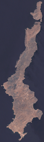
Satellite image of
- English: Karpathos
- Ελληνικά: Κάρπαθος
Image taken from NASA World Wind, OnEarth WMS global mosaic visual layer.
文件历史
点击某个日期/时间查看对应时刻的文件。
| 日期/时间 | 缩略图 | 大小 | 用户 | 备注 | |
|---|---|---|---|---|---|
| 当前 | 2006年9月23日 (六) 13:01 | 797 × 2,553(2.21 MB) | Hautala | {{PD-WorldWind}} Satellite image of * {{en|Karpathos}} * {{el|Κάρπαθος}} Image taken from NASA World Wind, OnEarth WMS global mosaic visual layer. Category:Karpathos Category:Satellite pictures of Greece |
文件用途
以下页面使用本文件:
全域文件用途
以下其他wiki使用此文件:
- ab.wikipedia.org上的用途
- ar.wikipedia.org上的用途
- be.wikipedia.org上的用途
- bg.wikipedia.org上的用途
- de.wikipedia.org上的用途
- en.wikipedia.org上的用途
- fi.wikipedia.org上的用途
- hy.wikipedia.org上的用途
- it.wikipedia.org上的用途
- ru.wikipedia.org上的用途
- sv.wikipedia.org上的用途