
File:Map of Titan - April 2011.jpg
原始文件 (4,374 × 2,430像素,文件大小:2.25 MB,MIME类型:image/jpeg)
摘要

|
本文件已被PIA19658-SaturnMoon-TitanGlobalMap-June2015.jpg取代。建议您使用其他文件。请注意,删除被取代的图片需要达成一致。
|

|
| 描述 |
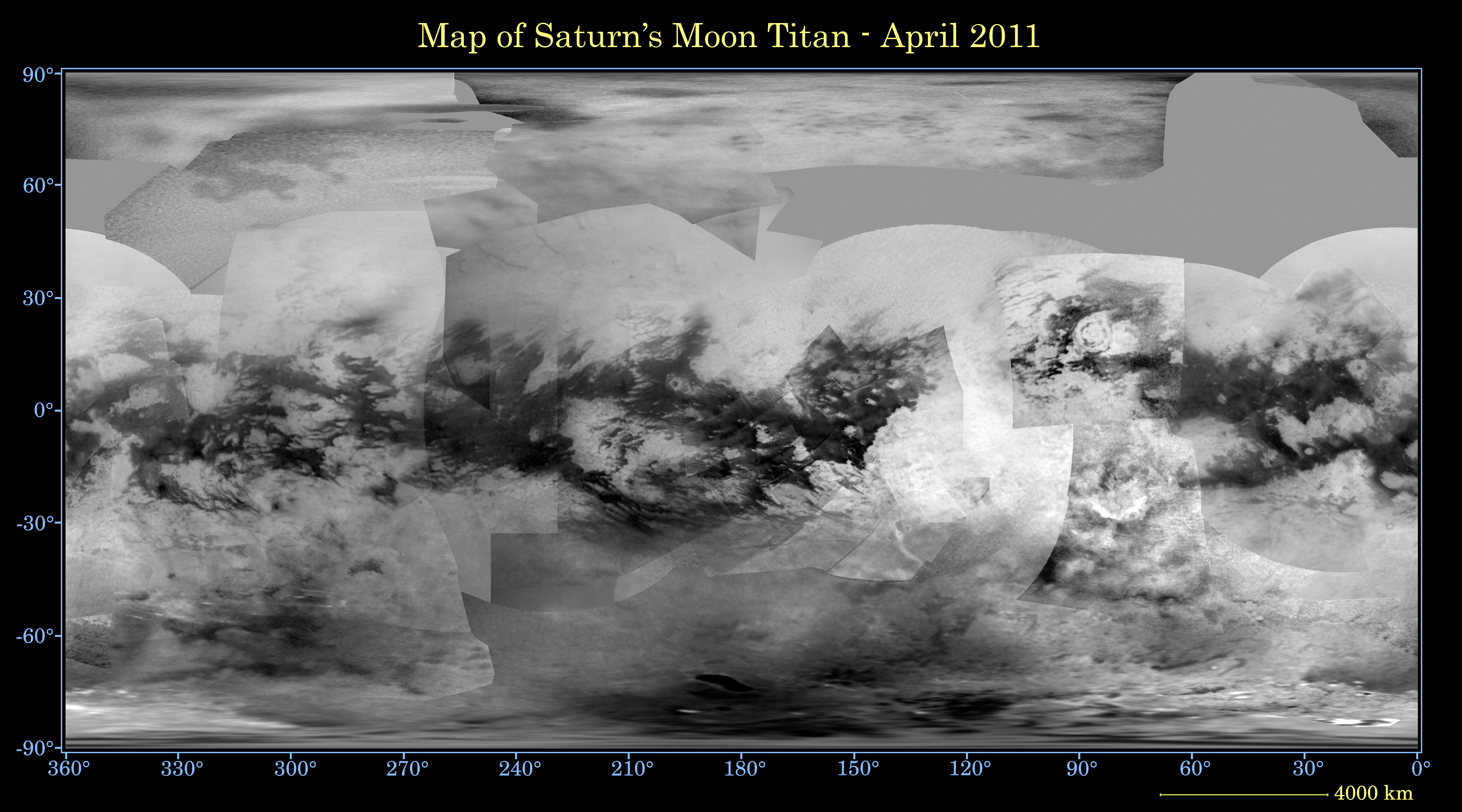
English: This global digital map of Saturn's moon Titan was created using images taken by the Cassini spacecraft's imaging science subsystem (ISS).
The images were taken using a filter centred at 938 nanometres, allowing researchers to examine variations in albedo (or inherent brightness) variations across the surface of Titan. Because of the scattering of light by Titan's dense atmosphere, no topographic shading is visible in these images. The map is an equidistant projection and has a scale of 4 kilometres per pixel. Actual resolution varies greatly across the map, with the best coverage (close to the map scale) along the equator near the centre of the map at 180 degrees west longitude and near the left and right edges at 0 and 360 degrees west longitude. The worst coverage is on the leading hemisphere (particularly around 120 degrees west longitude) and in some northern latitudes. Coverage in the northern polar region continues to improve as the north pole comes out of shadow after Titan's northern vernal equinox in August 2009. Large dark areas, now known to be liquid-hydrocarbon-filled lakes, have been documented at high latitudes. This map is an update to the version released in February 2009. Data from the last two years, including the most recent data in the map from April 2011, have improved coverage in the southern trailing hemisphere and over portions of the north polar region. The mean radius of Titan used for projection of this map is 2,575 kilometres. Titan is assumed to be spherical until a control network -- a model of the moon's shape based on multiple images tied together at defined points on the surface -- is created at some point in the future. |
| 日期 | |
| 来源 | CICLOPS |
| 作者 | NASA/JPL-Caltech/Space Science Institute |
许可协议
| 本文件完全由NASA创作,在美国属于公有领域。根据NASA的版权方针,NASA的材料除非另有声明否则不受版权保护。(参见Template:PD-USGov/zh、NASA版权方针页面或JPL图片使用方针。) | ||
 |
警告:
|
文件历史
点击某个日期/时间查看对应时刻的文件。
| 日期/时间 | 缩略图 | 大小 | 用户 | 备注 | |
|---|---|---|---|---|---|
| 当前 | 2011年10月27日 (四) 14:30 | | 4,374 × 2,430(2.25 MB) | Originalwana | {{Information |Description ={{en|1=This global digital map of Saturn's moon Titan was created using images taken by the Cassini spacecraft's imaging science subsystem (ISS). The images were taken using a filter centred at 938 nanometres, allowing rese |
文件用途
没有页面链接到本图像。
全域文件用途
以下其他wiki使用此文件:
- fr.wikipedia.org上的用途
- id.wikipedia.org上的用途
- it.wikipedia.org上的用途
- lb.wikipedia.org上的用途
- nl.wikipedia.org上的用途
- no.wikipedia.org上的用途
- pl.wikipedia.org上的用途
- ro.wikipedia.org上的用途
- www.wikidata.org上的用途