
File:Sweden Kalmar location map.svg

此SVG文件的PNG预览的大小:327 × 599像素。 其他分辨率:131 × 240像素 | 262 × 480像素 | 419 × 768像素 | 559 × 1,024像素 | 1,118 × 2,048像素 | 546 × 1,000像素。
原始文件 (SVG文件,尺寸为546 × 1,000像素,文件大小:217 KB)
摘要
| 描述 |
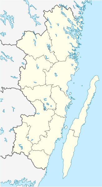
English: Location map of Kalmar County in Sweden. N-S stretching is 183%, geographic limits of the map:
Deutsch: Positionskarte von Kalmar län in Schweden. N-S-Streckung beträgt 183%, geographische Begrenzung der Karte:
|
| 日期 | |
| 来源 | 自己的作品 |
| 作者 | Erik Frohne |
| 其他版本 | 此文件衍生的作品: Öland Municipal centres.svg |
许可协议
我,本作品著作权人,特此采用以下许可协议发表本作品:

|
已授权您依据自由软件基金会发行的无固定段落及封面封底文字(Invariant Sections, Front-Cover Texts, and Back-Cover Texts)的GNU自由文件许可协议1.2版或任意后续版本的条款,复制、传播和/或修改本文件。该协议的副本请见“GNU Free Documentation License”。 |
本文件采用知识共享署名 3.0 未本地化版本许可协议授权。
- 您可以自由地:
- 共享 – 复制、发行并传播本作品
- 修改 – 改编作品
- 惟须遵守下列条件:
- 署名 – 您必须对作品进行署名,提供授权条款的链接,并说明是否对原始内容进行了更改。您可以用任何合理的方式来署名,但不得以任何方式表明许可人认可您或您的使用。
您可以选择您需要的许可协议。
文件历史
点击某个日期/时间查看对应时刻的文件。
| 日期/时间 | 缩略图 | 大小 | 用户 | 备注 | |
|---|---|---|---|---|---|
| 当前 | 2009年1月27日 (二) 08:23 | | 546 × 1,000(217 KB) | Erik Frohne | Waterline adjusted |
| 2009年1月18日 (日) 16:26 |  | 546 × 1,000(216 KB) | Erik Frohne | Added some lakes Category:Location maps of Sweden | |
| 2009年1月17日 (六) 09:58 |  | 546 × 1,000(183 KB) | Erik Frohne | {{Information |Description={{en|1=Location map of Kalmar in Sweden. N-S stretching is 183%, geographic limits of the map: * N: 58.20° N * S: 56.10° N * W: 15.10° E * E: 17.20° E }} {{de|1=Positionskarte von Kalmar in Sweden. N-S-Streckung beträgt 18 |
文件用途
没有页面链接到本图像。
全域文件用途
以下其他wiki使用此文件:
- ar.wikipedia.org上的用途
- arz.wikipedia.org上的用途
- bg.wikipedia.org上的用途
- ca.wikipedia.org上的用途
- ceb.wikipedia.org上的用途
- cs.wikipedia.org上的用途
- da.wikipedia.org上的用途
查看本文件的更多全域用途。