
File:USACE Tenkiller Lake and Dam.jpg
本预览的尺寸:750 × 600像素。 其他分辨率:300 × 240像素 | 600 × 480像素 | 960 × 768像素 | 1,280 × 1,024像素 | 1,500 × 1,200像素。
原始文件 (1,500 × 1,200像素,文件大小:810 KB,MIME类型:image/jpeg)
| 描述 |
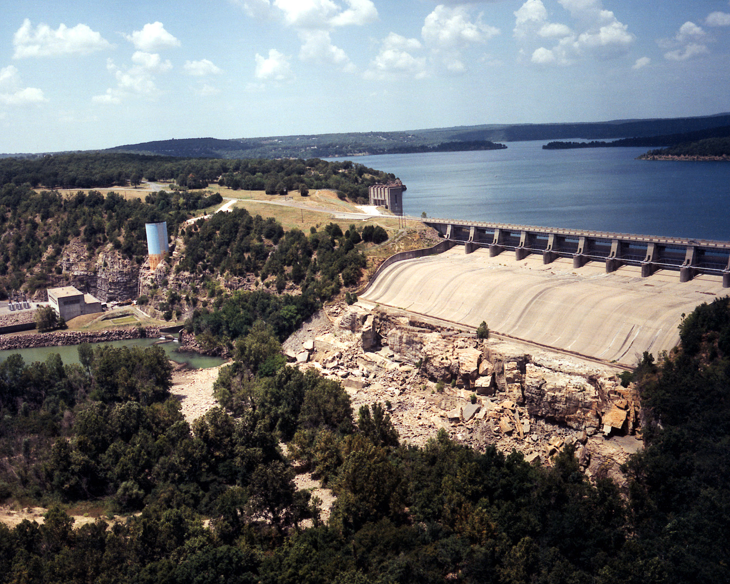
English: Aerial view of Tenkiller Ferry Lake (also known as Tenkiller Lake) and Dam on the Illinois River in Sequoyah County, Oklahoma, USA. The lake backs up into Cherokee County. The earth-fill dam was constructed between 1947 and 1952 by the United States Army Corps of Engineers for purposes of flood control and hydroelectric power generation. This photograph shows only the concrete spillway and powerhouse, and, does not show the largest, earth-fill part of the dam, which would be off to the right of the picture. View is to the north.
Coordinates: 35°35′42.36″N 95°2′51.5″W / 35.5951°N 95.047639°W |
|||
| 图中地点 | Sequoyah County, Oklahoma, USA | |||
| 日期 | (Caveat: Dates provided by U.S. Army Corps of Engineers Digital Visual Library are not reliable and may be wrong.) | |||
| 来源 |
U.S. Army Corps of Engineers Digital Visual Library Image page Image description page Digital Visual Library home page |
|||
| 作者 | U.S. Army Corps of Engineers, photographer not specified or unknown | |||
| 授权 (二次使用本文件) |
|
文件历史
点击某个日期/时间查看对应时刻的文件。
| 日期/时间 | 缩略图 | 大小 | 用户 | 备注 | |
|---|---|---|---|---|---|
| 当前 | 2007年5月11日 (五) 04:07 | | 1,500 × 1,200(810 KB) | DanMS | {{Information | Description = {{en|Aerial view of Tenkiller Ferry Lake (also known as Tenkiller Lake) and Dam on the Illinois River in Sequoyah County, Oklahoma, USA. The lake backs up into Cherokee County. The earth-fill dam was constructed between 19 |
文件用途
以下页面使用本文件:
全域文件用途
以下其他wiki使用此文件:
- ceb.wikipedia.org上的用途
- en.wikipedia.org上的用途
- en.wikivoyage.org上的用途
- www.wikidata.org上的用途