
File:Nubia NASA-WW places german.jpg
本预览的尺寸:391 × 600像素。 其他分辨率:156 × 240像素 | 472 × 724像素。
原始文件 (472 × 724像素,文件大小:58 KB,MIME类型:image/jpeg)
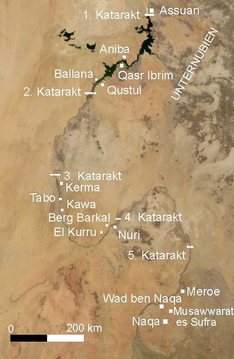
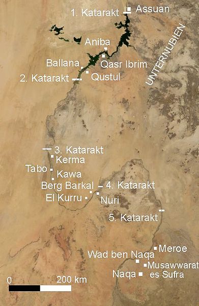
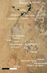
Deutsch: Nubien mit Orten in deutscher Sprache - Satellitenbild erstellt mit Nasa World Wind
English: Map of Ancient Nubia over-layed on satellite picture, with ancient placenames (in german).
- Satellite image created with Nasa World Wind, of present day southern Egypt and northern Sudan.
摘要
taken from de.wiki there under PD-WorldWind with description:
| 描述 |
摘要
|
|||
| 日期 | 2006年4月19日, 01:24:35 (上传日期) | |||
| 来源 | Originally from de.wikipedia; description page is (was) here | |||
| 作者 | User Udimu on de.wikipedia | |||
| 授权 (二次使用本文件) |
|

文件历史
点击某个日期/时间查看对应时刻的文件。
| 日期/时间 | 缩略图 | 大小 | 用户 | 备注 | |
|---|---|---|---|---|---|
| 当前 | 2006年4月15日 (六) 10:03 | | 472 × 724(58 KB) | Sven-steffen arndt |
文件用途
以下页面使用本文件:
全域文件用途
以下其他wiki使用此文件:
- ar.wikipedia.org上的用途
- arz.wikipedia.org上的用途
- ast.wikipedia.org上的用途
- be.wikipedia.org上的用途
- bn.wikipedia.org上的用途
- ca.wikipedia.org上的用途
- cv.wikipedia.org上的用途
- de.wikipedia.org上的用途
- el.wikipedia.org上的用途
- en.wikipedia.org上的用途
- eo.wikipedia.org上的用途
- es.wikipedia.org上的用途
- eu.wikipedia.org上的用途
- frr.wikipedia.org上的用途
- fr.wikipedia.org上的用途
- he.wikipedia.org上的用途
- hy.wikipedia.org上的用途
- ko.wikipedia.org上的用途
- la.wikipedia.org上的用途
- lv.wikipedia.org上的用途
- ro.wikipedia.org上的用途
- ru.wikipedia.org上的用途
- sl.wikipedia.org上的用途
- sr.wikipedia.org上的用途
- tr.wikipedia.org上的用途
- uk.wikipedia.org上的用途
- www.wikidata.org上的用途