
File:Greater London UK location map 2.svg

此 SVG 檔案的 PNG 預覽的大小:750 × 600 像素。 其他解析度:300 × 240 像素 | 600 × 480 像素 | 960 × 768 像素 | 1,280 × 1,024 像素 | 2,560 × 2,048 像素 | 1,425 × 1,140 像素。
原始檔案 (SVG 檔案,表面大小:1,425 × 1,140 像素,檔案大小:2.18 MB)
| 描述 |
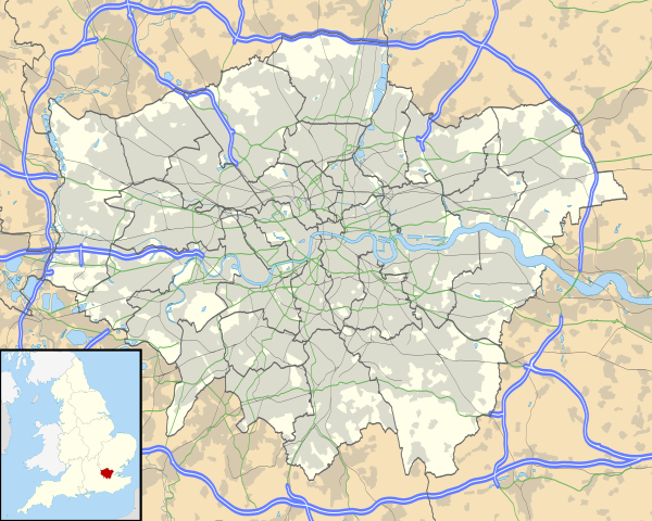
Map of Greater London, UK with the following information shown:
The data includes both primary routes and railway lines. Equirectangular map projection on WGS 84 datum, with N/S stretched 160% Geographic limits:
|
| 日期 | |
| 來源 |
|
| 作者 | Nilfanion, created using Ordnance Survey data |
| 授權許可 (重用此檔案) |
此檔案採用共享創意 姓名標示-相同方式分享 3.0 未在地化版本授權條款。 姓名標示: Contains Ordnance Survey data © Crown copyright and database right
|
| 其他版本 | File:Greater London UK district map (blank).svg - Blank map, File:Greater London UK location map.svg - excluding primary routes and railways |
.svg)
檔案歷史
點選日期/時間以檢視該時間的檔案版本。
| 日期/時間 | 縮圖 | 尺寸 | 用戶 | 備註 | |
|---|---|---|---|---|---|
| 目前 | 2010年10月5日 (二) 17:43 | | 1,425 × 1,140(2.18 MB) | Nilfanion | {{Information |Description=Map of Greater London, UK with the following information shown: *Administrative borders *Coastline, lakes and rivers *Roads and railways *Urban areas The data includes both primary routes and railway lines. |
檔案用途
超過 100 個頁面有用到此檔案。 下列清單只列出前 100 筆有用到此檔案的頁面。 您也可以檢視完整清單。
- 1948年夏季奥林匹克运动会足球比赛
- 1966年國際足協世界盃
- 2012年夏季奧林匹克運動會火炬傳遞
- 2014年至2015年英格蘭足球超級聯賽
- 2015年至2016年英格蘭足球乙級聯賽
- 2015年至2016年英格蘭足球冠軍聯賽
- 2015年至2016年英格蘭足球超級聯賽
- 丹麦山站
- 伊丽莎白二世女王大桥
- 伊靈公園站
- 伍德巷站
- 伍德福德站
- 佩卡姆
- 修院路站
- 倫敦城市機場
- 克拉珀姆交匯站
- 克羅伊登機場
- 北溫布利站
- 南伍德福德站
- 南肯頓站
- 南菲爾德斯站
- 南阿克頓站
- 古納斯伯里站
- 史丹佛溪站
- 哈利斯登站
- 哈羅及威爾德斯通站
- 國家航海博物館
- 埃爾特姆
- 埃里思
- 奇斯克公園站
- 女王公園站
- 威爾斯登交匯站
- 富勒姆大道站
- 巴金賽德站
- 布卢姆茨伯里
- 希思羅機場
- 希斯羅機場4號航站樓站
- 希斯羅機場5號航站樓站
- 帕森綠地站
- 帕特尼橋站
- 戈登·拉姆齊的飛機餐
- 斯尼亞斯布羅克站
- 斯托克韋爾站
- 斯特拉福德国际站
- 斯特拉福德站
- 斯特拉福德高街站
- 旺斯特德站
- 普拉斯托站
- 東帕特尼站
- 東漢姆站
- 東阿克頓站
- 查令十字
- 榆園站
- 歐洲頂級足球俱樂部列表
- 汉默史密斯站 (皮卡迪利线和区域线)
- 海諾特站
- 溫布利中央站
- 溫布頓公園站
- 溫布頓站
- 烏普頓公園站
- 牧者叢市場站
- 牧者叢站 (倫敦地鐵)
- 特南綠地站
- 男爵宮站
- 白城站 (倫敦地鐵)
- 白教堂站
- 石橋公園站
- 紅橋站 (倫敦)
- 紐貝利公園站
- 聖潘克拉斯車站
- 肯薩綠地站
- 肯辛顿(奥林匹亚)站
- 肯頓站
- 英国世界遗产列表
- 英格兰足球超级联赛
- 英格蘭足球俱樂部列表
- 荷蘭公園站
- 菲爾洛普站
- 萊頓斯通站
- 萊頓站
- 薩頓 (倫敦)
- 西布朗普頓站
- 西肯辛頓站
- 西萊斯里普站
- 西邦爾公園站
- 诺丁山
- 貝思納爾綠地站 (倫敦地鐵)
- 貝肯翠站
- 赫頓十字站
- 邱园站
- 里奇蒙站 (倫敦)
- 金丝雀码头
- 金販路站
- 間士丘站
- 阿克頓中央站
- 阿克頓鎮站
- 阿布尼站
- 雷文史各公園站
- 麥爾安德站
- User:KX675/Sandbox 1
檢視連結到這個檔案的更多連結。
全域檔案使用狀況
以下其他 wiki 使用了這個檔案:
- af.wikipedia.org 的使用狀況
- Londense Tower
- Westminster-abdy
- Twickenham
- Greenwich (Londen)
- Penge (Londen)
- Paleis van Westminster
- Canary Wharf
- St John's Wood
- Marylebone
- Stratford, Londen
- Queen Elizabeth Olympic Park
- Sjabloon:Liggingkaart Groter Londen
- Leyton
- Charing Cross
- Lughawe Londen-Heathrow
- Strand, Londen
- Muswell Hill
- London City-lughawe
- Dulwich Village
- Hampstead
- Silvertown
- Shoreditch
- Islington
- Clerkenwell
- Holland Park
- Soho
- Chelsea, Londen
- Southwark
- Hackney Central
- Notting Hill
- Paddington
- Crouch End
- Highgate
- Primrose Hill
- Bloomsbury
- Camden Town
- Spitalfields
- Vauxhall
- Holborn
- Kensington
- Battersea
- Belgravia
- Limehouse
- Bishopsgate
- ar.wikipedia.org 的使用狀況
檢視此檔案的更多全域使用狀況。