
File:WikiProject Asian Americans map.svg

此 SVG 檔案的 PNG 預覽的大小:574 × 341 像素。 其他解析度:320 × 190 像素 | 640 × 380 像素 | 1,024 × 608 像素 | 1,280 × 760 像素 | 2,560 × 1,521 像素。
原始檔案 (SVG 檔案,表面大小:574 × 341 像素,檔案大小:1.07 MB)
摘要
| 描述 |
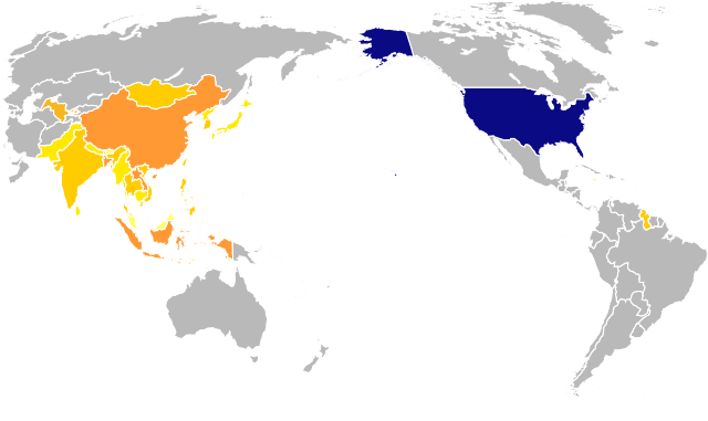
English: A map to be used in the identification of Wikipedia:WikiProject Asian Americans, highlighting both the United States and various areas associated with the Asian-American communities that are within the scope of the project. Highlighted in shades of orange: Bangladesh, Bhutan, Brunei Darussalam, Cambodia, China, Democratic People's Republic of Korea (North Korea), Guyana, Hong Kong, India, Indonesia, Jamaica, Japan, Lao People's Democratic Republic (Laos), Macao, Malaysia, Maldives, Mongolia, Myanmar, Nepal, Pakistan, Philippines, Republic of Korea (South Korea), Singapore, Sri Lanka, Taiwan, Province of China, Thailand, Timor-Leste (East Timor), Trinidad and Tobago, and Viet Nam. Highlighted in dark navy: American Samoa, Guam, Northern Marianas, Puerto Rico, United States of America, United States Minor Outlying Islands, and United States Virgin Islands. |
| 日期 | |
| 來源 | |
| 作者 |
|
| SVG開發 |
授權條款
我,本作品的著作權持有者,決定用以下授權條款發佈本作品:
| 我,此作品的版權所有人,釋出此作品至公共領域。此授權條款在全世界均適用。 這可能在某些國家不合法,如果是的話: 我授予任何人有權利使用此作品於任何用途,除受法律約束外,不受任何限制。 |
原始上傳日誌
This image is a derivative work of the following images:
- BlankMap-World-180E.svg licensed with PD-self
- 2008-04-13T22:24:07Z Lokal Profil 940x477 (3620359 Bytes) {{Information |Description=A blank map of the world centered at the 180E longitude line. Detailed SVG map with grouping enabled to connect all non-contiguous parts of a country's territory for easy colouring. Smaller count
Uploaded with derivativeFX
檔案歷史
點選日期/時間以檢視該時間的檔案版本。
| 日期/時間 | 縮圖 | 尺寸 | 用戶 | 備註 | |
|---|---|---|---|---|---|
| 目前 | 2015年2月14日 (六) 21:26 | | 574 × 341(1.07 MB) | EuroCarGT | Updated per request at Wikipedia's Graphics Lab |
| 2011年6月9日 (四) 21:00 |  | 574 × 341(967 KB) | MissMJ | Highlighting Maldives and East Timor. | |
| 2011年6月8日 (三) 05:48 |  | 575 × 342(990 KB) | MissMJ | Highlighting more countries. | |
| 2011年6月7日 (二) 20:21 |  | 585 × 345(1.04 MB) | MissMJ | Removed black border. | |
| 2011年6月7日 (二) 02:08 |  | 585 × 345(1.04 MB) | MissMJ | Adding back the white background. | |
| 2011年6月7日 (二) 02:04 |  | 585 × 345(1.04 MB) | MissMJ | Removing extraneous shapes outside the visible area to reduce file size. | |
| 2011年6月7日 (二) 02:01 |  | 585 × 345(2.62 MB) | MissMJ | {{Information |Description=A map to be used in the identification of Wikipedia:WikiProject Asian Americans, highlighting both the United States and various areas associated with the Asian-American communities that are within the scope of the project. |
檔案用途
下列19個頁面有用到此檔案:
全域檔案使用狀況
以下其他 wiki 使用了這個檔案:
- en.wikipedia.org 的使用狀況
- Talk:First transcontinental railroad
- Internment of Japanese Americans
- Issei
- Sansei
- Chinese Americans
- Talk:Chinese Americans
- Talk:Chinese Exclusion Act
- Asian Americans
- Talk:Margaret Cho
- Talk:Asia Carrera
- Talk:Iva Toguri D'Aquino
- Talk:Kalpana Chawla
- Talk:Dinesh D'Souza
- Talk:Gish Jen
- Talk:Internment of Japanese Americans
- Korean Americans
- Talk:Executive Order 9066
- Talk:Chien-Shiung Wu
- Talk:Rosalind Chao
- Amerasian
- Talk:Amerasian
- Talk:Maxine Hong Kingston
- Talk:Elaine Chao
- Talk:Fortune cookie
- Talk:Jook-sing
- Taiwanese Americans
- Talk:Yo-Yo Ma
- Talk:Taiwanese Americans
- Asian American Journalists Association
- User talk:Ishu
- Talk:Manzanar
- Talk:Asian Americans
- Talk:List of Japanese Americans
- Talk:Chinatown–International District, Seattle
- Talk:American-born Chinese
- Talk:Gayatri Chakravorty Spivak
- Vietnamese Americans
- Talk:Vietnamese Americans
- Talk:American Chinese cuisine
- Laotian Americans
- Talk:Japanese Americans
- Talk:List of Chinese Americans
- Talk:Vera Wang
- Talk:Soy sauce
- Talk:Deepak Chopra
- Talk:Korematsu v. United States
- Talk:99 Ranch Market
- Talk:Bruce Lee
- Talk:Chinatown, Manhattan
- Talk:Robert Kiyosaki
檢視此檔案的更多全域使用狀況。