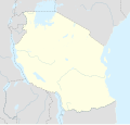
File:Tanzania location map.svg

此SVG文件的PNG预览的大小:630 × 600像素。 其他分辨率:252 × 240像素 | 504 × 480像素 | 807 × 768像素 | 1,076 × 1,024像素 | 2,152 × 2,048像素 | 3,302 × 3,143像素。
原始文件 (SVG文件,尺寸为3,302 × 3,143像素,文件大小:1.04 MB)
文件历史
点击某个日期/时间查看对应时刻的文件。
| 日期/时间 | 缩略图 | 大小 | 用户 | 备注 | |
|---|---|---|---|---|---|
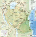
| 当前 | 2017年5月25日 (四) 20:15 |  | 3,302 × 3,143(1.04 MB) | Sémhur | Updated with Songwe Region |
| 2013年12月13日 (五) 14:16 |  | 3,096 × 2,947(1.03 MB) | Sémhur | Updated with the four new regions | |
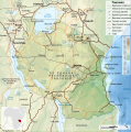
| 2009年7月25日 (六) 00:30 |  | 3,096 × 2,947(829 KB) | BetacommandBot | move approved by: User:Sémhur This image was moved from File:Tanzania location equirectangular map.svg =={{int:summary}}== {{Information |Description={{en|1=Location map of en:Tanzania.}} {{fr|1=Carte de géolocalisation de la [[:fr:Tanz |
文件用途
以下42个页面使用本文件:
- 乞力马扎罗国家公园
- 伊林加
- 卡塔維國家公園
- 卡桑加
- 喬扎尼楚瓦卡灣國家公園
- 圖庫尤
- 坦尚尼亞世界遺產列表
- 基尔瓦基斯瓦尼
- 基巴哈
- 基戈馬
- 塔波拉
- 塞伦盖蒂国家公园
- 塞卢斯禁猎区
- 多多马
- 姆特瓦拉机场
- 姆貝亞
- 孔多阿岩画遗址
- 巴加莫約
- 巴巴蒂
- 恩戈罗恩戈罗保护区
- 朱利叶斯·尼雷尔国际机场
- 松巴萬加
- 松蓋阿
- 桑給巴爾革命
- 桑给巴尔市
- 桑给巴尔石头城
- 楠西奥
- 温古贾岛
- 潘加尼
- 烏凱雷豐島
- 烏吉吉
- 烏德宗瓦山脈國家公園
- 科羅圭
- 莫希
- 莫罗戈罗
- 达累斯萨拉姆
- 阿魯沙國家公園
- 阿鲁沙
- 阿鲁沙机场
- 魯邦多島國家公園
- Template:Location map Tanzania
- Template:坦桑尼亚世界遗产
全域文件用途
以下其他wiki使用此文件:
- af.wikipedia.org上的用途
- als.wikipedia.org上的用途
- am.wikipedia.org上的用途
- an.wikipedia.org上的用途
- ar.wikipedia.org上的用途
- ast.wikipedia.org上的用途
- Monte Kilimanjaro
- Llagu Tanganica
- Llagu Victoria
- Dodoma
- Dar es Salaam
- Mahenge
- Montes Kipengere
- Montes Pare
- Montes Usambara
- Pradera volcánica del Serengueti
- Llagu Rukwa
- Llagu Eyasi
- Llagu Natron
- Parque nacional Serengueti
- Módulu:Mapa de llocalización/datos/Tanzania
- Módulu:Mapa de llocalización/datos/Tanzania/usu
- Archipiélagu de Zanzíbar
- Mezquita Gadafi
- Bagamoyo
- Gargüelu d'Olduvai
- Gran Mezquita de Kilwa
- Parque nacional Arusha
- Aeropuertu de Songwe
- Kigoma
- Puertu de Dar es-Salam
- Puertu de Tanga
- av.wikipedia.org上的用途
- azb.wikipedia.org上的用途
查看本文件的更多全域用途。


