
File:Bodensee satellit.jpg

預覽大小:800 × 496 像素。 其他解析度:320 × 198 像素 | 640 × 397 像素 | 1,024 × 635 像素 | 1,394 × 864 像素。
原始檔案 (1,394 × 864 像素,檔案大小:224 KB,MIME 類型:image/jpeg)
摘要
| 描述 |
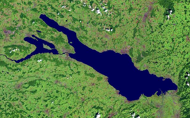
Deutsch: Satellitenaufnahme vom Bodensee |
| 日期 | 在2005年8月17日之前 |
| 來源 | from NASA World Wind - Free Satellite Image |
| 作者 | NASA |
摘要
| 本圖像屬於公有領域,因其為NASA的World Wind衛星地圖瀏覽器的一張截圖,且使用了公有領域圖層,如Blue Marble、MODIS、Landsat、SRTM、USGS、GLOBE等。
|
 |
檔案歷史
點選日期/時間以檢視該時間的檔案版本。
| 日期/時間 | 縮圖 | 尺寸 | 使用者 | 備註 | |
|---|---|---|---|---|---|
| 目前 | 2005年12月1日 (四) 15:28 | | 1,394 × 864(224 KB) | Wiki-vr | enhanced |
| 2005年8月17日 (三) 00:44 |  | 1,394 × 864(138 KB) | APPER | * Satellitenaufnahme vom Bodensee * from Nasa World Wind - Free Satellite Image {{PD-USGov}} |
檔案用途
下列頁面有用到此檔案:
全域檔案使用狀況
以下其他 wiki 使用了這個檔案:
- af.wikipedia.org 的使用狀況
- als.wikipedia.org 的使用狀況
- arz.wikipedia.org 的使用狀況
- az.wikipedia.org 的使用狀況
- ba.wikipedia.org 的使用狀況
- bg.wikipedia.org 的使用狀況
- bs.wikipedia.org 的使用狀況
- ceb.wikipedia.org 的使用狀況
- da.wikipedia.org 的使用狀況
- de.wikipedia.org 的使用狀況
- Bodensee
- Benutzer:Itta
- Mainau
- Reichenau (Insel)
- Benutzer:Rhinux
- Hoy (Bodensee)
- Werd (Bodensee)
- Benutzer:Marcel601
- Benutzer:Ralfonso
- Seerhein
- Benutzer:Trinityfolium
- Benutzer:Vorlage/Herkunftsvorlagen
- Benutzer:NicolasK
- Benutzer:Sir.toby
- Benutzer:Manerr
- Benutzer:NetCuRLi
- Galgeninsel
- Benutzer:Vorlage/vom Bodensee
- Benutzer:Shippo~dewiki
- Benutzer:Mkt.berlin88
- Benutzer:Mk-fn
- Benutzer:Widipedia
- Benutzer:Zollernalb
- Portal:Ungarn/Quiz
- Benutzer:Manu-LA
- Benutzer:Vorlage/Herkunftsvorlagen/Baden-Württemberg
- Benutzer:Vorlage/Herkunftsvorlagen/Bayern
- Bodensee-Rundweg
- Benutzer:TwilightFreak
- Benutzer:Master baerr
- Benutzer:MP Trixi
- Benutzer:Weber Mi
- Benutzer:Hintze
- Benutzer:KMJagger
- Benutzer:Sweet Chily
- Benutzer:Maasty
- Benutzer:Rudolf von Rheinfelden/Labor/Artikelbaustelle 2
檢視此檔案的更多全域使用狀況。