
File:German east africa map.png
預覽大小:600 × 600 像素。 其他解析度:240 × 240 像素 | 480 × 480 像素 | 768 × 768 像素 | 1,024 × 1,024 像素 | 2,000 × 2,000 像素。
原始檔案 (2,000 × 2,000 像素,檔案大小:602 KB,MIME 類型:image/png)
摘要
| 描述 |
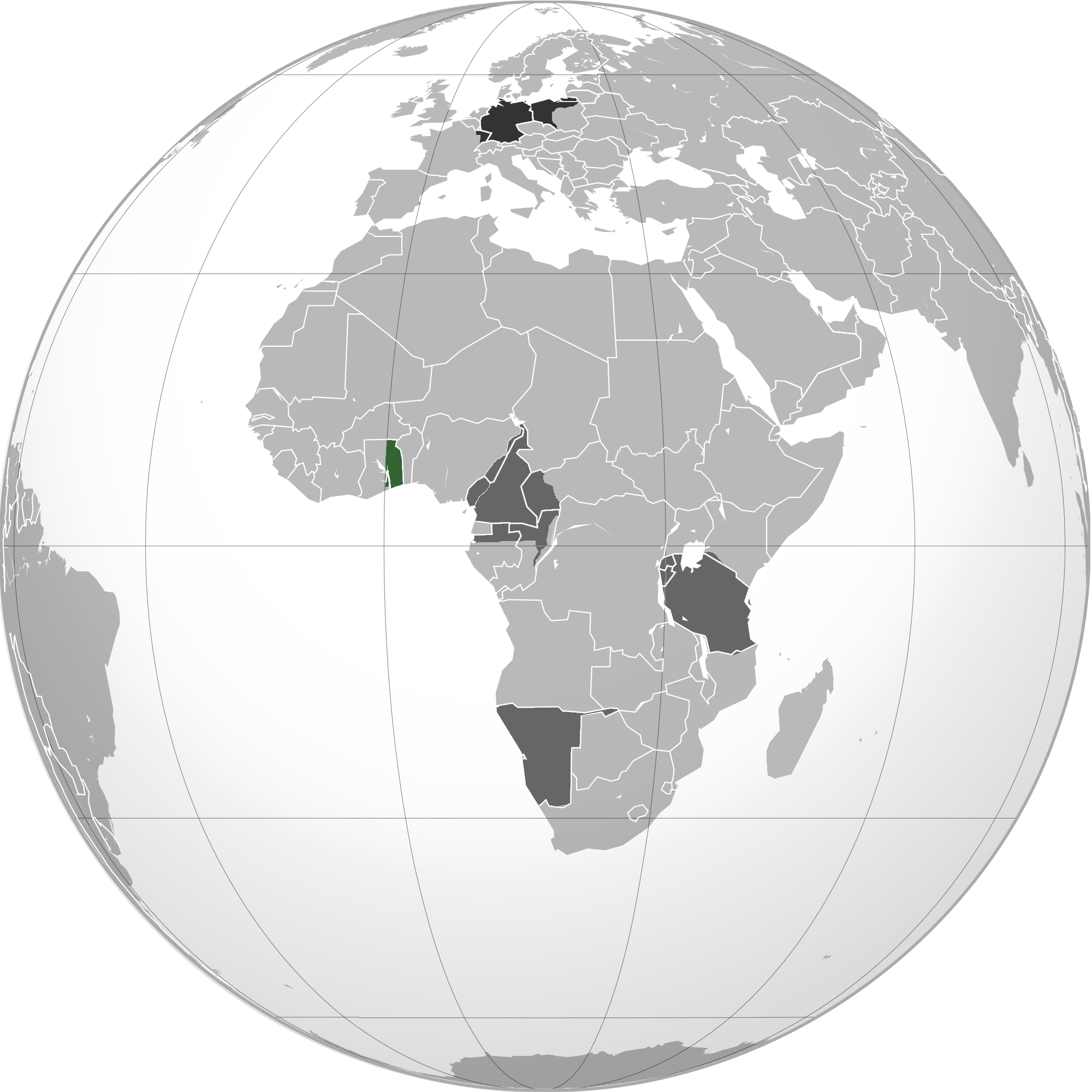
English: Green: Territory comprising German colony of German East Africa Dark gray: Other German possessions Darkest gray: German Empire Note: The map uses the borders of the present-day, but the historical extent for German territories are depicted. |
| 日期 | 2010年6月2日 (原始上傳日期) |
| 來源 | 原始上傳者自己的作品 |
| 作者 | User:VoodooIsland |
授權條款
| 此作品已由其作者,VoodooIsland,釋出至公有領域。此授權條款在全世界均適用。 這可能在某些國家不合法,如果是的話: |
原始上傳日誌
Transferred from en.wikipedia to Commons using For the Common Good.
The original description page was here. All following user names refer to en.wikipedia.
| 日期/時間 | 尺寸 | 使用者 | 備註 |
|---|---|---|---|
| 20:43, 2 June 2010 | 2,000 × 2,000 (609,979 bytes) | w:en:VoodooIsland (留言 | 貢獻) | '''Green''': Territory comprising German colony of German East Africa<br>'''Dark gray''': Other [[German colonial empire|German possessions]]<br>'''Darkest gray''': [[German Empire]] '''Note''': The map uses the borders of the present-day, but the histor |
檔案歷史
點選日期/時間以檢視該時間的檔案版本。
| 日期/時間 | 縮圖 | 尺寸 | 使用者 | 備註 | |
|---|---|---|---|---|---|
| 目前 | 2023年2月10日 (五) 15:41 | | 2,000 × 2,000(602 KB) | Goran tek-en | Added border of South Sudan as requested by Maphobbyist |
| 2014年3月21日 (五) 16:03 |  | 2,000 × 2,000(596 KB) | XXN | Transferred from en.wikipedia: see original upload log above |
檔案用途
下列頁面有用到此檔案:
全域檔案使用狀況
以下其他 wiki 使用了這個檔案:
- af.wikipedia.org 的使用狀況
- ar.wikipedia.org 的使用狀況
- azb.wikipedia.org 的使用狀況
- bg.wikipedia.org 的使用狀況
- cs.wikipedia.org 的使用狀況
- he.wikipedia.org 的使用狀況
- id.wikipedia.org 的使用狀況
- it.wikipedia.org 的使用狀況
- ka.wikipedia.org 的使用狀況
- lt.wikipedia.org 的使用狀況
- ms.wikipedia.org 的使用狀況
- nl.wikipedia.org 的使用狀況
- pnb.wikipedia.org 的使用狀況
- pt.wikipedia.org 的使用狀況
- sco.wikipedia.org 的使用狀況
- th.wikipedia.org 的使用狀況
- tr.wikipedia.org 的使用狀況
- uk.wikipedia.org 的使用狀況
- vi.wikipedia.org 的使用狀況