
File:Quiet River Tyne - geograph.org.uk - 205421.jpg
無更高解析度可提供。
Quiet_River_Tyne_-_geograph.org.uk_-_205421.jpg (640 × 480 像素,檔案大小:54 KB,MIME 類型:image/jpeg)
摘要
| 描述 |
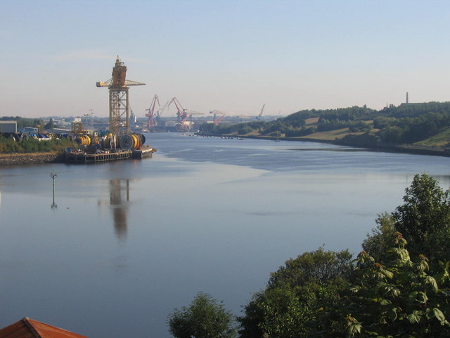
English: Quiet River Tyne. Impressive right angle bend in the Tyne shows us huge expanse of water. In the background is Swan Hunter's Shipyard. On 14th of July 2006 it was made public that the shipyard would never again make another ship.
On the 17th of July the HMS Lyme Bay was towed, half completed, from its slipway. |
| 日期 | |
| 來源 | From geograph.org.uk |
| 作者 | Mark Smiles |
| 目標地點 | | 位於此地的本圖片與其他圖片: OpenStreetMap |
|---|
_&language=zh-hant)
授權條款

|
此檔案採用創用CC 姓名標示-相同方式分享 2.0 通用版授權條款。
姓名標示: Mark Smiles
- 您可以自由:
- 分享 – 複製、發佈和傳播本作品
- 重新修改 – 創作演繹作品
- 惟需遵照下列條件:
- 姓名標示 – 您必須指名出正確的製作者,和提供授權條款的連結,以及表示是否有對內容上做出變更。您可以用任何合理的方式來行動,但不得以任何方式表明授權條款是對您許可或是由您所使用。
- 相同方式分享 – 如果您利用本素材進行再混合、轉換或創作,您必須基於如同原先的相同或兼容的條款,來分布您的貢獻成品。
檔案歷史
點選日期/時間以檢視該時間的檔案版本。
| 日期/時間 | 縮圖 | 尺寸 | 使用者 | 備註 | |
|---|---|---|---|---|---|
| 目前 | 2010年1月31日 (日) 20:47 | | 640 × 480(54 KB) | GeographBot | == {{int:filedesc}} == {{Information |description={{en|1=Quiet River Tyne. Impressive right angle bend in the Tyne shows us huge expanse of water. In the background is Swan Hunter's Shipyard. On 14th of July 2006 it was made public that the shipyard would |
檔案用途
下列頁面有用到此檔案:
全域檔案使用狀況
以下其他 wiki 使用了這個檔案:
- ar.wikipedia.org 的使用狀況
- bn.wiktionary.org 的使用狀況
- ca.wikipedia.org 的使用狀況
- en.wikipedia.org 的使用狀況
- en.wiktionary.org 的使用狀況
- es.wikipedia.org 的使用狀況
- fr.wikipedia.org 的使用狀況
- fy.wikipedia.org 的使用狀況
- ja.wikipedia.org 的使用狀況
- ko.wikipedia.org 的使用狀況
- lt.wikipedia.org 的使用狀況
- nn.wikipedia.org 的使用狀況
- th.wikipedia.org 的使用狀況
- uk.wikipedia.org 的使用狀況