
File:Map of the partition of the Kingdom of Poland and the Grand Duchy of Lithuania from 1799.jpg

預覽大小:669 × 600 像素。 其他解析度:268 × 240 像素 | 535 × 480 像素 | 856 × 768 像素 | 1,142 × 1,024 像素 | 2,284 × 2,048 像素 | 6,330 × 5,677 像素。
原始檔案 (6,330 × 5,677 像素,檔案大小:6.83 MB,MIME 類型:image/jpeg)
摘要
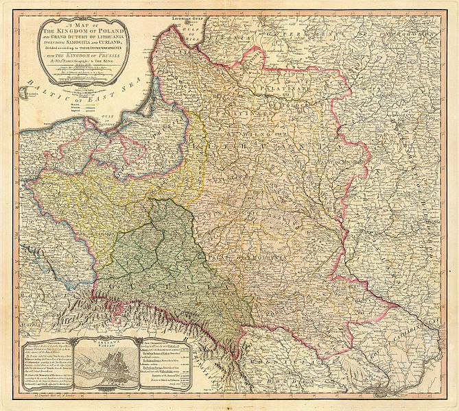
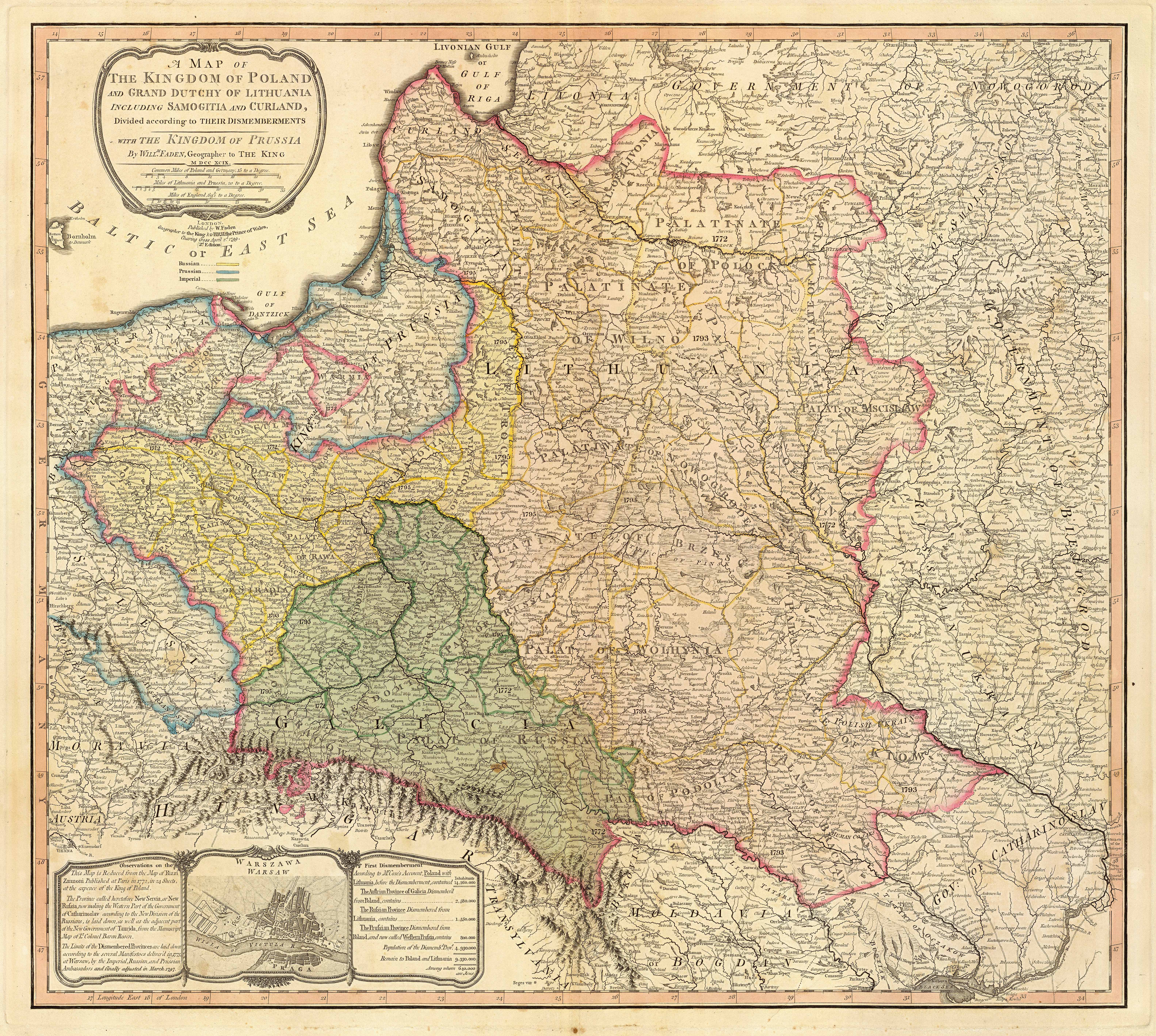
| 描述 | Title: "A map of the Kingdom of Poland and the Grand Duchy of Lithuania including Samogitia and Curland divided according to their dismemberments with the Kingdom of Prussia". A map from 1799 showing how the Polish-Lithuanian Commonwealth was partitioned in 1765-1795 between Prussia, Austria, and Russia. This is an extremely detailed map which lists all the cities and small towns and labels the regions according to their English names. The boundaries former Polish-Lithuanian Commonwealth colored light red. The areas taken by Prussia are colored yellow, those taken by Austria colored green, and those taken by Russia are colored beige. Prussia itself is bordered in blue. Eastern Pomerania and Warmia are shown as part of Prussia but bordered in red as well. |
| 日期 | |
| 來源 | http://www.belarusguide.com/images/maps/Kokosha/POlonia&Lituania-1799.jpg |
| 作者 |
授權條款
|
本作品在其來源國以及其他版權期限是作者逝世後100年或以下的國家與地區屬於公有領域。 | |
| 此作品無已知的著作權限制,亦不受所有相關和鄰接的權利限制。 | |
檔案歷史
點選日期/時間以檢視該時間的檔案版本。
| 日期/時間 | 縮圖 | 尺寸 | 用戶 | 備註 | |
|---|---|---|---|---|---|
| 目前 | 2007年9月23日 (日) 05:04 | | 6,330 × 5,677(6.83 MB) | Archaeogenetics | {{Information |Description=Title: "A map of the Kingdom of Poland and the Grand Duchy of Lithuania including Samogitia and Curland divided according to their dismemberments with the Kingdom of Prussia". A map from 1799 showing how the Polish-Lithuanian Co |
檔案用途
下列頁面有用到此檔案:
全域檔案使用狀況
以下其他 wiki 使用了這個檔案:
- en.wikipedia.org 的使用狀況
- et.wikipedia.org 的使用狀況
- lt.wikipedia.org 的使用狀況
- lt.wikibooks.org 的使用狀況
- pnb.wikipedia.org 的使用狀況
- th.wikipedia.org 的使用狀況
- uk.wikipedia.org 的使用狀況
- ur.wikipedia.org 的使用狀況