
File:Uttar Pradesh locator map.svg

此 SVG 檔案的 PNG 預覽的大小:615 × 599 像素。 其他解析度:246 × 240 像素 | 492 × 480 像素 | 788 × 768 像素 | 1,051 × 1,024 像素 | 2,101 × 2,048 像素 | 909 × 886 像素。
原始檔案 (SVG 檔案,表面大小:909 × 886 像素,檔案大小:838 KB)
摘要
| 描述 |
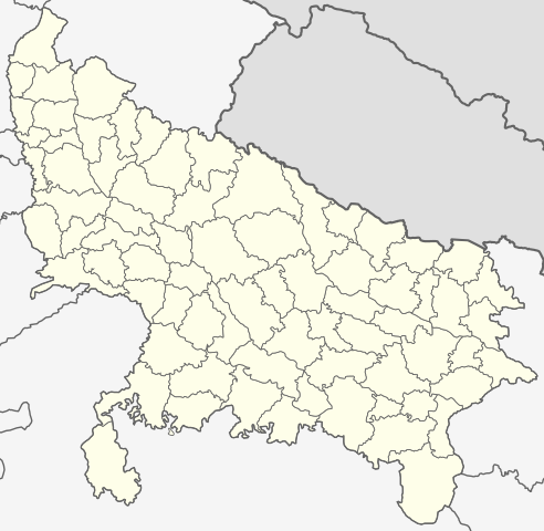
English: This map has been created by Faiz Haider, it is based on Map of Uttar Pradesh on National Portal of India. Equirectangular projection. Geographic limits of the map: top=31.00, bottom=23.50, left=76.60, right=85.00. |
| 日期 | 2009年二月10日 (原始上傳日期) |
| 來源 | Transferred from en.wikipedia to Commons by Hanhil using CommonsHelper. |
| 作者 | 英文維基百科的Faizhaider |
授權條款
| 此作品已由其作者,英文維基百科的Faizhaider,釋出至公有領域。此授權條款在全世界均適用。 這可能在某些國家不合法,如果是的話: Faizhaider授予任何人有權利使用此作品於任何用途,除受法律約束外,不受任何限制。 |
原始上傳日誌
The original description page was here. All following user names refer to en.wikipedia.
- 2009-02-10 08:49 Faizhaider 2400×2515× (140024 bytes) This map has been created by [[User:Faizhaider|me]], it is based on [http://india.gov.in/maps/up.php Map of Uttar Pradesh on National Portal of India].
檔案歷史
點選日期/時間以檢視該時間的檔案版本。
| 日期/時間 | 縮圖 | 尺寸 | 用戶 | 備註 | |
|---|---|---|---|---|---|
| 目前 | 2021年1月8日 (五) 03:11 | | 909 × 886(838 KB) | C1MM | Updated districts, made more accurate boundaries |
| 2011年3月6日 (日) 23:32 |  | 2,400 × 2,515(137 KB) | Plasticspork | Use more neutral colouring | |
| 2009年11月5日 (四) 21:34 |  | 2,400 × 2,515(137 KB) | File Upload Bot (Magnus Manske) | {{BotMoveToCommons|en.wikipedia|year={{subst:CURRENTYEAR}}|month={{subst:CURRENTMONTHNAME}}|day={{subst:CURRENTDAY}}}} {{Information |Description={{en|This map has been created by Faiz Haider, it is based on [http://india.gov.in/m |
檔案用途
下列71個頁面有用到此檔案:
- 乔达摩菩提那加尔县
- 伯斯蒂縣
- 伯爾拉姆布爾縣
- 加济阿巴德县
- 加茲布爾縣
- 勒克瑙縣
- 勒金布尔凯里县
- 卡斯甘傑縣
- 哈爾多伊縣
- 哈特拉斯縣
- 坎普爾郊縣
- 坎瑙吉縣
- 埃塔瓦縣
- 埃塔縣
- 奧萊亞縣
- 安倍德卡爾那加爾縣
- 安拉阿巴德縣
- 密拉特县
- 巴利亞縣
- 巴拉班基縣
- 巴格帕特县
- 巴赫賴奇縣
- 巴雷利縣
- 布兰德沙哈尔县
- 布道恩縣
- 戈勒克布爾縣
- 拉利特普爾縣
- 拘尸那揭羅縣
- 昌達烏利縣
- 普拉塔加爾縣
- 曼普里縣
- 松巴得拉縣
- 根瑙杰县
- 桑巴爾縣
- 比杰诺尔县
- 江布爾縣
- 沙賈漢布爾縣
- 法扎巴德縣
- 法魯卡巴德縣
- 溫瑙縣
- 班達縣
- 瓦拉納西縣
- 皮利比特縣
- 穆扎法爾訥格爾縣
- 米爾扎布爾縣
- 考夏姆比縣
- 聖卡比爾那加爾縣
- 聖拉維達斯那加爾縣
- 莫拉達巴德縣
- 菲罗扎巴德县
- 薩哈蘭普爾
- 薩哈蘭普爾縣
- 蘇丹普爾縣
- 蘭浦爾縣
- 詹西縣
- 謝拉瓦斯蒂縣
- 貢達縣
- 費特普爾縣
- 賈勞恩縣
- 迪奧里亞縣
- 錫塔布爾縣
- 錫達特那加爾縣
- 阿姆羅赫縣
- 阿格拉縣
- 阿桑加爾縣
- 阿里格爾縣
- 雷巴雷利縣
- 馬哈拉吉甘傑縣
- 馬圖拉縣
- 馬奧巴縣
- Template:北方邦行政区划小作品
全域檔案使用狀況
以下其他 wiki 使用了這個檔案:
- awa.wikipedia.org 的使用狀況
- bh.wikipedia.org 的使用狀況
- उत्तर प्रदेश
- गोरखपुर जिला
- गाजीपुर जिला
- रसड़ा
- गोरखपुर
- कुशीनगर जिला
- टेम्पलेट:उत्तर प्रदेश
- उत्तर प्रदेश के मंडल सभ के लिस्ट
- औंड़िहार
- रेवती, बलियाँ जिला
- चितबड़ागाँव
- बेल्थरा रोड
- गड़वार
- नगरा
- फेफना
- सहतवार
- उत्तर प्रदेश के जिला सभ के लिस्ट
- टेम्पलेट:Uttar Pradesh topics
- उत्तर प्रदेश पुलिस
- आजमगढ़ मंडल
- गोरखपुर मंडल
- इलाहाबाद मंडल
- वाराणसी मंडल
- जनसंख्या अनुसार उत्तर प्रदेश के शहरन के लिस्ट
- बस्ती मंडल
- आगरा मंडल
- अलीगढ़ मंडल
- ceb.wikipedia.org 的使用狀況
- en.wikipedia.org 的使用狀況
- Uttar Pradesh
- List of districts of Uttar Pradesh
- Urdu literature
- List of chief ministers of Uttar Pradesh
- Administrative divisions of Uttar Pradesh
- User talk:Planemad/Infobox Indian Landmark
- Template:Uttar Pradesh topics
- User:Faizhaider/gallery
- Noida ATS Shootout
- Pratapgarh stampede
- Chak Gharpur
- Climate of Uttar Pradesh
- List of cities in Uttar Pradesh by population
- List of urban agglomerations in Uttar Pradesh
- Uttar Pradesh Tourism
- Clean UP, Green UP
- List of urban local bodies in Uttar Pradesh
- fa.wikipedia.org 的使用狀況
檢視此檔案的更多全域使用狀況。