
File:Yarramap.png
預覽大小:800 × 486 像素。 其他解析度:320 × 194 像素 | 640 × 388 像素 | 972 × 590 像素。
原始檔案 (972 × 590 像素,檔案大小:31 KB,MIME 類型:image/png)
摘要
| 描述 |
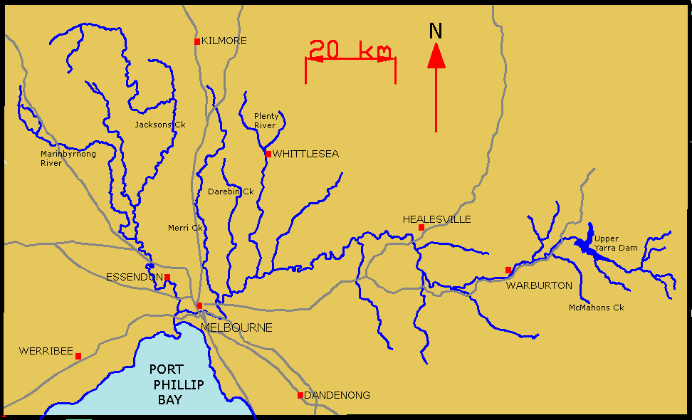
English: Map of Yarra River and its tributaries. |
| 日期 | 2006年八月25日 (原始上傳日期) |
| 來源 | Transferred from en.wikipedia to Commons. |
| 作者 | 英文維基百科的Lentisco |
授權條款
| 此作品已由其作者,英文維基百科的Lentisco,釋出至公有領域。此授權條款在全世界均適用。 這可能在某些國家不合法,如果是的話: Lentisco授予任何人有權利使用此作品於任何用途,除受法律約束外,不受任何限制。 |
原始上傳日誌
The original description page was here. All following user names refer to en.wikipedia.
- 2006-08-25 01:55 Lentisco 972×590×8 (31751 bytes) Map of Yarra River and its tributaries.
檔案歷史
點選日期/時間以檢視該時間的檔案版本。
| 日期/時間 | 縮圖 | 尺寸 | 用戶 | 備註 | |
|---|---|---|---|---|---|
| 目前 | 2008年3月23日 (日) 08:57 | | 972 × 590(31 KB) | File Upload Bot (Magnus Manske) | {{BotMoveToCommons|en.wikipedia}} {{Information |Description={{en|Map of Yarra River and its tributaries.}} |Source=Transferred from [http://en.wikipedia.org en.wikipedia] |Date=2006-08-25 (original upload date) |Author=Original uploader was [[:en:User:L |
檔案用途
下列頁面有用到此檔案:
全域檔案使用狀況
以下其他 wiki 使用了這個檔案:
- be-tarask.wikipedia.org 的使用狀況
- be.wikipedia.org 的使用狀況
- cs.wikipedia.org 的使用狀況
- de.wikipedia.org 的使用狀況
- en.wikipedia.org 的使用狀況
- es.wikipedia.org 的使用狀況
- fi.wikipedia.org 的使用狀況
- fr.wikipedia.org 的使用狀況
- ga.wikipedia.org 的使用狀況
- he.wikipedia.org 的使用狀況
- pl.wikipedia.org 的使用狀況
- ru.wikipedia.org 的使用狀況
- sr.wikipedia.org 的使用狀況
- uk.wikipedia.org 的使用狀況
- www.wikidata.org 的使用狀況