
File:IBEX all sky map.jpg

預覽大小:800 × 450 像素。 其他解析度:320 × 180 像素 | 640 × 360 像素 | 1,024 × 576 像素 | 1,280 × 720 像素 | 2,560 × 1,440 像素。
原始檔案 (2,560 × 1,440 像素,檔案大小:523 KB,MIME 類型:image/jpeg)
摘要
| 描述 |
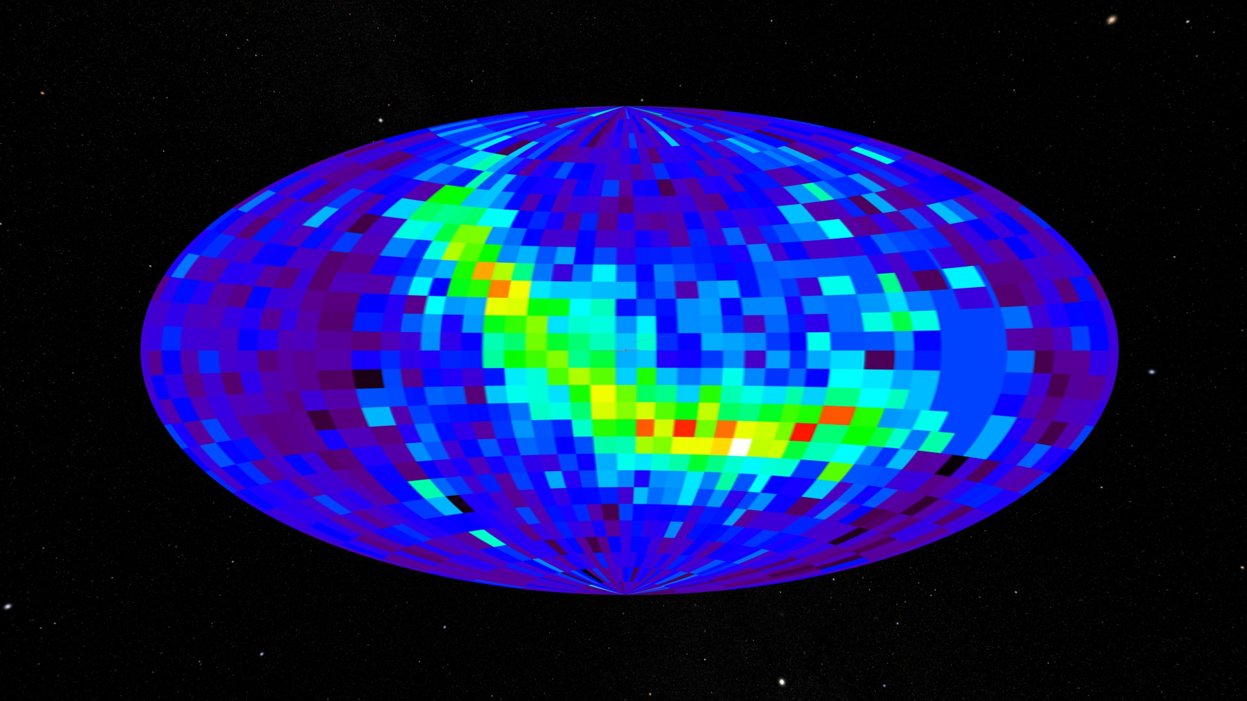
English: All-sky map created using the IBEX spacecraft. This data comes from the IBEX-Hi instrument showing differential flux at 0.9-1.5 keV. |
| 日期 | (released) |
| 來源 | https://svs.gsfc.nasa.gov/3635 (image link) |
| 作者 | NASA/Goddard Space Flight Center Scientific Visualization Studio/Tom Bridgman |
授權條款
| 本作品由NASA創作,屬於公有領域。根據NASA的版權政策:“NASA的創作除非另有聲明否則不受版權保護。”(參見:Template:PD-USGov/zh,NASA版權政策或JPL圖像使用政策) | ||
 |
警告:
|
檔案歷史
點選日期/時間以檢視該時間的檔案版本。
| 日期/時間 | 縮圖 | 尺寸 | 使用者 | 備註 | |
|---|---|---|---|---|---|
| 目前 | 2018年5月17日 (四) 06:30 | | 2,560 × 1,440(523 KB) | Huntster | Full resolution. |
| 2009年10月17日 (六) 00:05 |  | 320 × 180(41 KB) | Vanished user 392817 | {{Information |Description={{en|1=All sky map created using IBEX satellite. When using please give credit to NASA/Goddard Space Flight Center Scientific Visualization Studio.}} |Source=NASA |Author=NASA/Goddard Space Flight Center Scientific Visualization |
檔案用途
下列頁面有用到此檔案:
全域檔案使用狀況
以下其他 wiki 使用了這個檔案:
- ca.wikipedia.org 的使用狀況
- cs.wikipedia.org 的使用狀況
- en.wikipedia.org 的使用狀況
- en.wikinews.org 的使用狀況
- fa.wikipedia.org 的使用狀況
- fa.wikibooks.org 的使用狀況
- ja.wikipedia.org 的使用狀況
- ka.wikipedia.org 的使用狀況
- mk.wikipedia.org 的使用狀況
- ml.wikipedia.org 的使用狀況
- ms.wikipedia.org 的使用狀況
- pl.wikinews.org 的使用狀況
- pt.wikipedia.org 的使用狀況
- ro.wikipedia.org 的使用狀況
- ru.wikipedia.org 的使用狀況
- sk.wikipedia.org 的使用狀況
- sl.wikipedia.org 的使用狀況
- tr.wikipedia.org 的使用狀況