
File:AS17-M-0443.jpg
原始文件 (1,012 × 1,012像素,文件大小:258 KB,MIME类型:image/jpeg)
摘要
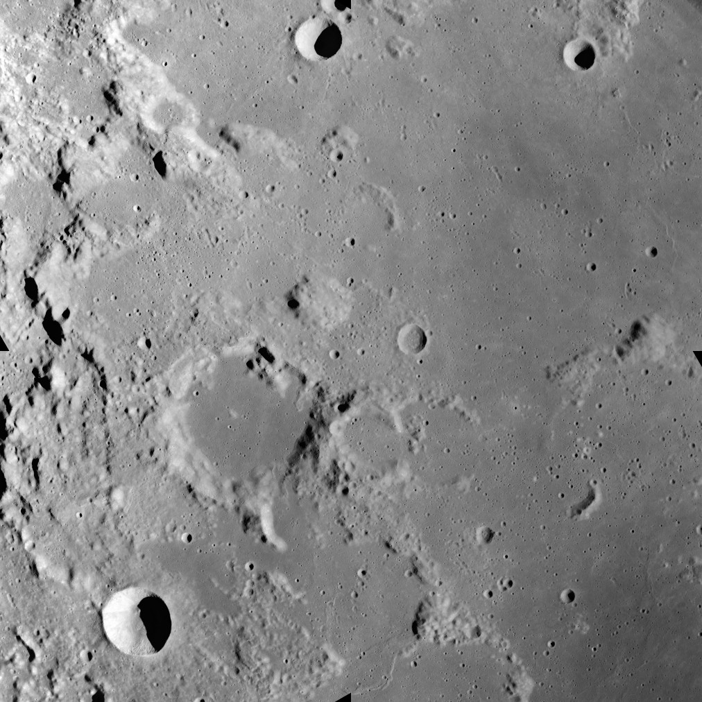
This image was taken during the Apollo 17 mapping metric sequence, revolution #14. The selenographic coordinates of this image are 20° N, 35.90° E.
At the center of this image is the dome-like Mons Maraldi, and just to the southwest is the flooded Maraldi crater. Most of the eastern half of this view is occupied by the Sinus Amoris, a lunar mare, and the flooded remnants of older formations. The bowl-shaped crater in the southwest corner is Gardner, and the cup-shaped crater at top-center is Franck.
This picture was produced by reducing a Hi-res image to 25% of full size, then rotating 90° counter-clockwise so that north is toward the top edge.
Source: Lunar & Planetary Institute, http://www.lpi.usra.edu/resources/apollo/frame/?AS17-M-0443 [1]
许可协议
| 本文件完全由NASA创作,在美国属于公有领域。根据NASA的版权方针,NASA的材料除非另有声明否则不受版权保护。(参见Template:PD-USGov/zh、NASA版权方针页面或JPL图片使用方针。) | ||
 |
警告:
|
文件历史
点击某个日期/时间查看对应时刻的文件。
| 日期/时间 | 缩略图 | 大小 | 用户 | 备注 | |
|---|---|---|---|---|---|
| 当前 | 2018年6月19日 (二) 20:22 | | 1,012 × 1,012(258 KB) | Jstuby | higher resolution, better quality, from ASU |
| 2006年1月27日 (五) 17:58 |  | 601 × 600(90 KB) | RJHall | Maraldi crater and surroundings from Apollo 17. |
文件用途
全域文件用途
以下其他wiki使用此文件:
- ca.wikipedia.org上的用途
- ce.wikipedia.org上的用途
- da.wikipedia.org上的用途
- de.wikipedia.org上的用途
- en.wikipedia.org上的用途
- es.wikipedia.org上的用途
- fa.wikipedia.org上的用途
- fr.wikipedia.org上的用途
- io.wikipedia.org上的用途
- it.wikipedia.org上的用途
- lb.wikipedia.org上的用途
- pl.wikipedia.org上的用途
- ru.wikipedia.org上的用途
- sv.wikipedia.org上的用途
- tt.wikipedia.org上的用途
- www.wikidata.org上的用途