
File:Alaska patterned ground 1973.jpg
本预览的尺寸:800 × 532像素。 其他分辨率:320 × 213像素 | 640 × 425像素 | 1,024 × 681像素 | 1,280 × 851像素 | 2,907 × 1,932像素。
原始文件 (2,907 × 1,932像素,文件大小:1.35 MB,MIME类型:image/jpeg)
| 这是一张修改过的图片,这意味着它已在原版本的基础上通过软件进行了编辑。其原始版本为:PATTERNED GROUND SHOWS ICE POLYGONS (LATTICE OUTLINES) AND TYPICAL SUMMER ARCTIC TUNDRA. PATTERNED GROUND, ICE... - NARA - 550392.jpg。
|
_AND_TYPICAL_SUMMER_ARCTIC_TUNDRA._PATTERNED_GROUND,_ICE..._-_NARA_-_550392.jpg)
摘要
| 描述 |
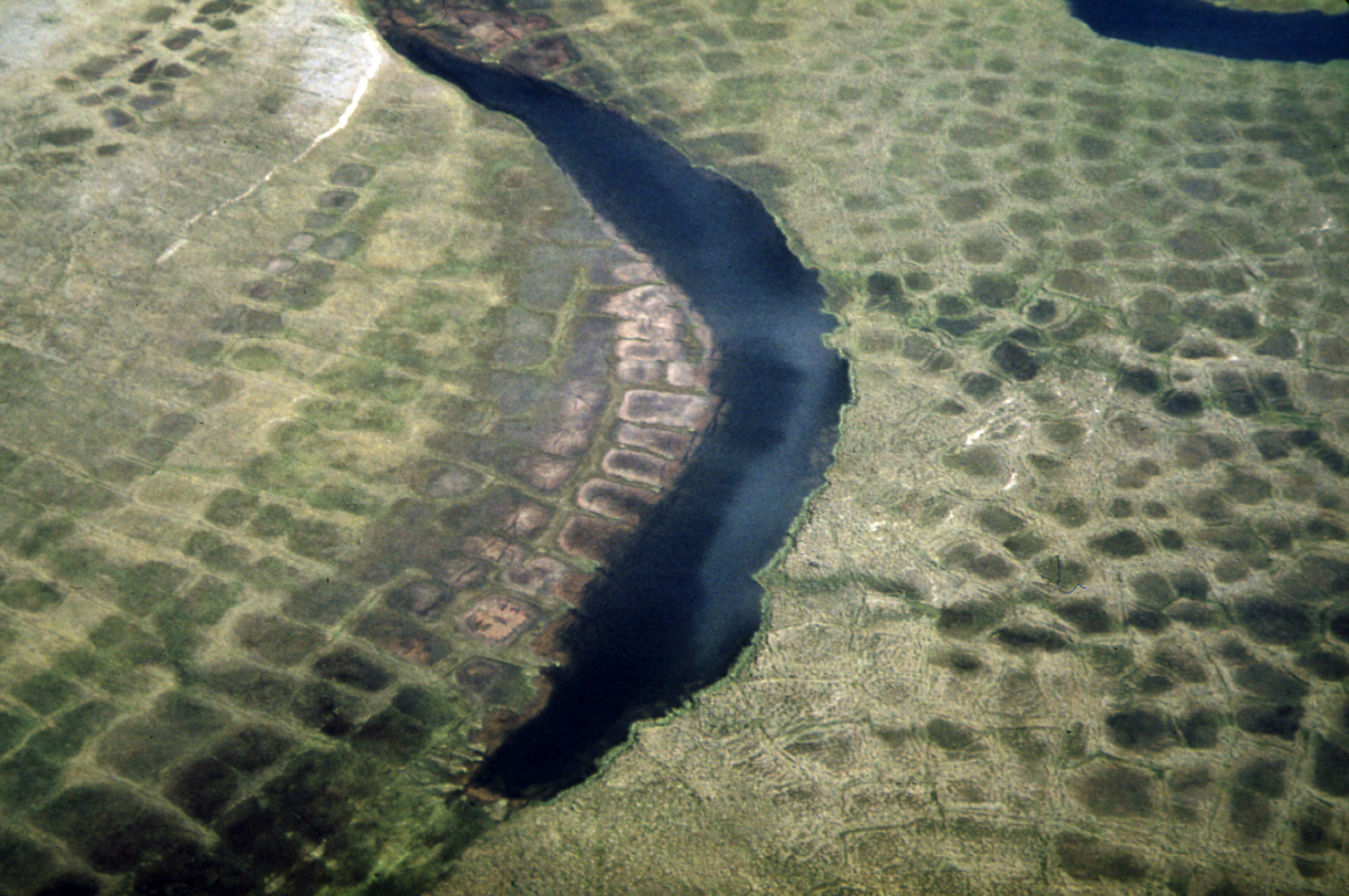
English: Patterned Ground Shows Ice Polygons (Lattice Outlines) and Typical Summer Arctic Tundra. Patterned Ground, Ice Polygons, and Permafrost Are Found Along the Entire Route of the Line, Although They Are Relatively Rare South of the Yukon River. Alaska (US state). Environmental Protection Agency, Project DOCUMERICA. |
|||
| 日期 | ||||
| 来源 |
Patterned Ground Shows Ice Polygons (Lattice Outlines) and Typical Summer Arctic Tundra...08/1973 (https://arcweb.archives.gov/arc/action/ExternalIdSearch?id=550392 Persistent URL).
|
|||
| 作者 | Dennis Cowals (1945-) | |||
| 其他版本 |
For information about ordering reproductions of photographs held by the Still Picture Unit, visit: www.archives.gov/research/order/still-pictures.html Reproductions may be ordered via an independent vendor. NARA maintains a list of vendors at www.archives.gov/research/order/vendors-photos-maps-dc.html Buy copies of selected National Archives photographs and documents at the National Archives Print Shop online: http://gallery.pictopia.com/natf/photo/ |
许可协议
本图像是从Flickr的公众相簿计画取得而来。该上传组织可能有多种理由认定该影像无已知版权限制,例如:
更多资讯请参见 https://flickr.com/commons/usage/ 如果该图像拥有特定且决定性的版权资讯,请在该影像新增额外的版权标签。更多资讯请参见Commons:Licensing。 |
| 此张图片原发布于Flickr,在2011年5月4日由管理员或审查员Logan检查后,确认检查时图片在Flickr的版权声明与维基共享资源的版权使用方针相符。 |
文件历史
点击某个日期/时间查看对应时刻的文件。
| 日期/时间 | 缩略图 | 大小 | 用户 | 备注 | |
|---|---|---|---|---|---|
| 当前 | 2011年6月28日 (二) 22:20 | | 2,907 × 1,932(1.35 MB) | Hohum | Cropped, colour correction (compared to other Arctic tundra polygons) |
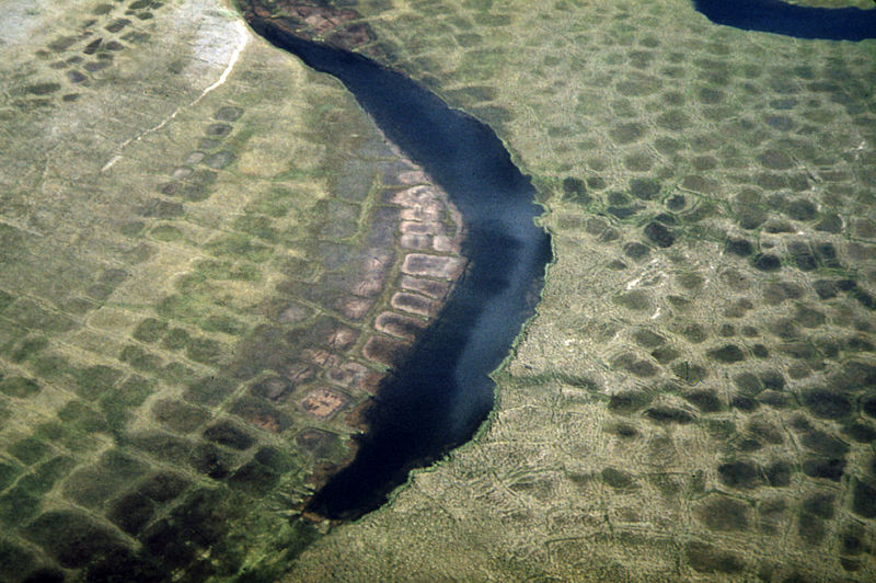
| 2011年5月4日 (三) 00:31 |  | 3,000 × 2,018(1.06 MB) | Logan | {{Information |Description='''Original Caption:''' Patterned Ground Shows Ice Polygons (Lattice Outlines) and Typical Summer Arctic Tundra. Patterned Ground, Ice Polygons, and Permafrost Are Found Along the Entire Route of the Line, Although They Are Rela |
文件用途
全域文件用途
以下其他wiki使用此文件:
- bh.wikipedia.org上的用途
- ca.wikipedia.org上的用途
- cs.wikipedia.org上的用途
- en.wikipedia.org上的用途
- fr.wikipedia.org上的用途
- ja.wikipedia.org上的用途
- kw.wikipedia.org上的用途
- pl.wikipedia.org上的用途