
File:Bopha Dec 6 2012 0300Z.jpg

本预览的尺寸:466 × 599像素。 其他分辨率:187 × 240像素 | 373 × 480像素 | 597 × 768像素 | 796 × 1,024像素 | 1,593 × 2,048像素 | 5,600 × 7,200像素。
原始文件 (5,600 × 7,200像素,文件大小:6.37 MB,MIME类型:image/jpeg)
摘要
| 描述 |
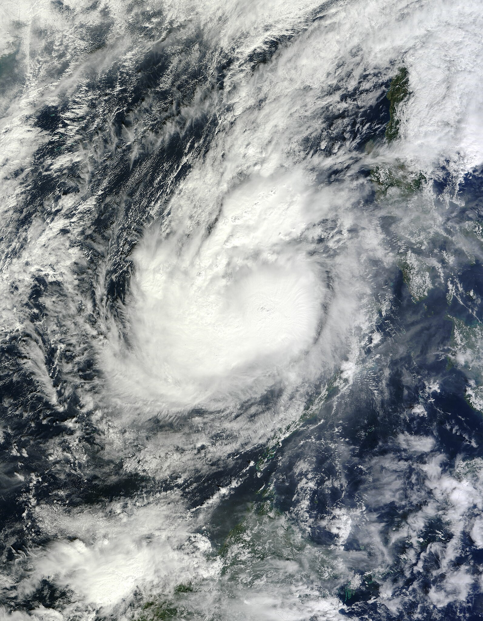
English: Bopha weakened from a typhoon to a tropical storm after passing over the southern Philippines in early December 2012. On December 6, the U.S. Navy’s Joint Typhoon Warning Center (JTWC) reported that Bopha had maximum sustained winds of 55 knots (100 kilometers per hour) and gusts up to 70 knots (130 kilometers per hour).
The Moderate Resolution Imaging Spectroradiometer (MODIS) on NASA’s Terra satellite captured this natural-color image on December 6, 2012, when Bopha was situated over the South China Sea. Although the storm retained the apostrophe shape characteristic of strong storms, it lacked a distinct eye. Bopha reached the South China Sea after passing over the southern Philippine island of Mindanao. It was the worst typhoon to strike the Philippines in 2012. As of December 7 (Philippines Time Zone), the storm had left nearly 200,000 people homeless, 380 people missing, and more than 300 people dead, according to the Philippine Daily Inquirer. The Guardian reported a death toll of 379, adding that the typhoon had ”washed away emergency shelters, a military camp, and entire families.” |
| 日期 | |
| 来源 | http://rapidfire.sci.gsfc.nasa.gov/cgi-bin/imagery/single.cgi?image=Bopha.A2012341.0300.250m.jpg |
| 作者 | NASA image courtesy Jeff Schmaltz, LANCE MODIS Rapid Response. Caption by Michon Scott. |
许可协议
| 本文件完全由NASA创作,在美国属于公有领域。根据NASA的版权方针,NASA的材料除非另有声明否则不受版权保护。(参见Template:PD-USGov/zh、NASA版权方针页面或JPL图片使用方针。) | ||
 |
警告:
|
文件历史
点击某个日期/时间查看对应时刻的文件。
| 日期/时间 | 缩略图 | 大小 | 用户 | 备注 | |
|---|---|---|---|---|---|
| 当前 | 2015年11月8日 (日) 05:15 | | 5,600 × 7,200(6.37 MB) | Nino Marakot | Gallery version |
| 2012年12月6日 (四) 06:07 |  | 5,500 × 7,071(5.78 MB) | Earth100 | User created page with UploadWizard |
文件用途
以下页面使用本文件: