
File:Cochise County Incorporated and Unincorporated areas Bisbee highlighted.svg

此SVG文件的PNG预览的大小:800 × 565像素。 其他分辨率:320 × 226像素 | 640 × 452像素 | 1,024 × 723像素 | 1,280 × 904像素 | 2,560 × 1,807像素。
原始文件 (SVG文件,尺寸为850 × 600像素,文件大小:51 KB)
摘要
| 描述 |
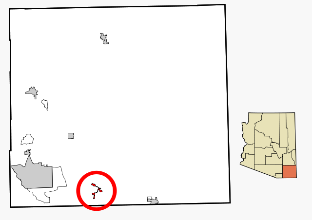
This map shows the incorporated areas and unincorporated areas in Cochise County, Arizona. |
| 日期 | |
| 来源 | My own work, based on public domain information |
| 作者 | Ixnayonthetimmay |
| 授权 (二次使用本文件) |
Copyleft-type licensing. See below. |
| 其他版本 | See Category:Maps of Cochise County for other versions of this image. |
许可协议
| 我,本作品著作权人,释出本作品至公有领域。这适用于全世界。 在一些国家这可能不合法;如果是这样的话,那么: 我无条件地授予任何人以任何目的使用本作品的权利,除非这些条件是法律规定所必需的。 |
文件历史
点击某个日期/时间查看对应时刻的文件。
| 日期/时间 | 缩略图 | 大小 | 用户 | 备注 | |
|---|---|---|---|---|---|
| 当前 | 2007年2月27日 (二) 18:16 | | 850 × 600(51 KB) | Ixnayonthetimmay | {{Information |Description=This map shows the incorporated areas and unincorporated areas in Cochise County, Arizona. Bisbee is highli |
文件用途
以下页面使用本文件:
全域文件用途
以下其他wiki使用此文件:
- ar.wikipedia.org上的用途
- arz.wikipedia.org上的用途
- ca.wikipedia.org上的用途
- ceb.wikipedia.org上的用途
- cy.wikipedia.org上的用途
- de.wikipedia.org上的用途
- en.wikipedia.org上的用途
- eu.wikipedia.org上的用途
- fa.wikipedia.org上的用途
- ht.wikipedia.org上的用途
- hu.wikipedia.org上的用途
- pt.wikipedia.org上的用途
- ro.wikipedia.org上的用途
- sr.wikipedia.org上的用途
- tr.wikipedia.org上的用途
- tt.wikipedia.org上的用途
- www.wikidata.org上的用途
- zh-min-nan.wikipedia.org上的用途