
File:Haiyan 2013-11-07 1800Z surface analysis.png

本预览的尺寸:600 × 600像素。 其他分辨率:240 × 240像素 | 480 × 480像素 | 768 × 768像素 | 1,024 × 1,024像素 | 2,000 × 2,000像素。
原始文件 (2,000 × 2,000像素,文件大小:193 KB,MIME类型:image/png)
摘要
| 描述 |
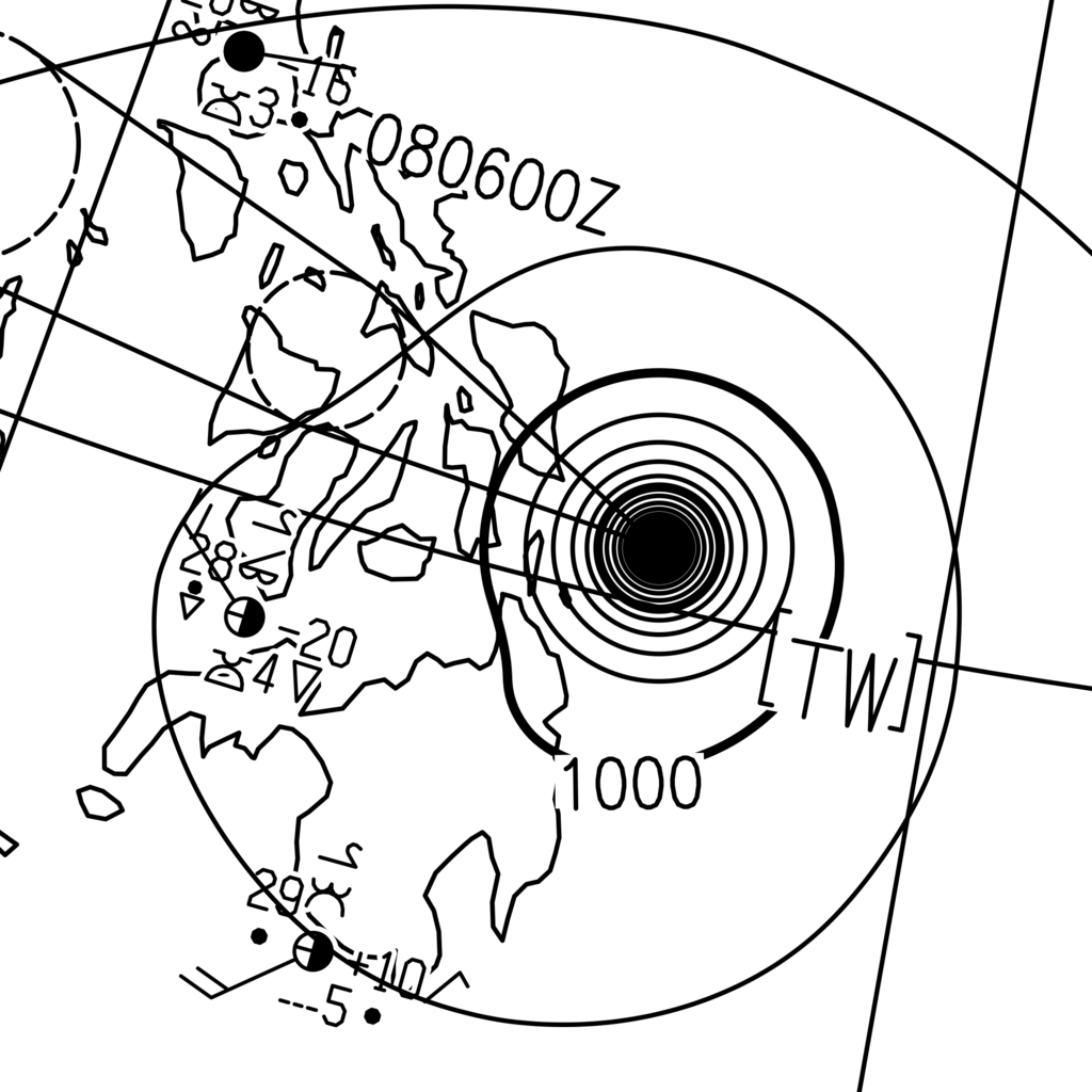
English: The surface analysis of Typhoon Haiyan on 8 November 2013 at 02:00 Philippine Standard Time (on 7 November 2013 at 18:00 Coordinated Universal Time), released the by Japan Meteorological Agency. The central pressure, which is not labeled over Haiyan on the image, was 895 hPa. |
| 日期 | |
| 来源 | http://www.jma.go.jp/jp/g3/images/asia/pdf/asas.pdf |
| 作者 | The Japan Meteorological Agency |
| 相机位置 | | 在以下服务上查看本图像和附近其他图像: OpenStreetMap |
|---|
许可协议
This image was produced by the 氣象廳. The legal notice (archive) stated that all the images published on their website is compatible with the Creative Commons Attribution 4.0 License, which means that all the images on this website is published under the Creative Commons Attribution 4.0 License unless otherwise specified.
|
 |

文件历史
点击某个日期/时间查看对应时刻的文件。
| 日期/时间 | 缩略图 | 大小 | 用户 | 备注 | |
|---|---|---|---|---|---|
| 当前 | 2015年1月4日 (日) 05:24 | | 2,000 × 2,000(193 KB) | Meow | Doubled the width and height. |
| 2015年1月4日 (日) 04:49 |  | 1,000 × 1,000(93 KB) | Meow | User created page with UploadWizard |
文件用途
没有页面链接到本图像。