
File:Niuatoputapu tafahi tonga.jpg

本预览的尺寸:342 × 599像素。 其他分辨率:137 × 240像素 | 274 × 480像素 | 644 × 1,127像素。
原始文件 (644 × 1,127像素,文件大小:131 KB,MIME类型:image/jpeg)
摘要
| 描述 |
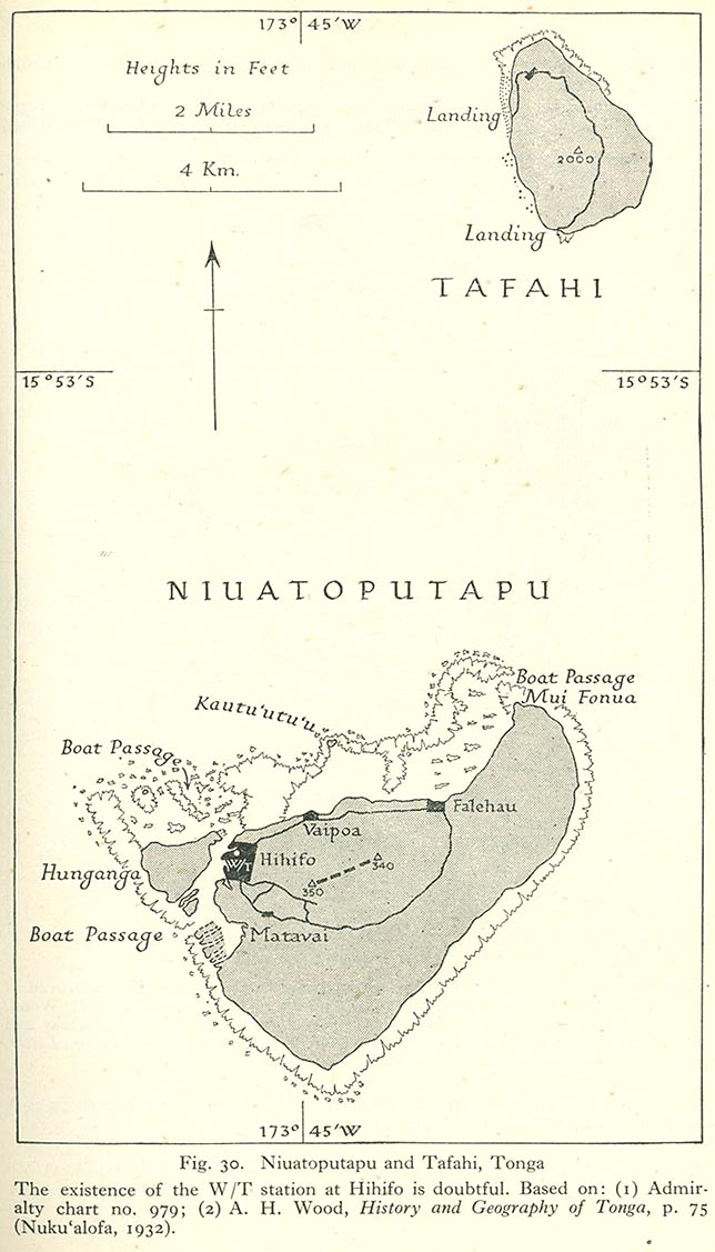
English: Niuatoputapu and Tafahi, Niua Islands, northern Tonga, Pacific Ocean |
| 日期 | 1932, 1945 |
| 来源 | map is linked from this page, direct link from "Pacific Islands", Geographical Handbook Series, Great Britain. Admiralty. Naval Intelligence Division, 1943-1945. The map is based on two other sources as indicated below the map in the graphics file. |
| 作者 | Admiralty. Naval Intelligence Division |
许可协议
本文件处于公有领域,因为it has been taken from a collection of public domain maps at the University of Texas Library- see http://www.lib.utexas.edu/usage_statement.html?maps=yes:
"Most of the maps scanned by the University of Texas Libraries and served from this web site are in the public domain. No permissions are needed to copy them. You may download them and use them as you wish. A few maps are copyrighted, and are clearly marked as such."
|
這一創作於英國管轄區內的作品現在位於公有領域。
其原因是以下之一:
HMSO已經宣布,皇家版權到期適用於全世界範圍(參考:HMSO Email Reply)
|
 |
文件历史
点击某个日期/时间查看对应时刻的文件。
| 日期/时间 | 缩略图 | 大小 | 用户 | 备注 | |
|---|---|---|---|---|---|
| 当前 | 2010年6月25日 (五) 12:55 | | 644 × 1,127(131 KB) | Ratzer | {{Information |Description={{en|1=Niuatoputapu and Tafahi, Niua Islands, northern Tonga, Pacific Ocean}} |Source=http://www.lib.utexas.edu/maps/historical/pacific_islands_1943_1945/niuatoputapu_tafahi_tonga.jpg |Author=unknown |Date=1932 |Permission= |oth |
文件用途
以下页面使用本文件:
全域文件用途
以下其他wiki使用此文件:
- de.wikipedia.org上的用途
- ka.wikipedia.org上的用途
- ru.wikipedia.org上的用途
- to.wikipedia.org上的用途