
File:Ophir Chasma.jpg
本预览的尺寸:569 × 600像素。 其他分辨率:228 × 240像素 | 455 × 480像素 | 729 × 768像素 | 972 × 1,024像素 | 2,438 × 2,569像素。
原始文件 (2,438 × 2,569像素,文件大小:778 KB,MIME类型:image/jpeg)
摘要
| 描述 |
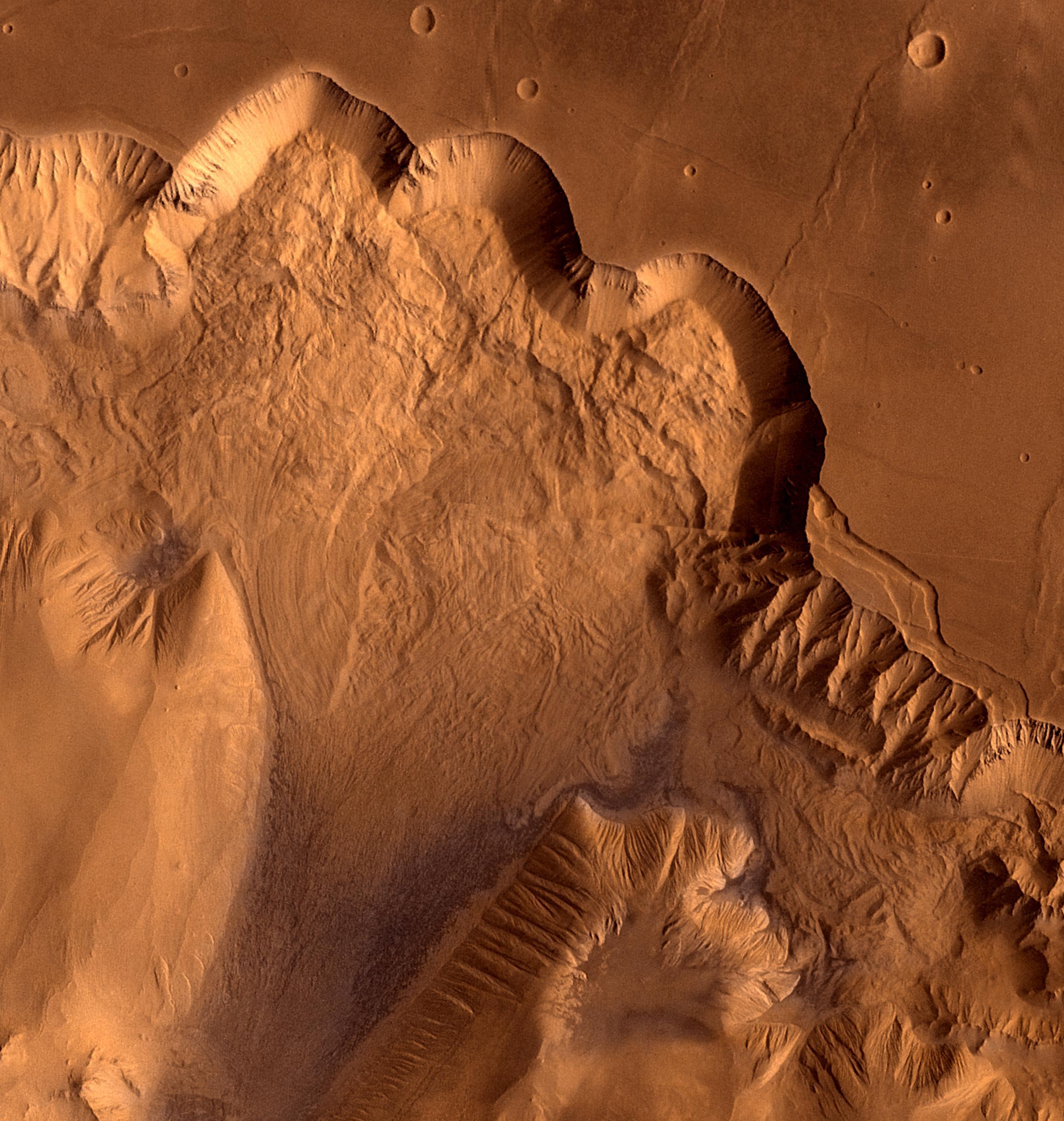
English: This synthetic oblique view shows Ophir Chasma, the northern most one of the connected valleys of Valles Marineris. For scale, the large impact crater in the right corner is about 30 km wide.
Ophir Chasma is a large west-northwest-trending trough about 100 km wide. The Chasma is bordered by high-walled cliffs, most likely faults, that show spur-and-gully morphology and smooth sections. The walls have been dissected by landslides forming re-entrants. The volume of the landslide debris is more than 1,000 times greater than that from the May 18, 1980, debris avalanche from Mount St. Helens. The longitudinal grooves seen in the foreground are thought to be due to differential shear and lateral spreading at high velocities. |
| 日期 | |
| 来源 | NASA Image of the Day |
| 作者 | NASA/JPL/USGS |
许可协议
| 本文件完全由NASA创作,在美国属于公有领域。根据NASA的版权方针,NASA的材料除非另有声明否则不受版权保护。(参见Template:PD-USGov/zh、NASA版权方针页面或JPL图片使用方针。) | ||
 |
警告:
|
文件历史
点击某个日期/时间查看对应时刻的文件。
| 日期/时间 | 缩略图 | 大小 | 用户 | 备注 | |
|---|---|---|---|---|---|
| 当前 | 2011年8月22日 (一) 18:54 | | 2,438 × 2,569(778 KB) | Originalwana | {{Information |Description ={{en|1=This synthetic oblique view shows Ophir Chasma, the northern most one of the connected valleys of Valles Marineris. For scale, the large impact crater in lower right corner is about 30 km wide. Ophir Chasma is a larg |
文件用途
以下页面使用本文件:
全域文件用途
以下其他wiki使用此文件:
- en.wikipedia.org上的用途
- it.wikipedia.org上的用途
- www.wikidata.org上的用途