
File:Pfaelzerwaldkarte Flussgebiete Moder.png
本预览的尺寸:800 × 538像素。 其他分辨率:320 × 215像素 | 640 × 431像素 | 1,024 × 689像素 | 1,280 × 861像素 | 2,284 × 1,537像素。
原始文件 (2,284 × 1,537像素,文件大小:5.04 MB,MIME类型:image/png)
摘要
| 描述 |
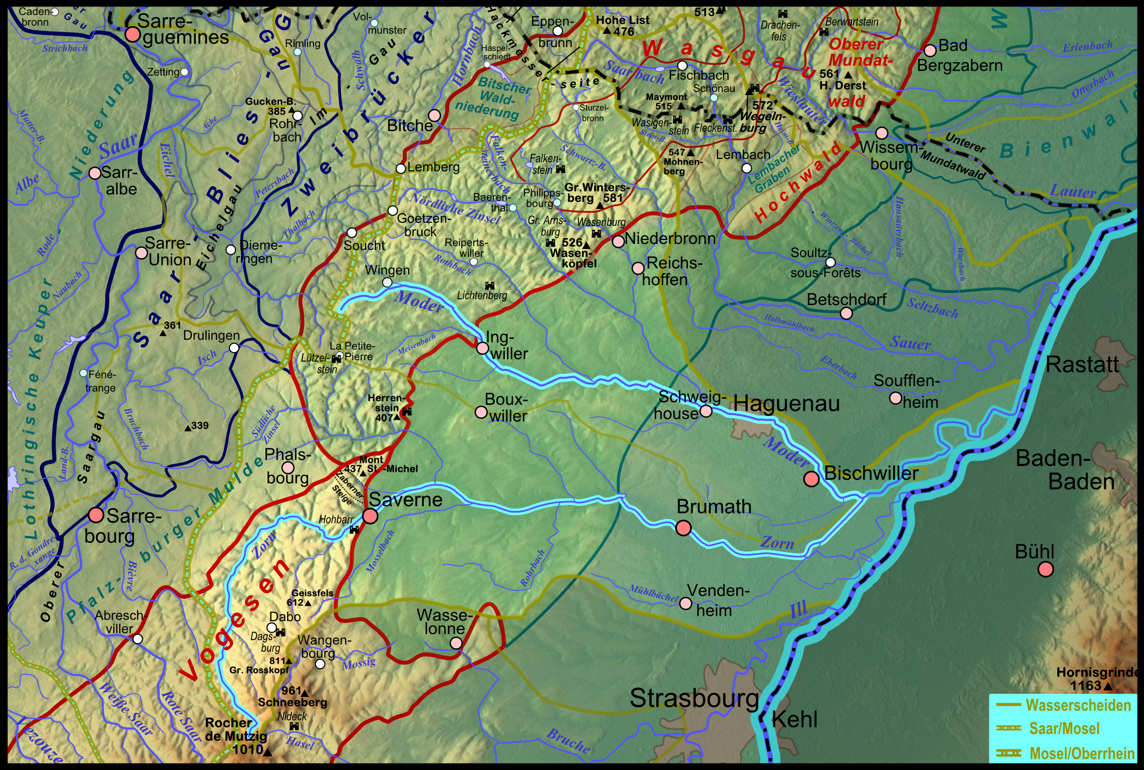
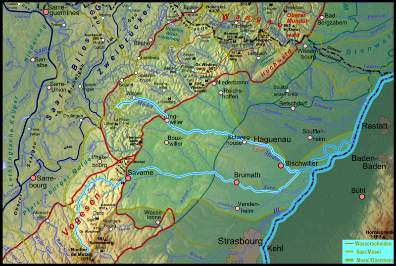
Deutsch: Karte des Flussgebietes des elsässischen Rhein- Nebenflusses Moder; der südliche Hauptarm Zorn ist ebenfalls hervorgehoben. Français : Carte du bassin hydrographique de la Moder en Alsace. |
| 日期 | |
| 来源 |
自己的作品
|
| 作者 | Elop |
| 其他版本 |
|
许可协议

|
已授权您依据自由软件基金会发行的无固定段落及封面封底文字(Invariant Sections, Front-Cover Texts, and Back-Cover Texts)的GNU自由文件许可协议1.2版或任意后续版本的条款,复制、传播和/或修改本文件。该协议的副本请见“GNU Free Documentation License”。 |
文件历史
点击某个日期/时间查看对应时刻的文件。
| 日期/时间 | 缩略图 | 大小 | 用户 | 备注 | |
|---|---|---|---|---|---|
| 当前 | 2012年1月18日 (三) 20:45 | | 2,284 × 1,537(5.04 MB) | Elop | == Summary == {{Information |Description ={{de|1=Karte des Flussgebietes der elsässischen de:Rhein- Nebenflusses Moder; der südliche Hauptarm Zorn ist ebenfalls hervorgehoben.}} |Sourc |
文件用途
以下页面使用本文件:
全域文件用途
以下其他wiki使用此文件:
- als.wikipedia.org上的用途
- ceb.wikipedia.org上的用途
- de.wikipedia.org上的用途
- en.wikipedia.org上的用途
- fr.wikipedia.org上的用途
- he.wikipedia.org上的用途
- simple.wikipedia.org上的用途
- sr.wikipedia.org上的用途
- www.wikidata.org上的用途