
File:Seale A New and Correct Map of the Coast of Africa, from Cape Blanco, to the Coast of Angola 1750 UTA (A Map of the Gold Coast on a larger Scale).jpg

本预览的尺寸:800 × 428像素。 其他分辨率:320 × 171像素 | 640 × 342像素 | 1,024 × 548像素 | 1,280 × 685像素 | 2,416 × 1,292像素。
原始文件 (2,416 × 1,292像素,文件大小:1.35 MB,MIME类型:image/jpeg)
摘要
| 标题 |
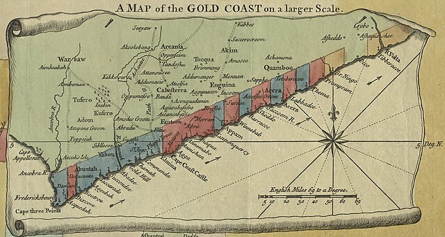
English: A Map of the Gold Coast on a larger Scale 从 English: A New & Correct Map of the Coast of Africa, from Cape Blanco, to the Coast of Angola: Exhibiting all the European Forts and Settlements |
| 日期 | |
| 来源 | UTA Libraries Cartographic Connections: 地图 / text |
| 創作作者 | |
| 荣誉行 |
English: UTA Libraries Special Collections, Gift of Dr. Jack Franke |
| Geotemporal data | |
| 地图位置 | 西非 |
| 地理参考 | 如果不适当,请设置 warp_status = skip 为隐藏。 |
| Bibliographic data | |
| 出版物 |
Universal Magazine |
| 作者 |
edited by J. Hinton |
| 出版地 | 倫敦 |
| Archival data | |
| 館藏 | |
| 表现形式 | 有色雕版在纸本上方 |
| 其他版本 | |

.jpg?uselang=zh)
.jpg?uselang=zh)
.jpg?action=history&uselang=zh)
.jpg)
许可协议

|
This file was provided to Wikimedia Commons by the University of Texas at Arlington Libraries as part of a cooperation project. The University of Texas at Arlington Libraries is part of the University of Texas at Arlington, a public research university located in Arlington, Texas.
|
|
本作品作者于1785年逝世,在其来源国以及其他著作权期限是作者逝世后100年或以下的国家和地区属于公有领域。 | |
| 本文件已被确认为免除已知的著作权法限制(包括所有相关权利)。 | |
文件历史
点击某个日期/时间查看对应时刻的文件。
| 日期/时间 | 缩略图 | 大小 | 用户 | 备注 | |
|---|---|---|---|---|---|
| 当前 | 2022年1月13日 (四) 20:33 | | 2,416 × 1,292(1.35 MB) | Michael Barera | File:Seale A New and Correct Map of the Coast of Africa, from Cape Blanco, to the Coast of Angola 1750 UTA.jpg cropped 45 % horizontally, 63 % vertically using CropTool with precise mode. |
文件用途
以下页面使用本文件:
全域文件用途
以下其他wiki使用此文件:
- de.wikipedia.org上的用途
- en.wikipedia.org上的用途
- es.wikipedia.org上的用途
- hu.wikipedia.org上的用途
- ja.wikipedia.org上的用途
- ru.wikipedia.org上的用途
- simple.wikipedia.org上的用途
.jpg)