
File:Tuanjie Lake 2003.png

本预览的尺寸:800 × 530像素。 其他分辨率:320 × 212像素 | 640 × 424像素 | 1,024 × 678像素 | 1,280 × 848像素 | 3,032 × 2,008像素。
原始文件 (3,032 × 2,008像素,文件大小:6.13 MB,MIME类型:image/png)
摘要
| 描述 |
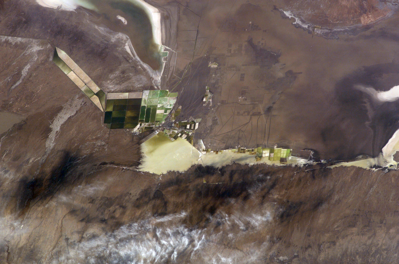
English: A photograph from the International Space Station of Qarhan, Golmud Co., Haixi Prefecture, Qinghai Province, China. To the top right is the SE corner of Lake Dabusun; to the bottom right is Tuanjie Lake. Surrounding both are their salt pans for collecting valuable minerals, particularly potash / potassium.
中文:中国青海省海西格尔木市察尔汗。团结湖与达布逊湖。 |
| 日期 | 摄于2003年10月18日, 09:19:23 UTC |
| 来源 | ISS007-E-17651 at Gateway to Astronaut Photography of Earth |
| 作者 | NASA |
本图像或视频收录于美国国家航空航天局 (NASA)休斯顿太空中心(Johnson Space Center),其照片编号是: ISS007-E-17651 此标签不表示文件的著作权状态。任何文件在附有此标签的同時还需要一个有效的著作权标签。请参阅许可协议说明页面以了解更多信息。 其他语言:
|
许可协议
This file is in the public domain in the United States because it was created by the Image Science & Analysis Laboratory, of the NASA Johnson Space Center. NASA copyright policy states that "NASA material is not protected by copyright unless noted". (NASA media use guidelines or Conditions of Use of Astronaut Photographs).
Photo source: ISS007-E-17651.
|
文件历史
点击某个日期/时间查看对应时刻的文件。
| 日期/时间 | 缩略图 | 大小 | 用户 | 备注 | |
|---|---|---|---|---|---|
| 当前 | 2019年8月20日 (二) 11:47 | | 3,032 × 2,008(6.13 MB) | Ras67 | cropped and colors adjusted from the source |
| 2019年8月9日 (五) 16:51 |  | 3,026 × 2,003(6.97 MB) | LlywelynII | User created page with UploadWizard |
文件用途
以下页面使用本文件:
全域文件用途
以下其他wiki使用此文件:
- en.wikipedia.org上的用途
- pa.wikipedia.org上的用途