
File:USACE Webbers Falls Lock and Dam.jpg
本预览的尺寸:400 × 599像素。 其他分辨率:160 × 240像素 | 320 × 480像素 | 1,001 × 1,500像素。
原始文件 (1,001 × 1,500像素,文件大小:580 KB,MIME类型:image/jpeg)
| 描述 |
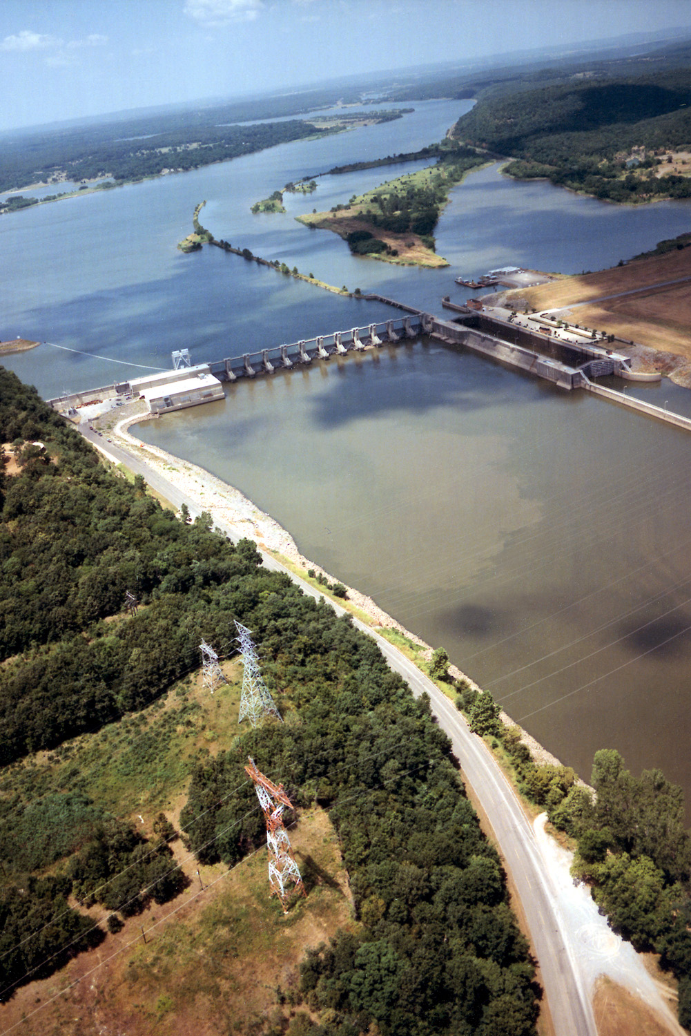
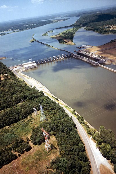
English: Aerial view of Webbers Falls Lock and Dam on the Arkansas River in Muskogee County, Oklahoma, USA. The dam is located about 4 miles (6.4 km) upriver from the town of Webbers Falls and about 62 miles (100 km) (straight line) southeast of Tulsa. The U.S. Army Corps of Engineers maintains the locks and the river channel for barge navigation on the river. View is upriver to the northwest.
Coordinates: 35°33′13.73″N 95°10′9.26″W / 35.5538139°N 95.1692389°W |
|||
| 图中地点 | Muskogee County, Oklahoma, USA | |||
| 日期 | (Caveat: Dates provided by U.S. Army Corps of Engineers Digital Visual Library are not reliable and may be wrong.) | |||
| 来源 |
U.S. Army Corps of Engineers Digital Visual Library Image page Image description page Digital Visual Library home page |
|||
| 作者 | U.S. Army Corps of Engineers, photographer not specified or unknown | |||
| 授权 (二次使用本文件) |
|
文件历史
点击某个日期/时间查看对应时刻的文件。
| 日期/时间 | 缩略图 | 大小 | 用户 | 备注 | |
|---|---|---|---|---|---|
| 当前 | 2007年5月11日 (五) 03:15 | | 1,001 × 1,500(580 KB) | DanMS | {{Information | Description = {{en|Aerial view of Webbers Falls Lock and Dam on the Arkansas River in Muskogee County, Oklahoma, USA. The dam is located about 4 miles (6.4 km) upriver from the town of Webbers Falls and about 62 miles (100 km) (straight |
文件用途
以下2个页面使用本文件:
全域文件用途
以下其他wiki使用此文件:
- da.wikipedia.org上的用途
- en.wikipedia.org上的用途
- es.wikipedia.org上的用途
- fr.wikipedia.org上的用途
- ja.wikipedia.org上的用途
- ky.wikipedia.org上的用途
- pt.wikipedia.org上的用途
- www.wikidata.org上的用途