
File:Yarramap.png
本预览的尺寸:800 × 486像素。 其他分辨率:320 × 194像素 | 640 × 388像素 | 972 × 590像素。
原始文件 (972 × 590像素,文件大小:31 KB,MIME类型:image/png)
摘要
| 描述 |
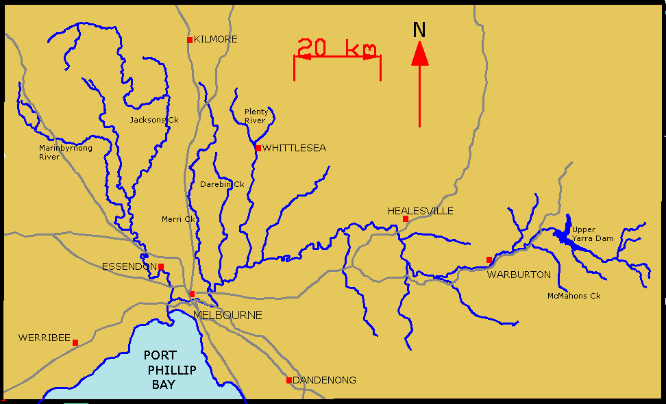
English: Map of Yarra River and its tributaries. |
| 日期 | 2006年8月25日 (原始上传日期) |
| 来源 | 本檔案是從en.wikipedia轉移到維基共享資源。 |
| 作者 | 英语维基百科的Lentisco |
许可协议
| 本作品已被作者英语维基百科的Lentisco释出到公有领域。这适用于全世界。 在一些国家这可能不合法;如果是这样的话,那么: Lentisco无条件地授予任何人以任何目的使用本作品的权利,除非这些条件是法律规定所必需的。 |
原始上传日志
原始描述頁面位於這裡。下列使用者名稱均來自en.wikipedia。
- 2006-08-25 01:55 Lentisco 972×590×8 (31751 bytes) Map of Yarra River and its tributaries.
文件历史
点击某个日期/时间查看对应时刻的文件。
| 日期/时间 | 缩略图 | 大小 | 用户 | 备注 | |
|---|---|---|---|---|---|
| 当前 | 2008年3月23日 (日) 08:57 | | 972 × 590(31 KB) | File Upload Bot (Magnus Manske) | {{BotMoveToCommons|en.wikipedia}} {{Information |Description={{en|Map of Yarra River and its tributaries.}} |Source=Transferred from [http://en.wikipedia.org en.wikipedia] |Date=2006-08-25 (original upload date) |Author=Original uploader was [[:en:User:L |
文件用途
以下页面使用本文件:
全域文件用途
以下其他wiki使用此文件:
- be-tarask.wikipedia.org上的用途
- be.wikipedia.org上的用途
- cs.wikipedia.org上的用途
- de.wikipedia.org上的用途
- en.wikipedia.org上的用途
- es.wikipedia.org上的用途
- fi.wikipedia.org上的用途
- fr.wikipedia.org上的用途
- ga.wikipedia.org上的用途
- he.wikipedia.org上的用途
- pl.wikipedia.org上的用途
- ru.wikipedia.org上的用途
- sr.wikipedia.org上的用途
- uk.wikipedia.org上的用途
- www.wikidata.org上的用途