
File:Atlas Mongolica East.png
本预览的尺寸:800 × 571像素。 其他分辨率:320 × 228像素 | 640 × 457像素 | 1,000 × 714像素。
原始文件 (1,000 × 714像素,文件大小:355 KB,MIME类型:image/png)
摘要
| 描述 |
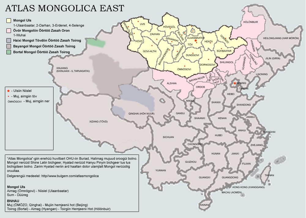
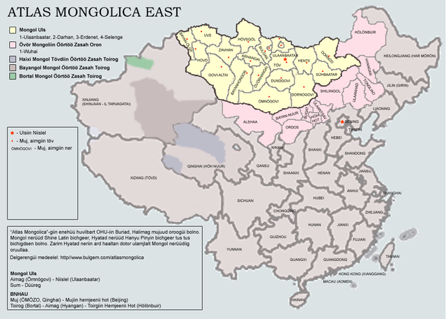
English: Atlas of Eastern Mongols. The map is being in process. Latest version will include Buryatia and Kalmykia; county-level subjects within the PRC. Note that the current version is a draft with some major errors: No Govi-Sümber province of Mongolia and no Wuhai prefecture of Inner Mongolia is present.
The map uses Latin Mongolian. |
| 日期 | 2007年10月23日 (原始上传日期) |
| 来源 | Transferred from en.wikipedia to Commons by man77. |
| 作者 | 英语维基百科的Dagvadorj |
许可协议
| 本作品已被作者英语维基百科的Dagvadorj释出到公有领域。这适用于全世界。 在一些国家这可能不合法;如果是这样的话,那么: Dagvadorj无条件地授予任何人以任何目的使用本作品的权利,除非这些条件是法律规定所必需的。 |
原始上传日志
The original description page was here. All following user names refer to en.wikipedia.
- 2007-10-23 08:30 Dagvadorj 1000×714×8 (363781 bytes) Atlas of Eastern Mongols. The map is being in process. Latest version will include Buryatia and Kalmykia; county-level subjects within the PRC. Note that the current version is a draft with some major errors: No Govi-Sümber province of Mongolia and no Wu
文件历史
点击某个日期/时间查看对应时刻的文件。
| 日期/时间 | 缩略图 | 大小 | 用户 | 备注 | |
|---|---|---|---|---|---|
| 当前 | 2008年4月11日 (五) 12:20 | | 1,000 × 714(355 KB) | File Upload Bot (Magnus Manske) | {{BotMoveToCommons|en.wikipedia}} {{Information |Description={{en|Atlas of Eastern Mongols. The map is being in process. Latest version will include Buryatia and Kalmykia; county-level subjects within the PRC. Note that the current version is a draft wit |
文件用途
以下页面使用本文件:
全域文件用途
以下其他wiki使用此文件:
- el.wikipedia.org上的用途
- es.wikipedia.org上的用途
- fr.wikipedia.org上的用途
- gan.wikipedia.org上的用途
- ja.wikipedia.org上的用途
- ko.wikipedia.org上的用途
- lv.wikipedia.org上的用途
- mk.wikipedia.org上的用途
- mn.wikipedia.org上的用途
- nl.wikipedia.org上的用途
- sr.wikipedia.org上的用途
- vi.wikipedia.org上的用途