
File:SJC Airport Diagram.svg

此 SVG 檔案的 PNG 預覽的大小:378 × 545 像素。 其他解析度:166 × 240 像素 | 333 × 480 像素 | 533 × 768 像素 | 710 × 1,024 像素 | 1,420 × 2,048 像素。
原始檔案 (SVG 檔案,表面大小:378 × 545 像素,檔案大小:658 KB)
摘要
| 描述 |
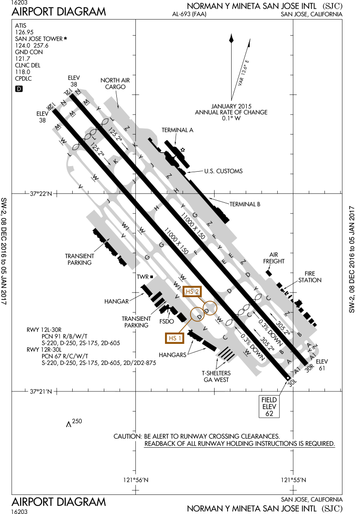
English: FAA Airport Diagram of airport: SJC |
| 日期 | |
| 來源 |
FAA Airport Diagrams; note that these change every 28 days. Taken from PDF on FAA site and converted to SVG using en:Wikipedia:How to draw SVG circuits using Xcircuit. |
| 作者 | Produced by the National Aeronautical Charting Office (NACO), a department of the United States en:Federal Aviation Administration. |
| 其他版本 | File:SJC - FAA airport diagram.gif, File:KSJC.png |
| 拍攝地點 | | 位於此地的本圖片與其他圖片: OpenStreetMap |
|---|
W3C-validity not checked.
授權條款
|
|
 |
檔案歷史
點選日期/時間以檢視該時間的檔案版本。
| 日期/時間 | 縮圖 | 尺寸 | 使用者 | 備註 | |
|---|---|---|---|---|---|
| 目前 | 2017年1月10日 (二) 18:43 | | 378 × 545(658 KB) | Grendelkhan | SVG version of FAA's PDF diagram. |
| 2014年8月20日 (三) 07:46 |  | 378 × 548(653 KB) | Grendelkhan | SVG version of FAA's PDF diagram. |
檔案用途
下列頁面有用到此檔案:
全域檔案使用狀況
以下其他 wiki 使用了這個檔案:
- af.wikipedia.org 的使用狀況
- de.wikipedia.org 的使用狀況
- en.wikipedia.org 的使用狀況
- es.wikipedia.org 的使用狀況
- fr.wikipedia.org 的使用狀況
- id.wikipedia.org 的使用狀況
- ja.wikipedia.org 的使用狀況
- ur.wikipedia.org 的使用狀況
- vi.wikipedia.org 的使用狀況
- www.wikidata.org 的使用狀況