
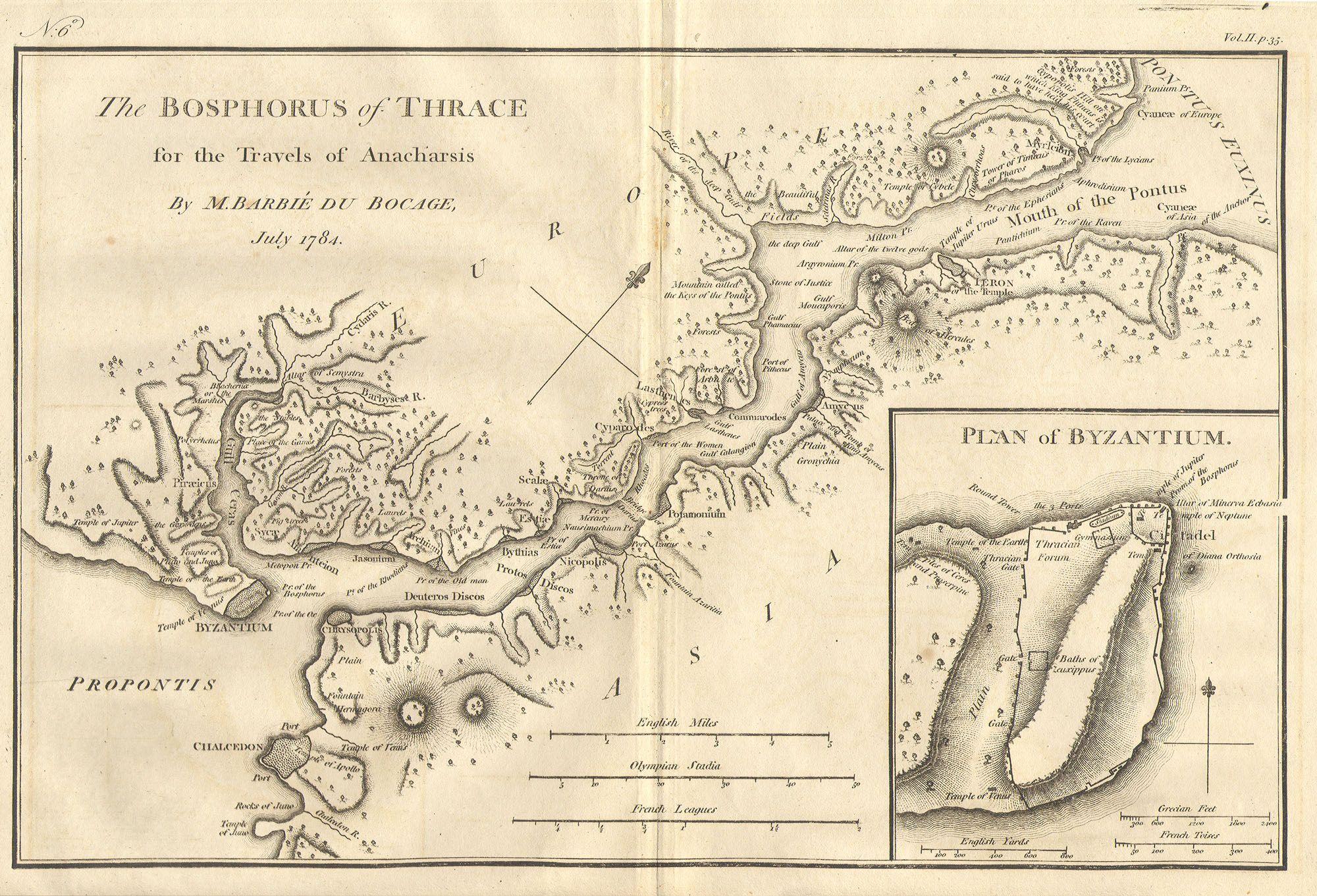
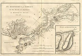
File:1784 Bocage Map of The Bosphorus and the City of Byzantium - Istanbul - Constantinople - Geographicus - Bosphorus-white-1793.jpg
預覽大小:800 × 544 像素。 其他解析度:320 × 218 像素 | 640 × 436 像素 | 1,024 × 697 像素 | 1,280 × 871 像素 | 2,000 × 1,361 像素。
原始檔案 (2,000 × 1,361 像素,檔案大小:665 KB,MIME 類型:image/jpeg)
| Bosphorus and the city of Byzantium. | ||||||
|---|---|---|---|---|---|---|
| 作家 | ||||||
| 標題 |
Bosphorus and the city of Byzantium. |
|||||
| 描述 |
English: This lovely map, depicting the Bosphorus and the city of Byzantium, was prepared by Jean-Denis Barbié du Bocage in 1784 for the “Travels of Anarcharsis”. The map shows the narrow naval passage from the Propontis (Sea of Marmara) to the Pontus Euxinus (Black Sea). There is a beautiful inset plan of the Horn of Byzantium. Today Byzantium is Istanbul, but the horn and many of the ancient structures still exists. This map also shows the area in considerable topographical detail. |
|||||
| 日期 | 1784年 | |||||
| 尺寸 | 高度:8.5英寸(21.5公分);寬度:12英寸(30.4公分) | |||||
| 登錄號 |
Geographicus link: Bosphorus-white-1793 |
|||||
| 來源/攝影者 |
|
|||||
| 授權許可 (重用此檔案) |
|
|||||
| 其他版本 | ||||||

檔案歷史
點選日期/時間以檢視該時間的檔案版本。
| 日期/時間 | 縮圖 | 尺寸 | 使用者 | 備註 | |
|---|---|---|---|---|---|
| 目前 | 2011年3月15日 (二) 20:46 | | 2,000 × 1,361(665 KB) | BotMultichill | {{subst:User:Multichill/Geographicus |link=http://www.geographicus.com/P/AntiqueMap/Bosphorus-white-1793 |product_name=1784 Bocage Map of The Bosphorus and the City of Byzantium / Istanbul / Constantinople |map_title=Bosphorus and the city of Byzantium. | |
檔案用途
下列頁面有用到此檔案:
全域檔案使用狀況
以下其他 wiki 使用了這個檔案:
- ar.wikipedia.org 的使用狀況
- arz.wikipedia.org 的使用狀況
- ast.wikipedia.org 的使用狀況
- az.wikipedia.org 的使用狀況
- ca.wikipedia.org 的使用狀況
- cs.wikipedia.org 的使用狀況
- el.wikipedia.org 的使用狀況
- en.wikipedia.org 的使用狀況
- eo.wikipedia.org 的使用狀況
- eu.wikipedia.org 的使用狀況
- gl.wikipedia.org 的使用狀況
- he.wikivoyage.org 的使用狀況
- hu.wikipedia.org 的使用狀況
- hy.wikipedia.org 的使用狀況
- it.wikipedia.org 的使用狀況
- nap.wikipedia.org 的使用狀況
- pt.wikipedia.org 的使用狀況
- ro.wikipedia.org 的使用狀況
- sk.wikipedia.org 的使用狀況
- tr.wikipedia.org 的使用狀況
- www.wikidata.org 的使用狀況